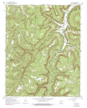
Boxley Topo Map Arkansas
To zoom in, hover over the map of Boxley
USGS Topo Quad 35093h4 - 1:24,000 scale
| Topo Map Name: | Boxley |
| USGS Topo Quad ID: | 35093h4 |
| Print Size: | ca. 21 1/4" wide x 27" high |
| Southeast Coordinates: | 35.875° N latitude / 93.375° W longitude |
| Map Center Coordinates: | 35.9375° N latitude / 93.4375° W longitude |
| U.S. State: | AR |
| Filename: | o35093h4.jpg |
| Download Map JPG Image: | Boxley topo map 1:24,000 scale |
| Map Type: | Topographic |
| Topo Series: | 7.5´ |
| Map Scale: | 1:24,000 |
| Source of Map Images: | United States Geological Survey (USGS) |
| Alternate Map Versions: |
Boxley AR 1968, updated 1969 Download PDF Buy paper map Boxley AR 1968, updated 1977 Download PDF Buy paper map Boxley AR 1968, updated 1990 Download PDF Buy paper map Boxley AR 2011 Download PDF Buy paper map Boxley AR 2014 Download PDF Buy paper map |
| FStopo: | US Forest Service topo Boxley is available: Download FStopo PDF Download FStopo TIF |
1:24,000 Topo Quads surrounding Boxley
Forum |
Marble |
Osage |
Osage Ne |
Gaither |
Huntsville |
Kingston |
Osage Sw |
Ponca |
Jasper |
Witter |
Weathers |
Boxley |
Murray |
Parthenon |
Pettigrew |
Boston |
Fallsville |
Swain |
Deer |
Yale |
Oark |
Ozone |
Rosetta |
Fort Douglas |
> Back to 35093e1 at 1:100,000 scale
> Back to 35092a1 at 1:250,000 scale
> Back to U.S. Topo Maps home
Boxley topo map: Gazetteer
Boxley: Dams
Fowler Lake Dam elevation 644m 2112′Boxley: Populated Places
Boxley elevation 334m 1095′Mossville elevation 689m 2260′
Reeves elevation 692m 2270′
Ryker elevation 664m 2178′
Boxley: Reservoirs
Fowler Lake elevation 644m 2112′Boxley: Ridges
Hurricane Ridge elevation 660m 2165′Boxley: Streams
Arrington Creek elevation 327m 1072′Beech Creek elevation 331m 1085′
Edgeman Creek elevation 355m 1164′
Edgemon Creek elevation 420m 1377′
Lower Fork Whitaker Creek elevation 470m 1541′
Moore Creek elevation 326m 1069′
Smith Creek elevation 342m 1122′
Whitaker Creek elevation 395m 1295′
Whiteley Creek elevation 317m 1040′
Boxley: Summits
Cave Mountain elevation 658m 2158′Reeves Mountain elevation 733m 2404′
Boxley: Valleys
Dug Hollow elevation 395m 1295′Evans Hollow elevation 540m 1771′
Hale Hollow elevation 485m 1591′
Harve Hollow elevation 561m 1840′
Lewis Hollow elevation 486m 1594′
Little Pine Hollow elevation 395m 1295′
Panther Camp Hollow elevation 423m 1387′
Pine Hollow elevation 418m 1371′
Williams Hollow elevation 547m 1794′
Boxley digital topo map on disk
Buy this Boxley topo map showing relief, roads, GPS coordinates and other geographical features, as a high-resolution digital map file on DVD:


