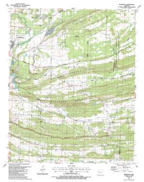
Burnville Topo Map Arkansas
To zoom in, hover over the map of Burnville
USGS Topo Quad 35094b2 - 1:24,000 scale
| Topo Map Name: | Burnville |
| USGS Topo Quad ID: | 35094b2 |
| Print Size: | ca. 21 1/4" wide x 27" high |
| Southeast Coordinates: | 35.125° N latitude / 94.125° W longitude |
| Map Center Coordinates: | 35.1875° N latitude / 94.1875° W longitude |
| U.S. State: | AR |
| Filename: | o35094b2.jpg |
| Download Map JPG Image: | Burnville topo map 1:24,000 scale |
| Map Type: | Topographic |
| Topo Series: | 7.5´ |
| Map Scale: | 1:24,000 |
| Source of Map Images: | United States Geological Survey (USGS) |
| Alternate Map Versions: |
Burnville AR 1947, updated 1978 Download PDF Buy paper map Burnville AR 1951, updated 1951 Download PDF Buy paper map Burnville AR 1987, updated 1988 Download PDF Buy paper map Burnville AR 2011 Download PDF Buy paper map Burnville AR 2014 Download PDF Buy paper map |
1:24,000 Topo Quads surrounding Burnville
> Back to 35094a1 at 1:100,000 scale
> Back to 35094a1 at 1:250,000 scale
> Back to U.S. Topo Maps home
Burnville topo map: Gazetteer
Burnville: Bridges
Milltown Bridge elevation 193m 633′Burnville: Cliffs
Big Creek Narrows elevation 192m 629′Burnville: Dams
Arkansas Noname 212 Dam elevation 203m 666′Burnville: Lakes
Greenwood Lake elevation 157m 515′Burnville: Oilfields
Bragg Gas Field elevation 209m 685′Burnville: Populated Places
Burnville elevation 191m 626′Carnis elevation 168m 551′
Fidelity (historical) elevation 150m 492′
Milltown elevation 201m 659′
Burnville: Ridges
Devils Backbone Ridge elevation 217m 711′Little White Oak Ridge elevation 226m 741′
Pinnacle Ridge elevation 220m 721′
Washburn Mountains elevation 219m 718′
White Oak Mountains elevation 288m 944′
Burnville: Streams
Heartsill Creek elevation 146m 479′Vineyard Creek elevation 157m 515′
Burnville digital topo map on disk
Buy this Burnville topo map showing relief, roads, GPS coordinates and other geographical features, as a high-resolution digital map file on DVD:


