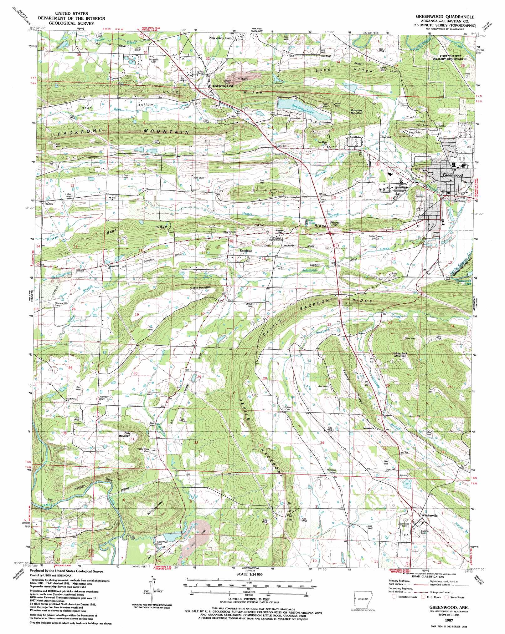
Greenwood Topo Map Arkansas
To zoom in, hover over the map of Greenwood
USGS Topo Quad 35094b3 - 1:24,000 scale
| Topo Map Name: | Greenwood |
| USGS Topo Quad ID: | 35094b3 |
| Print Size: | ca. 21 1/4" wide x 27" high |
| Southeast Coordinates: | 35.125° N latitude / 94.25° W longitude |
| Map Center Coordinates: | 35.1875° N latitude / 94.3125° W longitude |
| U.S. State: | AR |
| Filename: | o35094b3.jpg |
| Download Map JPG Image: | Greenwood topo map 1:24,000 scale |
| Map Type: | Topographic |
| Topo Series: | 7.5´ |
| Map Scale: | 1:24,000 |
| Source of Map Images: | United States Geological Survey (USGS) |
| Alternate Map Versions: |
Greenwood AR 1951 Download PDF Buy paper map Greenwood AR 1951 Download PDF Buy paper map Greenwood AR 1951, updated 1983 Download PDF Buy paper map Greenwood AR 1987, updated 1988 Download PDF Buy paper map Greenwood AR 2011 Download PDF Buy paper map Greenwood AR 2014 Download PDF Buy paper map |
1:24,000 Topo Quads surrounding Greenwood
Muldrow |
Fort Smith |
Van Buren |
Alma |
Mulberry |
Fort Coffee |
South Fort Smith |
Barling |
Lavaca |
Charleston |
Spiro |
Hackett |
Greenwood |
Burnville |
Barber |
Poteau East |
Hartford |
Huntington |
Abbott |
Ione |
Heavener |
Bates |
Cauthron |
Hon |
Waldron |
> Back to 35094a1 at 1:100,000 scale
> Back to 35094a1 at 1:250,000 scale
> Back to U.S. Topo Maps home
Greenwood topo map: Gazetteer
Greenwood: Dams
Greenwood Reservoir Dam elevation 179m 587′Shadow Lake Dam elevation 191m 626′
Williamson Lake Dam elevation 175m 574′
Greenwood: Oilfields
Bonanza Gas Field elevation 152m 498′Greenwood: Parks
Bell Park elevation 224m 734′Buckner Park elevation 208m 682′
Greenwood: Populated Places
Big Rock elevation 194m 636′Excelsior elevation 178m 583′
Greenwood elevation 159m 521′
Old Jenny Lind elevation 148m 485′
Witcherville elevation 213m 698′
Greenwood: Post Offices
Greenwood Post Office elevation 151m 495′Greenwood: Reservoirs
Greenwood Reservoir elevation 179m 587′Shadow Lake elevation 191m 626′
Williamson Lake elevation 175m 574′
Greenwood: Ridges
Long Ridge elevation 205m 672′Sand Ridge elevation 219m 718′
Young Ridge elevation 260m 853′
Greenwood: Streams
Adamson Creek elevation 148m 485′Hester Creek elevation 154m 505′
Mackenay Creek elevation 152m 498′
Vineyard Branch elevation 169m 554′
Greenwood: Summits
Backbone Mountain elevation 268m 879′Billcol Mountain elevation 251m 823′
Diffy Mountain elevation 255m 836′
Donahue Mountain elevation 259m 849′
Griffith Mountain elevation 247m 810′
Short Mountain elevation 204m 669′
Skinner Hill elevation 190m 623′
White Rock Mountain elevation 261m 856′
Greenwood digital topo map on disk
Buy this Greenwood topo map showing relief, roads, GPS coordinates and other geographical features, as a high-resolution digital map file on DVD: