Mountainburg Sw Topo Map Arkansas
To zoom in, hover over the map of Mountainburg Sw
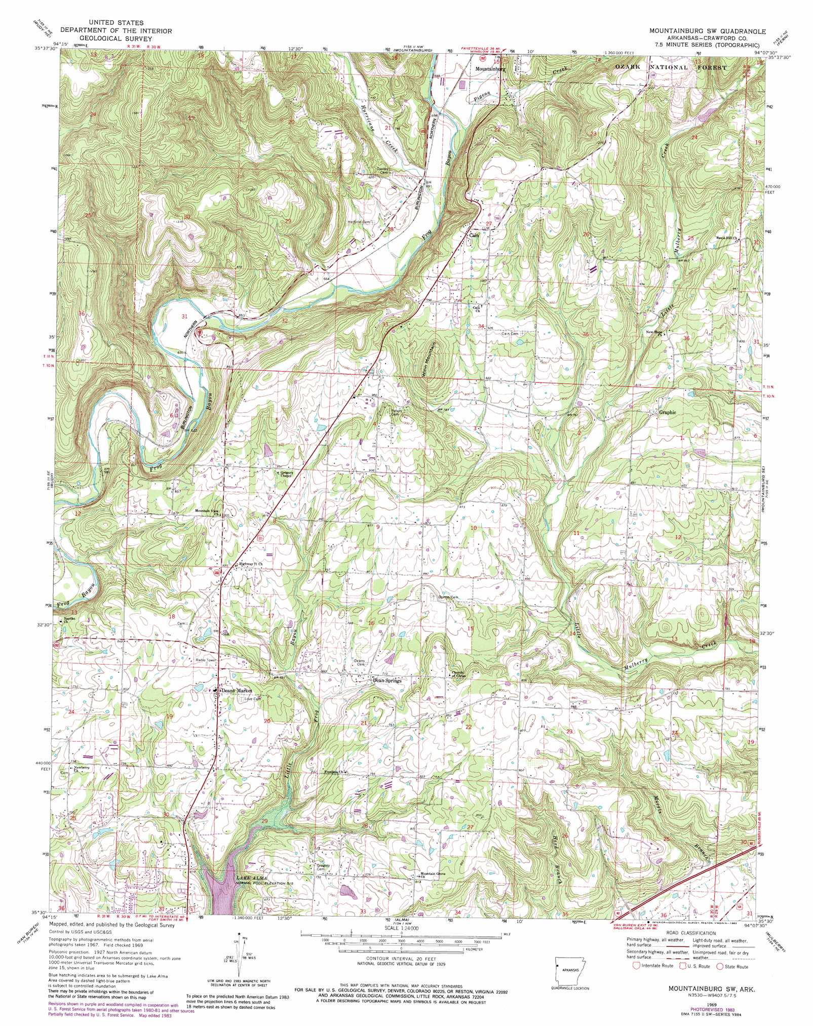
USGS Topo Quad 35094e2 - 1:24,000 scale
| Topo Map Name: | Mountainburg Sw |
| USGS Topo Quad ID: | 35094e2 |
| Print Size: | ca. 21 1/4" wide x 27" high |
| Southeast Coordinates: | 35.5° N latitude / 94.125° W longitude |
| Map Center Coordinates: | 35.5625° N latitude / 94.1875° W longitude |
| U.S. State: | AR |
| Filename: | o35094e2.jpg |
| Download Map JPG Image: | Mountainburg Sw topo map 1:24,000 scale |
| Map Type: | Topographic |
| Topo Series: | 7.5´ |
| Map Scale: | 1:24,000 |
| Source of Map Images: | United States Geological Survey (USGS) |
| Alternate Map Versions: |
Mountainburg SW AR 1969, updated 1971 Download PDF Buy paper map Mountainburg SW AR 1969, updated 1977 Download PDF Buy paper map Mountainburg SW AR 1969, updated 1983 Download PDF Buy paper map Mountainburg SW AR 1969, updated 1983 Download PDF Buy paper map Mountainburg SW AR 2011 Download PDF Buy paper map Mountainburg SW AR 2014 Download PDF Buy paper map |
| FStopo: | US Forest Service topo Mountainburg SW is available: Download FStopo PDF Download FStopo TIF |
1:24,000 Topo Quads surrounding Mountainburg Sw
Evansville |
Strickler |
Winslow |
Brentwood |
Delaney |
Natural Dam |
Rudy Ne |
Mountainburg |
Fern |
Bidville |
Uniontown |
Rudy |
Mountainburg Sw |
Mountainburg Se |
Cravens |
Fort Smith |
Van Buren |
Alma |
Mulberry |
Cecil |
South Fort Smith |
Barling |
Lavaca |
Charleston |
Branch |
> Back to 35094e1 at 1:100,000 scale
> Back to 35094a1 at 1:250,000 scale
> Back to U.S. Topo Maps home
Mountainburg Sw topo map: Gazetteer
Mountainburg Sw: Dams
Hammond Lake Dam elevation 285m 935′Morris Lake Dam elevation 223m 731′
Mountainburg Sw: Populated Places
Belmont (historical) elevation 264m 866′Cain elevation 340m 1115′
Dean Springs elevation 222m 728′
Deans Market elevation 241m 790′
Graphic elevation 278m 912′
Lancaster (historical) elevation 187m 613′
Mountainburg Sw: Reservoirs
Hammond Lake elevation 285m 935′Morris Lake elevation 223m 731′
Mountainburg Sw: Springs
Fine Springs elevation 238m 780′Mountainburg Sw: Streams
Hurricane Creek elevation 201m 659′Pigeon Creek elevation 210m 688′
Mountainburg Sw: Summits
Winn Mountain elevation 331m 1085′Mountainburg Sw: Valleys
Bonita Hollow elevation 161m 528′Mountainburg Sw digital topo map on disk
Buy this Mountainburg Sw topo map showing relief, roads, GPS coordinates and other geographical features, as a high-resolution digital map file on DVD: