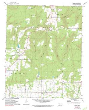
Brushy Topo Map Oklahoma
To zoom in, hover over the map of Brushy
USGS Topo Quad 35094e6 - 1:24,000 scale
| Topo Map Name: | Brushy |
| USGS Topo Quad ID: | 35094e6 |
| Print Size: | ca. 21 1/4" wide x 27" high |
| Southeast Coordinates: | 35.5° N latitude / 94.625° W longitude |
| Map Center Coordinates: | 35.5625° N latitude / 94.6875° W longitude |
| U.S. State: | OK |
| Filename: | o35094e6.jpg |
| Download Map JPG Image: | Brushy topo map 1:24,000 scale |
| Map Type: | Topographic |
| Topo Series: | 7.5´ |
| Map Scale: | 1:24,000 |
| Source of Map Images: | United States Geological Survey (USGS) |
| Alternate Map Versions: |
Brushy OK 1973, updated 1974 Download PDF Buy paper map Brushy OK 1973, updated 1991 Download PDF Buy paper map Brushy OK 2010 Download PDF Buy paper map Brushy OK 2013 Download PDF Buy paper map Brushy OK 2016 Download PDF Buy paper map |
1:24,000 Topo Quads surrounding Brushy
> Back to 35094e1 at 1:100,000 scale
> Back to 35094a1 at 1:250,000 scale
> Back to U.S. Topo Maps home
Brushy topo map: Gazetteer
Brushy: Dams
Sallisaw Creek Site 22 Dam elevation 333m 1092′Sallisaw Creek Site 30 Dam elevation 276m 905′
Sallisaw Creek Site 36 Dam elevation 203m 666′
Sallisaw Creek Site 37 Dam elevation 198m 649′
Brushy: Populated Places
Akins elevation 182m 597′Brushy elevation 295m 967′
Stoney Point elevation 403m 1322′
Brushy: Ranges
Brushy Mountains elevation 428m 1404′Brushy: Reservoirs
Brushy Lake elevation 277m 908′Sallisaw Creek Site 22 Reservoir elevation 333m 1092′
Sallisaw Creek Site 30 Reservoir elevation 276m 905′
Sallisaw Creek Site 36 Reservoir elevation 203m 666′
Sallisaw Creek Site 37 Reservoir elevation 198m 649′
Brushy: Ridges
Hay Ridge elevation 473m 1551′Long Ridge elevation 455m 1492′
Brushy: Streams
Charlie Creek elevation 173m 567′Brushy: Summits
Rocky Mountain elevation 391m 1282′Brushy: Valleys
Mud Spring Hollow elevation 207m 679′Obi Hollow elevation 275m 902′
Polecat Hollow elevation 228m 748′
Walker Hollow elevation 262m 859′
Wildcat Hollow elevation 304m 997′
Brushy digital topo map on disk
Buy this Brushy topo map showing relief, roads, GPS coordinates and other geographical features, as a high-resolution digital map file on DVD:


