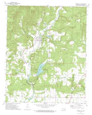
Marble City Topo Map Oklahoma
To zoom in, hover over the map of Marble City
USGS Topo Quad 35094e7 - 1:24,000 scale
| Topo Map Name: | Marble City |
| USGS Topo Quad ID: | 35094e7 |
| Print Size: | ca. 21 1/4" wide x 27" high |
| Southeast Coordinates: | 35.5° N latitude / 94.75° W longitude |
| Map Center Coordinates: | 35.5625° N latitude / 94.8125° W longitude |
| U.S. State: | OK |
| Filename: | o35094e7.jpg |
| Download Map JPG Image: | Marble City topo map 1:24,000 scale |
| Map Type: | Topographic |
| Topo Series: | 7.5´ |
| Map Scale: | 1:24,000 |
| Source of Map Images: | United States Geological Survey (USGS) |
| Alternate Map Versions: |
Marble City OK 1972, updated 1974 Download PDF Buy paper map Marble City OK 2010 Download PDF Buy paper map Marble City OK 2012 Download PDF Buy paper map Marble City OK 2016 Download PDF Buy paper map |
1:24,000 Topo Quads surrounding Marble City
> Back to 35094e1 at 1:100,000 scale
> Back to 35094a1 at 1:250,000 scale
> Back to U.S. Topo Maps home
Marble City topo map: Gazetteer
Marble City: Airports
Barry Dotson Ranch Airport elevation 277m 908′Marble City: Dams
Sallisaw Creek Site 28 Dam elevation 253m 830′Sallisaw Creek Site 29 Dam elevation 193m 633′
Sallisaw Creek Site 33 Dam elevation 205m 672′
Sallisaw Creek Site 5 Dam elevation 186m 610′
Sallisaw Creek Site 6 Dam elevation 195m 639′
Sallisaw Creek Site 8 Dam elevation 194m 636′
Marble City: Flats
Bird Flat elevation 277m 908′Marble City: Parks
Sallisaw State Recreation Area elevation 208m 682′Marble City: Populated Places
Dwight Mission elevation 201m 659′Flute Springs elevation 203m 666′
Marble City elevation 197m 646′
Marble City: Reservoirs
Brushy Creek Reservoir elevation 193m 633′Sallisaw Creek Site 28 Reservoir elevation 253m 830′
Sallisaw Creek Site 29 Reservoir elevation 193m 633′
Sallisaw Creek Site 33 Reservoir elevation 205m 672′
Sallisaw Creek Site 6 Reservoir elevation 195m 639′
Sallisaw Creek Site 8 Reservoir elevation 194m 636′
Ssllisaw Creek Site 5 Reservoir elevation 186m 610′
Marble City: Streams
Brushy Creek elevation 164m 538′Dry Creek elevation 184m 603′
Marble City: Summits
Andes Mountain elevation 251m 823′Grapevine Mountain elevation 259m 849′
Hastings Mountain elevation 228m 748′
Leathers Mountain elevation 275m 902′
Little Round Mountain elevation 270m 885′
Negro Mountain elevation 224m 734′
Quarry Mountain elevation 422m 1384′
Round Mountain elevation 317m 1040′
Schoolhouse Mountain elevation 241m 790′
Ussery Mountain elevation 399m 1309′
Marble City: Valleys
McEachin Hollow elevation 198m 649′Payne Hollow elevation 191m 626′
Trot Hollow elevation 190m 623′
Marble City digital topo map on disk
Buy this Marble City topo map showing relief, roads, GPS coordinates and other geographical features, as a high-resolution digital map file on DVD:


