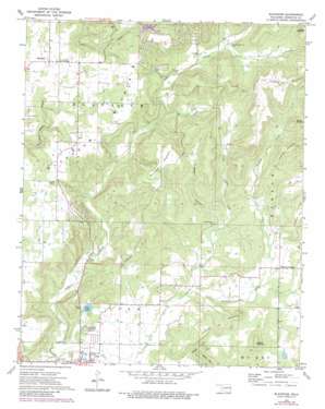
Blackgum Topo Map Oklahoma
To zoom in, hover over the map of Blackgum
USGS Topo Quad 35094e8 - 1:24,000 scale
| Topo Map Name: | Blackgum |
| USGS Topo Quad ID: | 35094e8 |
| Print Size: | ca. 21 1/4" wide x 27" high |
| Southeast Coordinates: | 35.5° N latitude / 94.875° W longitude |
| Map Center Coordinates: | 35.5625° N latitude / 94.9375° W longitude |
| U.S. State: | OK |
| Filename: | o35094e8.jpg |
| Download Map JPG Image: | Blackgum topo map 1:24,000 scale |
| Map Type: | Topographic |
| Topo Series: | 7.5´ |
| Map Scale: | 1:24,000 |
| Source of Map Images: | United States Geological Survey (USGS) |
| Alternate Map Versions: |
Blackgum OK 1972, updated 1974 Download PDF Buy paper map Blackgum OK 1972, updated 1983 Download PDF Buy paper map Blackgum OK 2010 Download PDF Buy paper map Blackgum OK 2012 Download PDF Buy paper map Blackgum OK 2016 Download PDF Buy paper map |
1:24,000 Topo Quads surrounding Blackgum
> Back to 35094e1 at 1:100,000 scale
> Back to 35094a1 at 1:250,000 scale
> Back to U.S. Topo Maps home
Blackgum topo map: Gazetteer
Blackgum: Dams
Sallisaw Creek Site 3 Dam elevation 174m 570′Blackgum: Populated Places
Blackgum elevation 276m 905′Box elevation 280m 918′
Evening Shade elevation 351m 1151′
Pinhook Corner elevation 211m 692′
Blackgum: Reservoirs
Sallisaw Creek Site 3 Reservoir elevation 174m 570′Vian Lake elevation 177m 580′
Blackgum: Streams
Pinhook Creek elevation 171m 561′Blackgum: Summits
Anderson Mountain elevation 246m 807′Blackgum Mountain elevation 337m 1105′
Chuculate Mountain elevation 317m 1040′
Cowhead Mountain elevation 369m 1210′
Lizzard Mountain elevation 271m 889′
Round Mountain elevation 352m 1154′
Blackgum: Valleys
Boggy Hollow elevation 169m 554′Wells Hollow elevation 191m 626′
Blackgum digital topo map on disk
Buy this Blackgum topo map showing relief, roads, GPS coordinates and other geographical features, as a high-resolution digital map file on DVD:


