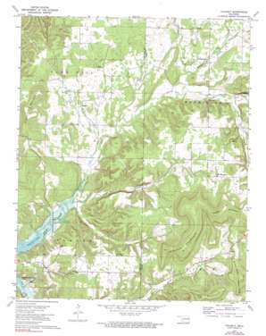
Tailholt Topo Map Oklahoma
To zoom in, hover over the map of Tailholt
USGS Topo Quad 35094g7 - 1:24,000 scale
| Topo Map Name: | Tailholt |
| USGS Topo Quad ID: | 35094g7 |
| Print Size: | ca. 21 1/4" wide x 27" high |
| Southeast Coordinates: | 35.75° N latitude / 94.75° W longitude |
| Map Center Coordinates: | 35.8125° N latitude / 94.8125° W longitude |
| U.S. State: | OK |
| Filename: | o35094g7.jpg |
| Download Map JPG Image: | Tailholt topo map 1:24,000 scale |
| Map Type: | Topographic |
| Topo Series: | 7.5´ |
| Map Scale: | 1:24,000 |
| Source of Map Images: | United States Geological Survey (USGS) |
| Alternate Map Versions: |
Tailholt OK 1972, updated 1974 Download PDF Buy paper map Tailholt OK 1972, updated 1991 Download PDF Buy paper map Tailholt OK 2010 Download PDF Buy paper map Tailholt OK 2012 Download PDF Buy paper map Tailholt OK 2016 Download PDF Buy paper map |
1:24,000 Topo Quads surrounding Tailholt
> Back to 35094e1 at 1:100,000 scale
> Back to 35094a1 at 1:250,000 scale
> Back to U.S. Topo Maps home
Tailholt topo map: Gazetteer
Tailholt: Populated Places
Barber elevation 200m 656′Rocky Mountain elevation 304m 997′
Tailholt elevation 250m 820′
Tenkiller elevation 272m 892′
Wauhillau elevation 249m 816′
Tailholt: Springs
Bitting Spring elevation 262m 859′July Spring elevation 278m 912′
Tailholt: Streams
Bidding Creek elevation 230m 754′North Fork Dry Creek elevation 247m 810′
South Fork Dry Creek elevation 247m 810′
Tailholt: Summits
Hungry Mountain elevation 436m 1430′Jackson Mountain elevation 425m 1394′
Sanders Mountain elevation 448m 1469′
Sugar Mountain elevation 373m 1223′
Tailholt: Valleys
Negro Jake Hollow elevation 205m 672′Smith Hollow elevation 242m 793′
Tailholt digital topo map on disk
Buy this Tailholt topo map showing relief, roads, GPS coordinates and other geographical features, as a high-resolution digital map file on DVD:


