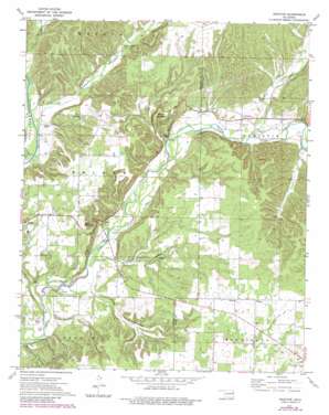
Proctor Topo Map Oklahoma
To zoom in, hover over the map of Proctor
USGS Topo Quad 35094h7 - 1:24,000 scale
| Topo Map Name: | Proctor |
| USGS Topo Quad ID: | 35094h7 |
| Print Size: | ca. 21 1/4" wide x 27" high |
| Southeast Coordinates: | 35.875° N latitude / 94.75° W longitude |
| Map Center Coordinates: | 35.9375° N latitude / 94.8125° W longitude |
| U.S. State: | OK |
| Filename: | o35094h7.jpg |
| Download Map JPG Image: | Proctor topo map 1:24,000 scale |
| Map Type: | Topographic |
| Topo Series: | 7.5´ |
| Map Scale: | 1:24,000 |
| Source of Map Images: | United States Geological Survey (USGS) |
| Alternate Map Versions: |
Proctor OK 1972, updated 1974 Download PDF Buy paper map Proctor OK 1972, updated 1983 Download PDF Buy paper map Proctor OK 2010 Download PDF Buy paper map Proctor OK 2012 Download PDF Buy paper map Proctor OK 2016 Download PDF Buy paper map |
1:24,000 Topo Quads surrounding Proctor
> Back to 35094e1 at 1:100,000 scale
> Back to 35094a1 at 1:250,000 scale
> Back to U.S. Topo Maps home
Proctor topo map: Gazetteer
Proctor: Populated Places
Briggs elevation 277m 908′Eldon elevation 241m 790′
New Spring Place (historical) elevation 331m 1085′
Proctor elevation 251m 823′
Titanic elevation 325m 1066′
Proctor: Streams
Hogeye Creek elevation 320m 1049′Tyner Creek elevation 232m 761′
Wall Trip Branch elevation 216m 708′
Willow Branch Creek elevation 207m 679′
Proctor: Summits
Eldon Mountain elevation 307m 1007′Proctor Mountain elevation 302m 990′
Proctor: Valleys
Field Hollow elevation 219m 718′Mining Camp Hollow elevation 207m 679′
Pumpkin Hollow elevation 220m 721′
Proctor digital topo map on disk
Buy this Proctor topo map showing relief, roads, GPS coordinates and other geographical features, as a high-resolution digital map file on DVD:


