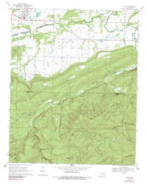
Kinta Topo Map Oklahoma
To zoom in, hover over the map of Kinta
USGS Topo Quad 35095a2 - 1:24,000 scale
| Topo Map Name: | Kinta |
| USGS Topo Quad ID: | 35095a2 |
| Print Size: | ca. 21 1/4" wide x 27" high |
| Southeast Coordinates: | 35° N latitude / 95.125° W longitude |
| Map Center Coordinates: | 35.0625° N latitude / 95.1875° W longitude |
| U.S. State: | OK |
| Filename: | o35095a2.jpg |
| Download Map JPG Image: | Kinta topo map 1:24,000 scale |
| Map Type: | Topographic |
| Topo Series: | 7.5´ |
| Map Scale: | 1:24,000 |
| Source of Map Images: | United States Geological Survey (USGS) |
| Alternate Map Versions: |
Kinta OK 1969, updated 1971 Download PDF Buy paper map Kinta OK 1969, updated 1989 Download PDF Buy paper map Kinta OK 2010 Download PDF Buy paper map Kinta OK 2012 Download PDF Buy paper map Kinta OK 2016 Download PDF Buy paper map |
1:24,000 Topo Quads surrounding Kinta
> Back to 35095a1 at 1:100,000 scale
> Back to 35094a1 at 1:250,000 scale
> Back to U.S. Topo Maps home
Kinta topo map: Gazetteer
Kinta: Cliffs
Bee Bluff elevation 217m 711′Kinta: Dams
Kinta Lake Dam elevation 166m 544′Kinta: Populated Places
Kinta elevation 166m 544′Kinta: Ranges
Sans Bois Mountains elevation 459m 1505′Kinta: Reservoirs
Kinta Lake elevation 168m 551′Kinta: Streams
Andrew Creek elevation 159m 521′Beaver Creek elevation 158m 518′
Camp Creek elevation 173m 567′
Chickasaw Creek elevation 157m 515′
Mountain Fork elevation 153m 501′
Right Prong Mountain Fork elevation 226m 741′
Turkey Creek elevation 159m 521′
Kinta: Summits
Blue Mountain elevation 556m 1824′Hulsey Mountain elevation 300m 984′
White Rocks elevation 420m 1377′
Kinta: Valleys
Bear Gulch elevation 233m 764′Bird Hollow elevation 249m 816′
Dry Creek Hollow elevation 190m 623′
Grassy Lake Hollow elevation 221m 725′
Smokestack Hollow elevation 236m 774′
Twentynine Hollow elevation 206m 675′
Vaughn Hollow elevation 158m 518′
Kinta digital topo map on disk
Buy this Kinta topo map showing relief, roads, GPS coordinates and other geographical features, as a high-resolution digital map file on DVD:


