Gore Topo Map Oklahoma
To zoom in, hover over the map of Gore
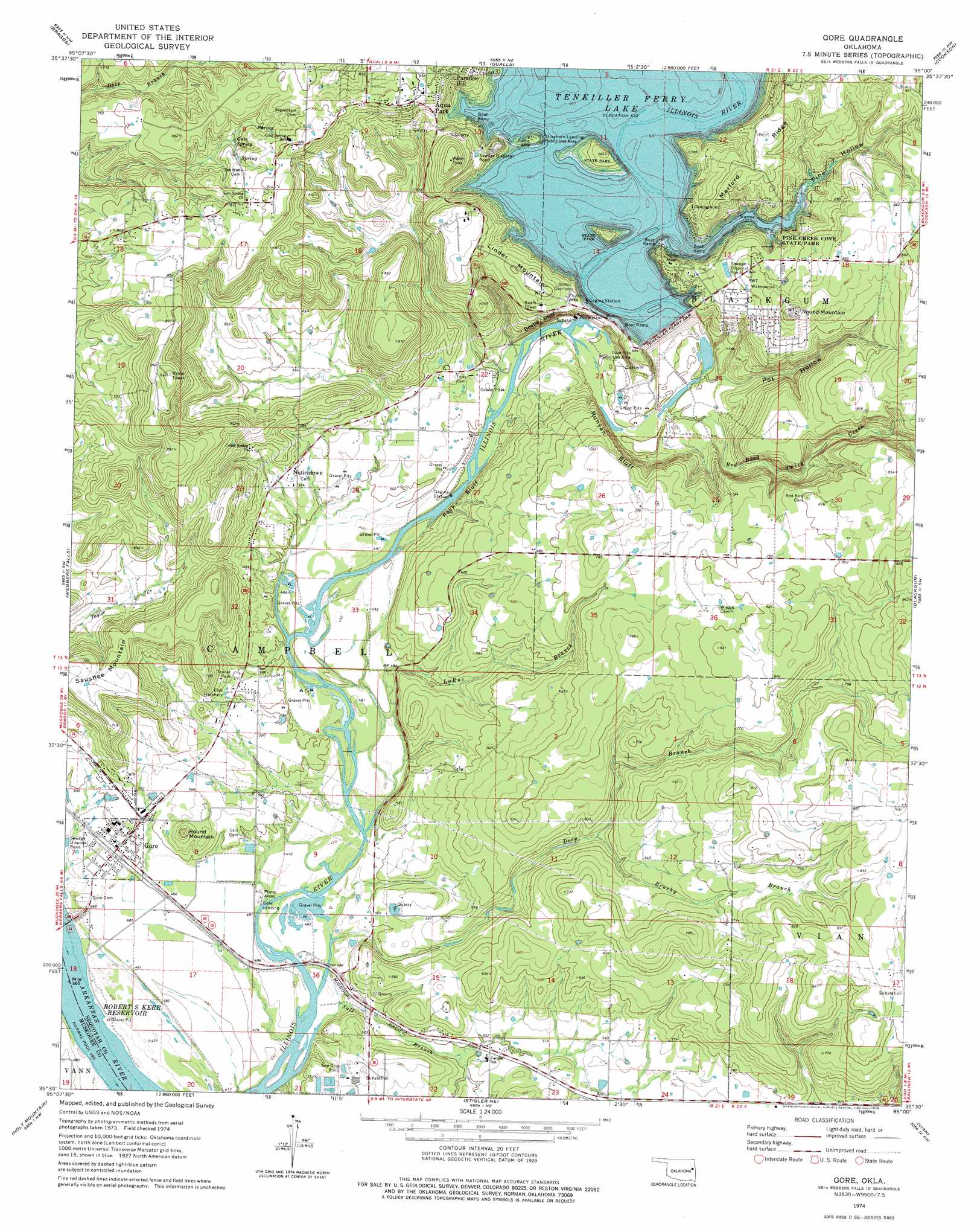
USGS Topo Quad 35095e1 - 1:24,000 scale
| Topo Map Name: | Gore |
| USGS Topo Quad ID: | 35095e1 |
| Print Size: | ca. 21 1/4" wide x 27" high |
| Southeast Coordinates: | 35.5° N latitude / 95° W longitude |
| Map Center Coordinates: | 35.5625° N latitude / 95.0625° W longitude |
| U.S. State: | OK |
| Filename: | o35095e1.jpg |
| Download Map JPG Image: | Gore topo map 1:24,000 scale |
| Map Type: | Topographic |
| Topo Series: | 7.5´ |
| Map Scale: | 1:24,000 |
| Source of Map Images: | United States Geological Survey (USGS) |
| Alternate Map Versions: |
Webbers Falls SE OK 1972, updated 1974 Download PDF Buy paper map Gore OK 1974, updated 1978 Download PDF Buy paper map Gore OK 1974, updated 1978 Download PDF Buy paper map Gore OK 2010 Download PDF Buy paper map Gore OK 2012 Download PDF Buy paper map Gore OK 2016 Download PDF Buy paper map |
1:24,000 Topo Quads surrounding Gore
Northeast Muskogee |
Fort Gibson Dam |
Zeb |
Park Hill |
Tailholt |
Southeast Muskogee |
Braggs |
Qualls |
Cookson |
Bunch |
Keefton |
Webbers Falls |
Gore |
Blackgum |
Marble City |
Warner |
Holt Mountain |
Stigler Ne |
Vian |
Sallisaw |
Porum |
Stigler West |
Stigler East |
Keota |
Robert S Kerr Dam |
> Back to 35095e1 at 1:100,000 scale
> Back to 35094a1 at 1:250,000 scale
> Back to U.S. Topo Maps home
Gore topo map: Gazetteer
Gore: Airports
Fin and Feather Resort Heliport elevation 251m 823′Gore: Cliffs
Beetle Bluff elevation 165m 541′Rock Bluff elevation 164m 538′
Runyan Bluff elevation 155m 508′
Gore: Dams
Tenkiller Dam elevation 182m 597′Tenkiller Ferry Dam elevation 203m 666′
Gore: Parks
Pine Creek Cove State Park elevation 222m 728′Strayhorn Landing Public Use Area elevation 203m 666′
Gore: Populated Places
Aqua Park elevation 272m 892′Carlisle elevation 171m 561′
Gore elevation 151m 495′
Gore Landing elevation 146m 479′
Notichtown elevation 166m 544′
Redbird Smith elevation 243m 797′
Gore: Reservoirs
Tenkiller Ferry Lake elevation 196m 643′Tenkiller Lake elevation 182m 597′
Gore: Ridges
Merford Ridge elevation 256m 839′Gore: Springs
Gum Spring elevation 238m 780′Gore: Streams
Brushy Branch elevation 171m 561′Deep Branch elevation 145m 475′
LaRue Branch elevation 146m 479′
Red Bird Smith Creek elevation 153m 501′
Salt Branch elevation 140m 459′
Gore: Summits
Linder Mountain elevation 243m 797′Round Mountain elevation 291m 954′
Round Mountain elevation 195m 639′
Sausbee Mountain elevation 234m 767′
Gore: Valleys
Pine Hollow elevation 193m 633′Pot Hollow elevation 153m 501′
Gore digital topo map on disk
Buy this Gore topo map showing relief, roads, GPS coordinates and other geographical features, as a high-resolution digital map file on DVD: