Council Hill Topo Map Oklahoma
To zoom in, hover over the map of Council Hill
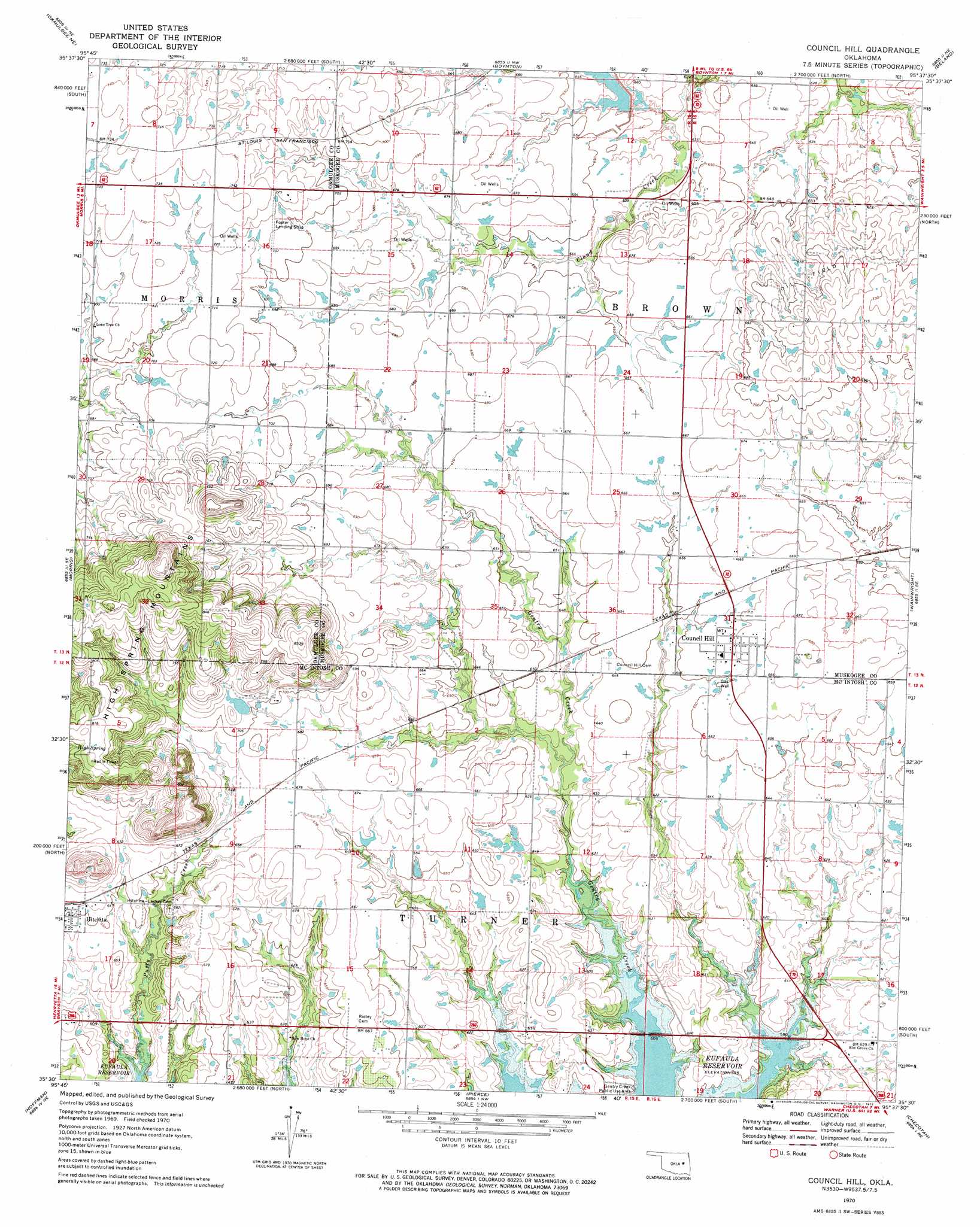
USGS Topo Quad 35095e6 - 1:24,000 scale
| Topo Map Name: | Council Hill |
| USGS Topo Quad ID: | 35095e6 |
| Print Size: | ca. 21 1/4" wide x 27" high |
| Southeast Coordinates: | 35.5° N latitude / 95.625° W longitude |
| Map Center Coordinates: | 35.5625° N latitude / 95.6875° W longitude |
| U.S. State: | OK |
| Filename: | o35095e6.jpg |
| Download Map JPG Image: | Council Hill topo map 1:24,000 scale |
| Map Type: | Topographic |
| Topo Series: | 7.5´ |
| Map Scale: | 1:24,000 |
| Source of Map Images: | United States Geological Survey (USGS) |
| Alternate Map Versions: |
Council Hill OK 1970, updated 1972 Download PDF Buy paper map Council Hill OK 2010 Download PDF Buy paper map Council Hill OK 2012 Download PDF Buy paper map Council Hill OK 2016 Download PDF Buy paper map |
1:24,000 Topo Quads surrounding Council Hill
Spanish Peak |
Concharty Mountain |
Haskell |
Taft |
Northwest Muskogee |
Okmulgee North |
Okmulgee Ne |
Boynton |
Beland |
Southwest Muskogee |
Okmulgee South |
Morris |
Council Hill |
Wainwright |
Oktaha |
Henryetta |
Hoffman |
Pierce |
Checotah |
Warner Nw |
Henryetta Sw |
Raiford |
Stidham |
Eufaula |
Texanna |
> Back to 35095e1 at 1:100,000 scale
> Back to 35094a1 at 1:250,000 scale
> Back to U.S. Topo Maps home
Council Hill topo map: Gazetteer
Council Hill: Airports
Meadowlark Field elevation 227m 744′Council Hill: Parks
Gentry Creek Public Use Area elevation 183m 600′Council Hill: Populated Places
Council Hill elevation 201m 659′Council Hill: Springs
High Spring elevation 243m 797′Council Hill: Streams
Putty Creek elevation 178m 583′Council Hill digital topo map on disk
Buy this Council Hill topo map showing relief, roads, GPS coordinates and other geographical features, as a high-resolution digital map file on DVD: