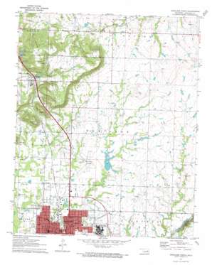
Okmulgee North Topo Map Oklahoma
To zoom in, hover over the map of Okmulgee North
USGS Topo Quad 35095f8 - 1:24,000 scale
| Topo Map Name: | Okmulgee North |
| USGS Topo Quad ID: | 35095f8 |
| Print Size: | ca. 21 1/4" wide x 27" high |
| Southeast Coordinates: | 35.625° N latitude / 95.875° W longitude |
| Map Center Coordinates: | 35.6875° N latitude / 95.9375° W longitude |
| U.S. State: | OK |
| Filename: | o35095f8.jpg |
| Download Map JPG Image: | Okmulgee North topo map 1:24,000 scale |
| Map Type: | Topographic |
| Topo Series: | 7.5´ |
| Map Scale: | 1:24,000 |
| Source of Map Images: | United States Geological Survey (USGS) |
| Alternate Map Versions: |
Okmulgee North OK 1971, updated 1973 Download PDF Buy paper map Okmulgee North OK 2010 Download PDF Buy paper map Okmulgee North OK 2012 Download PDF Buy paper map Okmulgee North OK 2016 Download PDF Buy paper map |
1:24,000 Topo Quads surrounding Okmulgee North
> Back to 35095e1 at 1:100,000 scale
> Back to 35094a1 at 1:250,000 scale
> Back to U.S. Topo Maps home
Okmulgee North topo map: Gazetteer
Okmulgee North: Airports
Gerhart Airport elevation 285m 935′Okmulgee Municipal Airport elevation 211m 692′
Okmulgee North: Dams
Okmulgee Creek Site 1 Dam elevation 207m 679′Okmulgee Creek Site 2 Dam elevation 201m 659′
Oknoname 111002 Dam elevation 259m 849′
Oknoname 111024 Dam elevation 224m 734′
Oknoname 111025 Dam elevation 227m 744′
Oknoname 111026 Dam elevation 217m 711′
Oknoname 111082 Dam elevation 211m 692′
Oknoname 111083 Dam elevation 210m 688′
Oknoname 111084 Dam elevation 225m 738′
Oknoname 111085 Dam elevation 248m 813′
Oknoname 111086 Dam elevation 241m 790′
Upper Washita Site 37 Dam elevation 220m 721′
Okmulgee North: Parks
Hawthorn Park elevation 202m 662′Okmulgee North: Populated Places
Natura elevation 218m 715′Preston elevation 239m 784′
Okmulgee North: Reservoirs
Okmulgee Creek Site 1 Reservoir elevation 207m 679′Okmulgee Creek Site 2 Reservoir elevation 201m 659′
Oknoname 111002 Reservoir elevation 259m 849′
Oknoname 111024 Reservoir elevation 224m 734′
Oknoname 111025 Reservoir elevation 227m 744′
Oknoname 111026 Reservoir elevation 217m 711′
Oknoname 111082 Reservoir elevation 211m 692′
Oknoname 111083 Reservoir elevation 210m 688′
Oknoname 111084 Reservoir elevation 225m 738′
Oknoname 111085 Reservoir elevation 248m 813′
Oknoname 111086 Reservoir elevation 241m 790′
Upper Washita Site 37 Reservoir elevation 220m 721′
Okmulgee North digital topo map on disk
Buy this Okmulgee North topo map showing relief, roads, GPS coordinates and other geographical features, as a high-resolution digital map file on DVD:


