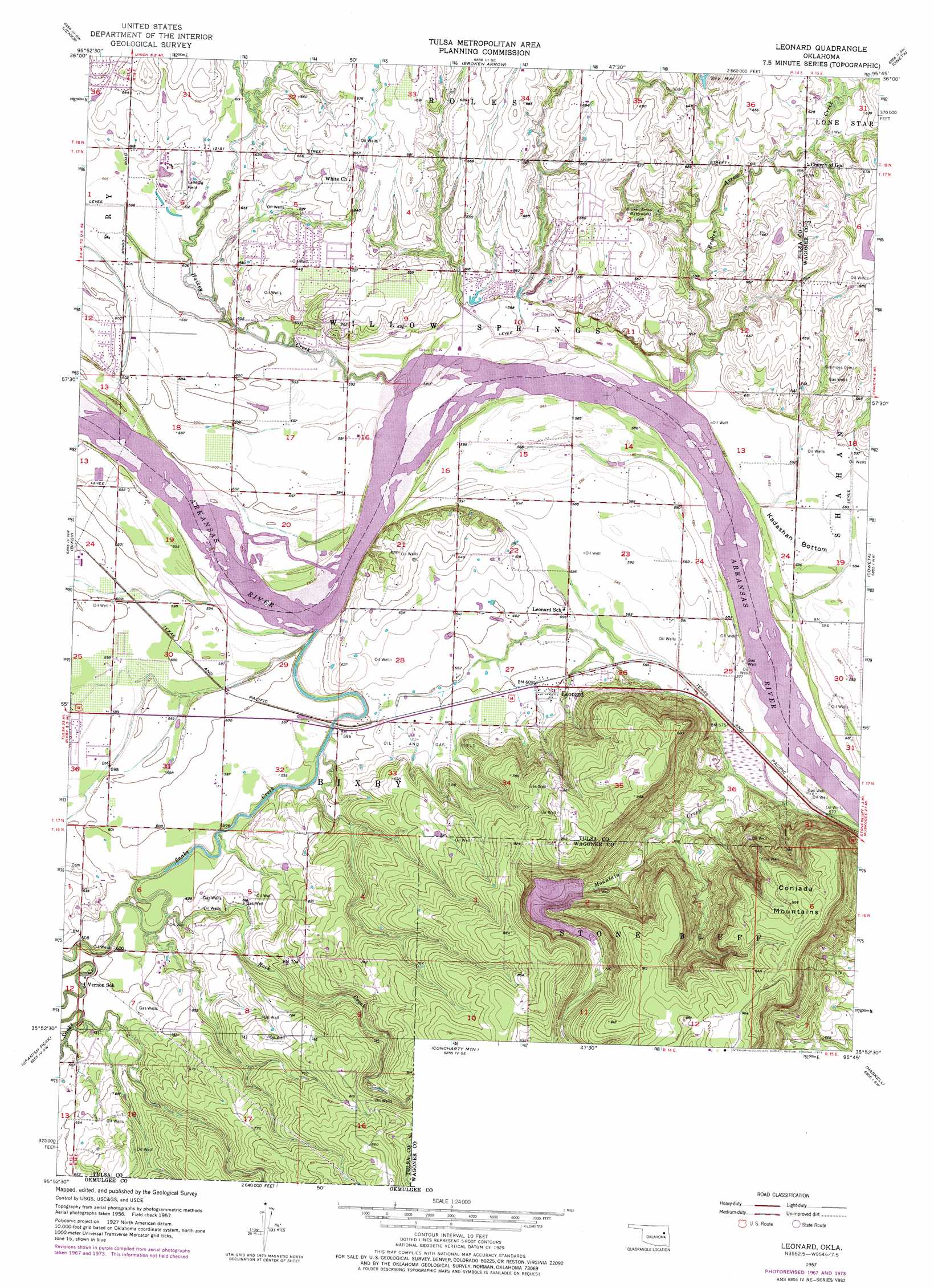
Leonard Topo Map Oklahoma
To zoom in, hover over the map of Leonard
USGS Topo Quad 35095h7 - 1:24,000 scale
| Topo Map Name: | Leonard |
| USGS Topo Quad ID: | 35095h7 |
| Print Size: | ca. 21 1/4" wide x 27" high |
| Southeast Coordinates: | 35.875° N latitude / 95.75° W longitude |
| Map Center Coordinates: | 35.9375° N latitude / 95.8125° W longitude |
| U.S. State: | OK |
| Filename: | o35095h7.jpg |
| Download Map JPG Image: | Leonard topo map 1:24,000 scale |
| Map Type: | Topographic |
| Topo Series: | 7.5´ |
| Map Scale: | 1:24,000 |
| Source of Map Images: | United States Geological Survey (USGS) |
| Alternate Map Versions: |
Leonard OK 1957, updated 1968 Download PDF Buy paper map Leonard OK 1957, updated 1975 Download PDF Buy paper map Leonard OK 1957, updated 1975 Download PDF Buy paper map Leonard OK 2010 Download PDF Buy paper map Leonard OK 2012 Download PDF Buy paper map Leonard OK 2016 Download PDF Buy paper map |
1:24,000 Topo Quads surrounding Leonard
Sand Springs |
Tulsa |
Mingo |
Catoosa |
Inola |
Sapulpa North |
Jenks |
Broken Arrow |
Oneta |
Catoosa Se |
Sapulpa South |
Bixby |
Leonard |
Coweta |
Red Bird |
Lake Boren |
Spanish Peak |
Concharty Mountain |
Haskell |
Taft |
Beggs |
Okmulgee North |
Okmulgee Ne |
Boynton |
Beland |
> Back to 35095e1 at 1:100,000 scale
> Back to 35094a1 at 1:250,000 scale
> Back to U.S. Topo Maps home
Leonard topo map: Gazetteer
Leonard: Dams
Bixhoma Dam elevation 211m 692′Leonard: Populated Places
Leonard elevation 186m 610′Leonard: Reservoirs
Bixhoma Lake elevation 211m 692′Bixhoma Lake elevation 211m 692′
Leonard: Streams
Hailkey Creek elevation 178m 583′Snake Creek elevation 180m 590′
Leonard: Summits
Conjada Mountains elevation 295m 967′Leonard digital topo map on disk
Buy this Leonard topo map showing relief, roads, GPS coordinates and other geographical features, as a high-resolution digital map file on DVD: