Maud Topo Map Oklahoma
To zoom in, hover over the map of Maud
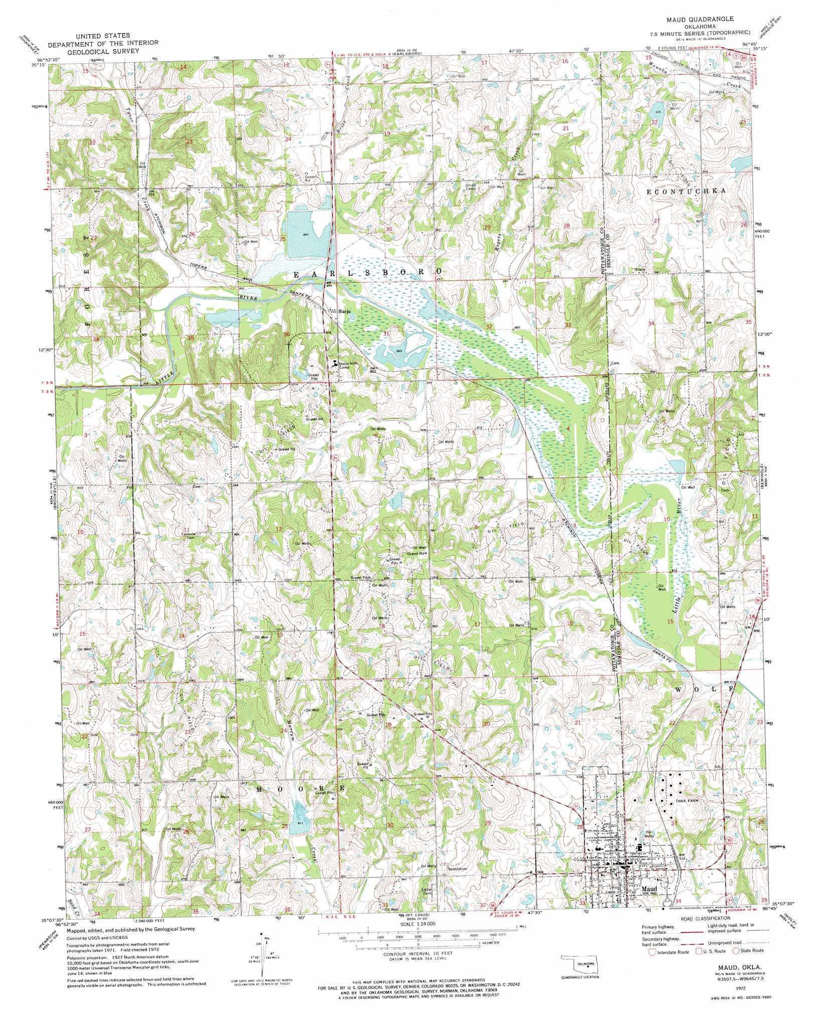
USGS Topo Quad 35096b7 - 1:24,000 scale
| Topo Map Name: | Maud |
| USGS Topo Quad ID: | 35096b7 |
| Print Size: | ca. 21 1/4" wide x 27" high |
| Southeast Coordinates: | 35.125° N latitude / 96.75° W longitude |
| Map Center Coordinates: | 35.1875° N latitude / 96.8125° W longitude |
| U.S. State: | OK |
| Filename: | o35096b7.jpg |
| Download Map JPG Image: | Maud topo map 1:24,000 scale |
| Map Type: | Topographic |
| Topo Series: | 7.5´ |
| Map Scale: | 1:24,000 |
| Source of Map Images: | United States Geological Survey (USGS) |
| Alternate Map Versions: |
Maud OK 1972, updated 1974 Download PDF Buy paper map Maud OK 2010 Download PDF Buy paper map Maud OK 2012 Download PDF Buy paper map Maud OK 2016 Download PDF Buy paper map |
1:24,000 Topo Quads surrounding Maud
Mcloud |
Aydelotte |
Shawnee Ne |
Prague |
Prague Ne |
Shawnee Reservoir |
Shawnee |
Earlsboro |
Prague Sw |
Prague Se |
Macomb |
Brooksville |
Maud |
Seminole |
Wewoka West |
Tribbey |
Pearson |
Saint Louis |
Wolf |
Tate Mountain |
Wanette |
Asher |
Konawa |
Vamoosa |
Sasakwa |
> Back to 35096a1 at 1:100,000 scale
> Back to 35096a1 at 1:250,000 scale
> Back to U.S. Topo Maps home
Maud topo map: Gazetteer
Maud: Dams
Big Wewoka Creek Site 1 Dam elevation 281m 921′Big Wewoka Creek Site 2 Dam elevation 283m 928′
J E McSpadden Dam elevation 287m 941′
Oknoname 12516 Dam elevation 280m 918′
Salt Creek Site 27 Dam elevation 277m 908′
Maud: Populated Places
Harjo elevation 278m 912′Maud elevation 295m 967′
Maud: Reservoirs
Big Wewoka Creek Site 1 Reservoir elevation 281m 921′Big Wewoka Creek Site 2 Reservoir elevation 283m 928′
J E McSpadden Reservoir elevation 287m 941′
Oknoname 12516 Reservoir elevation 280m 918′
Salt Creek Site 27 Reservoir elevation 277m 908′
Maud: Streams
Brier Creek elevation 271m 889′Rogers Creek elevation 271m 889′
Tyner Creek elevation 271m 889′
Maud digital topo map on disk
Buy this Maud topo map showing relief, roads, GPS coordinates and other geographical features, as a high-resolution digital map file on DVD: