Dustin Topo Map Oklahoma
To zoom in, hover over the map of Dustin
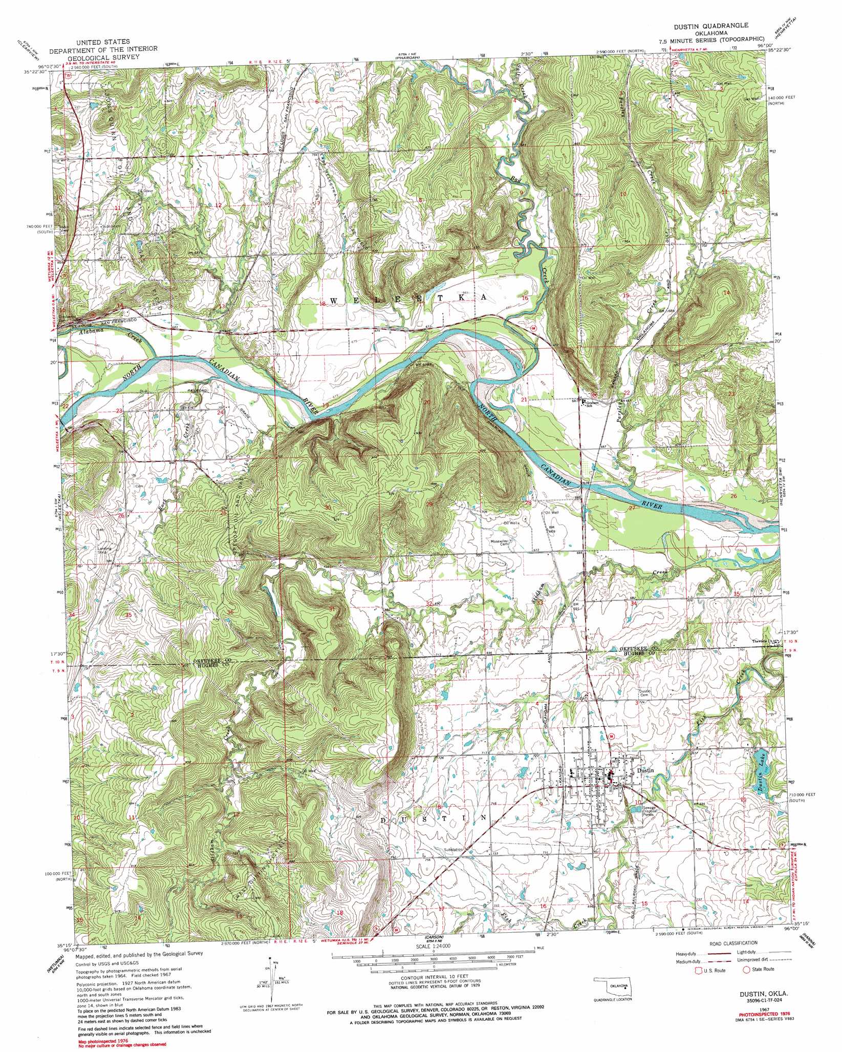
USGS Topo Quad 35096c1 - 1:24,000 scale
| Topo Map Name: | Dustin |
| USGS Topo Quad ID: | 35096c1 |
| Print Size: | ca. 21 1/4" wide x 27" high |
| Southeast Coordinates: | 35.25° N latitude / 96° W longitude |
| Map Center Coordinates: | 35.3125° N latitude / 96.0625° W longitude |
| U.S. State: | OK |
| Filename: | o35096c1.jpg |
| Download Map JPG Image: | Dustin topo map 1:24,000 scale |
| Map Type: | Topographic |
| Topo Series: | 7.5´ |
| Map Scale: | 1:24,000 |
| Source of Map Images: | United States Geological Survey (USGS) |
| Alternate Map Versions: |
Dustin OK 1967, updated 1968 Download PDF Buy paper map Dustin OK 1967, updated 1983 Download PDF Buy paper map Dustin OK 1967, updated 1986 Download PDF Buy paper map Dustin OK 2010 Download PDF Buy paper map Dustin OK 2012 Download PDF Buy paper map Dustin OK 2016 Download PDF Buy paper map |
1:24,000 Topo Quads surrounding Dustin
Mason |
Okfuskee |
Okmulgee Lake |
Okmulgee South |
Morris |
Okemah |
Clearview |
Pharoah |
Henryetta |
Hoffman |
Okemah Se |
Weleetka |
Dustin |
Henryetta Sw |
Raiford |
Yeager |
Wetumka |
Carson |
Hanna |
Indianola |
Lake Holdenville |
Lamar |
Wetumka Se |
Scipio |
Lake Mcalester |
> Back to 35096a1 at 1:100,000 scale
> Back to 35096a1 at 1:250,000 scale
> Back to U.S. Topo Maps home
Dustin topo map: Gazetteer
Dustin: Dams
Dustin Lake Dam elevation 223m 731′Oknoname 063012 Dam elevation 216m 708′
Oknoname 107030 Dam elevation 232m 761′
Dustin: Oilfields
East Weleetka Oil and Gas Field elevation 220m 721′Gregory Oil and Gas Field elevation 260m 853′
West Dustin Oil Field elevation 244m 800′
Dustin: Populated Places
Bookertee elevation 233m 764′Dustin elevation 218m 715′
Dustin: Reservoirs
Dustin Lake elevation 223m 731′Dustin Lake elevation 213m 698′
Oknoname 063012 Reservoir elevation 216m 708′
Oknoname 107030 Reservoir elevation 232m 761′
Dustin: Streams
Alabama Creek elevation 201m 659′Bad Creek elevation 198m 649′
Parsley Creek elevation 198m 649′
Rock Creek elevation 201m 659′
Salt Creek elevation 202m 662′
Dustin digital topo map on disk
Buy this Dustin topo map showing relief, roads, GPS coordinates and other geographical features, as a high-resolution digital map file on DVD: