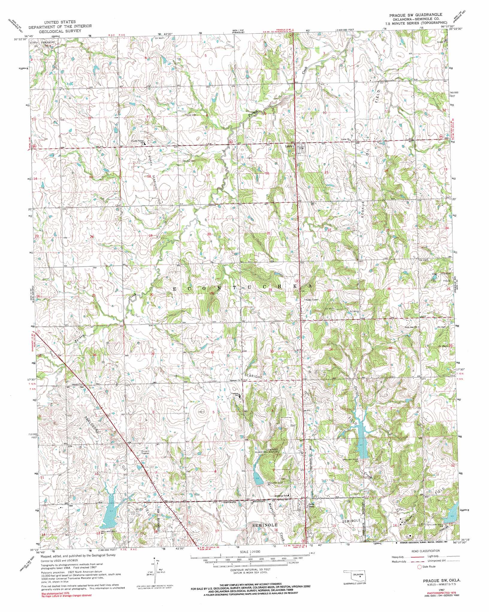
Prague Sw Topo Map Oklahoma
To zoom in, hover over the map of Prague Sw
USGS Topo Quad 35096c6 - 1:24,000 scale
| Topo Map Name: | Prague Sw |
| USGS Topo Quad ID: | 35096c6 |
| Print Size: | ca. 21 1/4" wide x 27" high |
| Southeast Coordinates: | 35.25° N latitude / 96.625° W longitude |
| Map Center Coordinates: | 35.3125° N latitude / 96.6875° W longitude |
| U.S. State: | OK |
| Filename: | o35096c6.jpg |
| Download Map JPG Image: | Prague Sw topo map 1:24,000 scale |
| Map Type: | Topographic |
| Topo Series: | 7.5´ |
| Map Scale: | 1:24,000 |
| Source of Map Images: | United States Geological Survey (USGS) |
| Alternate Map Versions: |
Prague SW OK 1967, updated 1968 Download PDF Buy paper map Prague SW OK 1967, updated 1991 Download PDF Buy paper map Prague SW OK 2010 Download PDF Buy paper map Prague SW OK 2012 Download PDF Buy paper map Prague SW OK 2016 Download PDF Buy paper map |
1:24,000 Topo Quads surrounding Prague Sw
Meeker |
Sparks |
Arlington |
Paden |
Welty |
Aydelotte |
Shawnee Ne |
Prague |
Prague Ne |
Boley |
Shawnee |
Earlsboro |
Prague Sw |
Prague Se |
Cromwell |
Brooksville |
Maud |
Seminole |
Wewoka West |
Wewoka East |
Pearson |
Saint Louis |
Wolf |
Tate Mountain |
Holdenville |
> Back to 35096a1 at 1:100,000 scale
> Back to 35096a1 at 1:250,000 scale
> Back to U.S. Topo Maps home
Prague Sw topo map: Gazetteer
Prague Sw: Airports
Seminole Municipal Airport elevation 308m 1010′Prague Sw: Dams
Big Wewoka Creek Site 3 Dam elevation 297m 974′Big Wewoka Creek Site 5 Dam elevation 277m 908′
Big Wewoka Creek Site 9 Dam elevation 281m 921′
C Jarvis Dam elevation 289m 948′
Prague Sw: Oilfields
Earlsboro Oil Field elevation 296m 971′East Keokuk Oil Field elevation 309m 1013′
Keokuk Oil Field elevation 279m 915′
North Searight Oil Field elevation 291m 954′
Searight Oil Field elevation 313m 1026′
Prague Sw: Populated Places
Little elevation 294m 964′Prague Sw: Reservoirs
Big Wewoka Creek Site 3 Reservoir elevation 297m 974′Big Wewoka Creek Site 5 Reservoir elevation 277m 908′
Big Wewoka Creek Site 9 Reservoir elevation 281m 921′
C Jarvis Reservoir elevation 289m 948′
Prague Sw digital topo map on disk
Buy this Prague Sw topo map showing relief, roads, GPS coordinates and other geographical features, as a high-resolution digital map file on DVD: