Clearview Topo Map Oklahoma
To zoom in, hover over the map of Clearview
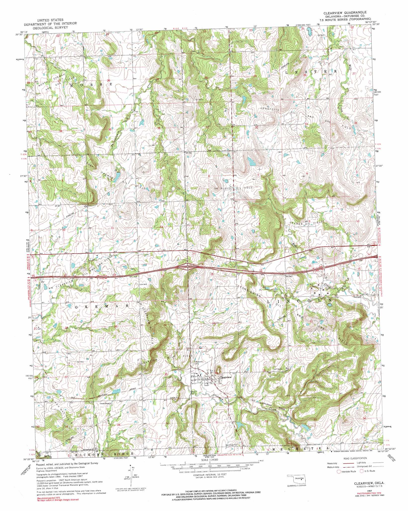
USGS Topo Quad 35096d2 - 1:24,000 scale
| Topo Map Name: | Clearview |
| USGS Topo Quad ID: | 35096d2 |
| Print Size: | ca. 21 1/4" wide x 27" high |
| Southeast Coordinates: | 35.375° N latitude / 96.125° W longitude |
| Map Center Coordinates: | 35.4375° N latitude / 96.1875° W longitude |
| U.S. State: | OK |
| Filename: | o35096d2.jpg |
| Download Map JPG Image: | Clearview topo map 1:24,000 scale |
| Map Type: | Topographic |
| Topo Series: | 7.5´ |
| Map Scale: | 1:24,000 |
| Source of Map Images: | United States Geological Survey (USGS) |
| Alternate Map Versions: |
Clearview OK 1967, updated 1968 Download PDF Buy paper map Clearview OK 1967, updated 1991 Download PDF Buy paper map Clearview OK 2010 Download PDF Buy paper map Clearview OK 2012 Download PDF Buy paper map Clearview OK 2016 Download PDF Buy paper map |
1:24,000 Topo Quads surrounding Clearview
Gypsy |
Newby |
Nuyaka |
Beggs |
Okmulgee North |
Welty |
Mason |
Okfuskee |
Okmulgee Lake |
Okmulgee South |
Boley |
Okemah |
Clearview |
Pharoah |
Henryetta |
Cromwell |
Okemah Se |
Weleetka |
Dustin |
Henryetta Sw |
Wewoka East |
Yeager |
Wetumka |
Carson |
Hanna |
> Back to 35096a1 at 1:100,000 scale
> Back to 35096a1 at 1:250,000 scale
> Back to U.S. Topo Maps home
Clearview topo map: Gazetteer
Clearview: Dams
Oknoname 107026 Dam elevation 245m 803′Oknoname 107027 Dam elevation 250m 820′
Oknoname 107028 Dam elevation 240m 787′
Clearview: Oilfields
Clearview Oil Field elevation 245m 803′Deaner Oil Field elevation 256m 839′
East Okemah Oil Field elevation 258m 846′
North Clearview Oil Field elevation 296m 971′
Northwest Clearview Oil and Gas Field elevation 262m 859′
Southeast Blakely Oil Field elevation 264m 866′
Clearview: Populated Places
Clearview elevation 240m 787′Clearview: Reservoirs
Oknoname 107026 Reservoir elevation 245m 803′Oknoname 107027 Reservoir elevation 250m 820′
Oknoname 107028 Reservoir elevation 240m 787′
Clearview digital topo map on disk
Buy this Clearview topo map showing relief, roads, GPS coordinates and other geographical features, as a high-resolution digital map file on DVD: