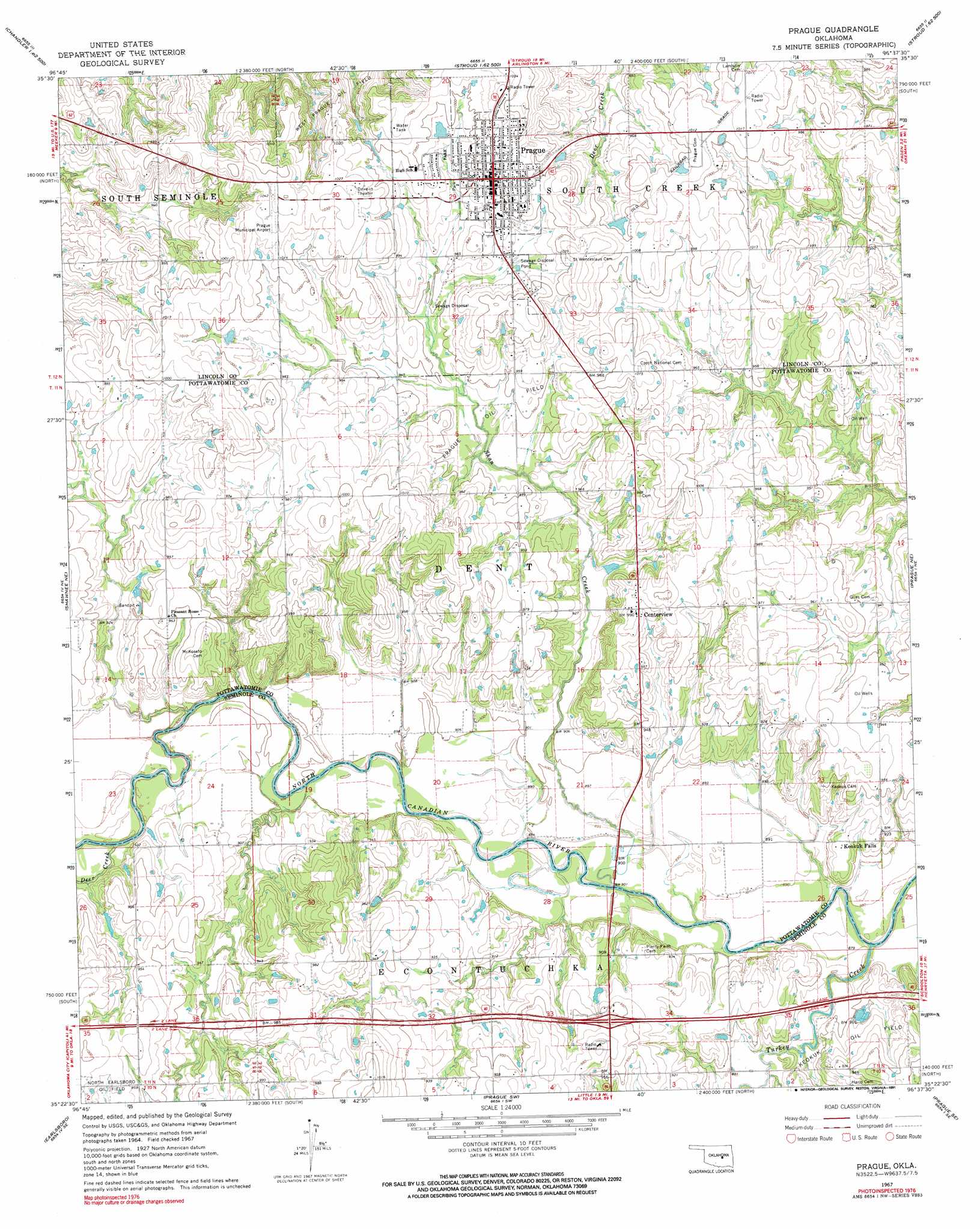
Prague Topo Map Oklahoma
To zoom in, hover over the map of Prague
USGS Topo Quad 35096d6 - 1:24,000 scale
| Topo Map Name: | Prague |
| USGS Topo Quad ID: | 35096d6 |
| Print Size: | ca. 21 1/4" wide x 27" high |
| Southeast Coordinates: | 35.375° N latitude / 96.625° W longitude |
| Map Center Coordinates: | 35.4375° N latitude / 96.6875° W longitude |
| U.S. State: | OK |
| Filename: | o35096d6.jpg |
| Download Map JPG Image: | Prague topo map 1:24,000 scale |
| Map Type: | Topographic |
| Topo Series: | 7.5´ |
| Map Scale: | 1:24,000 |
| Source of Map Images: | United States Geological Survey (USGS) |
| Alternate Map Versions: |
Prague OK 1967, updated 1968 Download PDF Buy paper map Prague OK 1967, updated 1991 Download PDF Buy paper map Prague OK 2010 Download PDF Buy paper map Prague OK 2012 Download PDF Buy paper map Prague OK 2016 Download PDF Buy paper map |
1:24,000 Topo Quads surrounding Prague
Chandler |
Davenport |
Stroud South |
Ritts Junction |
Gypsy |
Meeker |
Sparks |
Arlington |
Paden |
Welty |
Aydelotte |
Shawnee Ne |
Prague |
Prague Ne |
Boley |
Shawnee |
Earlsboro |
Prague Sw |
Prague Se |
Cromwell |
Brooksville |
Maud |
Seminole |
Wewoka West |
Wewoka East |
> Back to 35096a1 at 1:100,000 scale
> Back to 35096a1 at 1:250,000 scale
> Back to U.S. Topo Maps home
Prague topo map: Gazetteer
Prague: Airports
Prague Municipal Airport elevation 315m 1033′Prague: Dams
Oknoname 12521 Dam elevation 287m 941′Oknoname 12522 Dam elevation 290m 951′
Prague: Oilfields
Prague Oil Field elevation 287m 941′West Prague Oil Field elevation 305m 1000′
Prague: Populated Places
Centerview elevation 298m 977′Keokuk Falls elevation 282m 925′
Prague elevation 308m 1010′
Prague: Reservoirs
Oknoname 12521 Reservoir elevation 287m 941′Oknoname 12522 Reservoir elevation 290m 951′
Prague: Streams
Deer Creek elevation 274m 898′Provaznik Creek elevation 281m 921′
Shan Creek elevation 268m 879′
Turkey Creek elevation 265m 869′
Prague digital topo map on disk
Buy this Prague topo map showing relief, roads, GPS coordinates and other geographical features, as a high-resolution digital map file on DVD: