Chandler Topo Map Oklahoma
To zoom in, hover over the map of Chandler
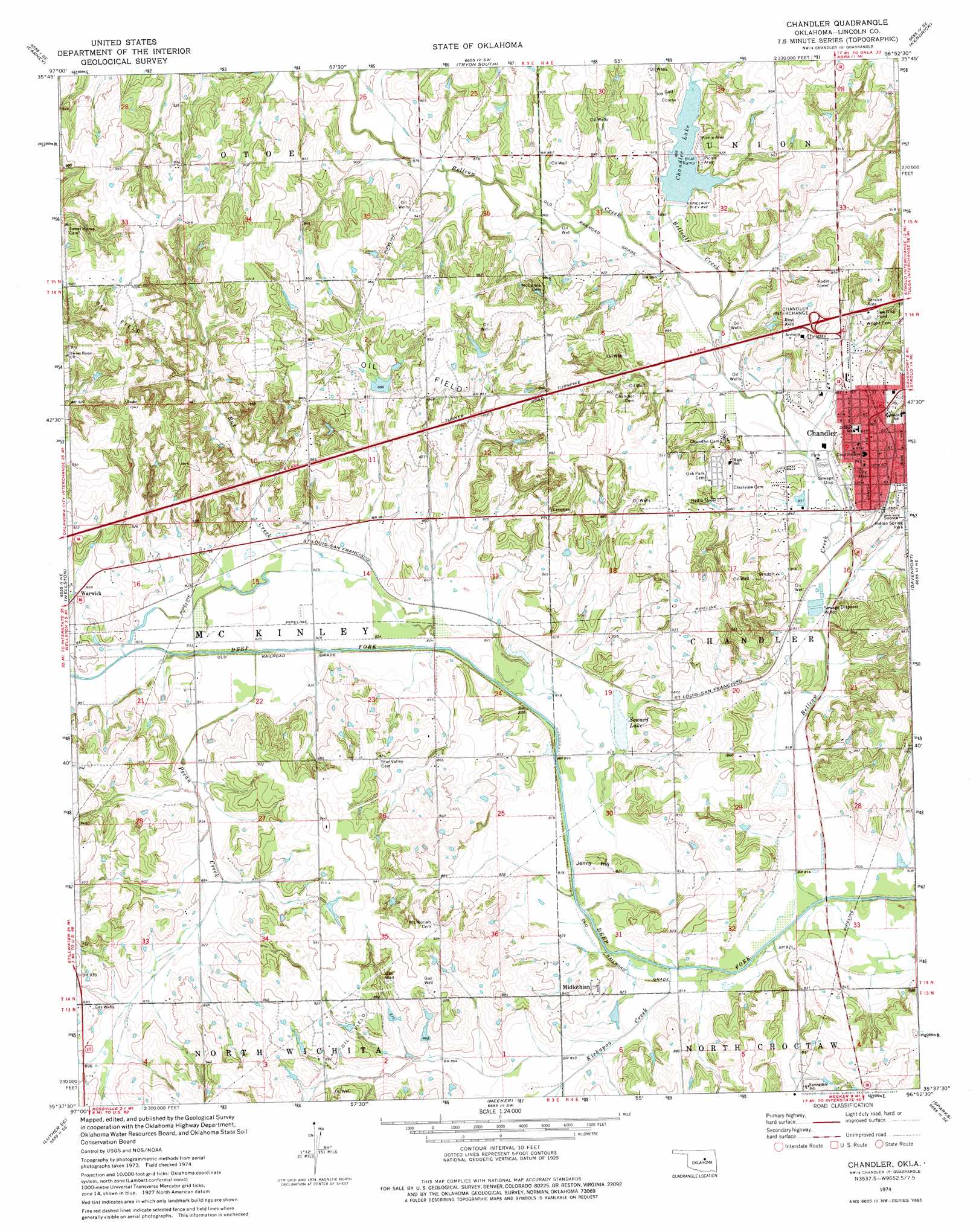
USGS Topo Quad 35096f8 - 1:24,000 scale
| Topo Map Name: | Chandler |
| USGS Topo Quad ID: | 35096f8 |
| Print Size: | ca. 21 1/4" wide x 27" high |
| Southeast Coordinates: | 35.625° N latitude / 96.875° W longitude |
| Map Center Coordinates: | 35.6875° N latitude / 96.9375° W longitude |
| U.S. State: | OK |
| Filename: | o35096f8.jpg |
| Download Map JPG Image: | Chandler topo map 1:24,000 scale |
| Map Type: | Topographic |
| Topo Series: | 7.5´ |
| Map Scale: | 1:24,000 |
| Source of Map Images: | United States Geological Survey (USGS) |
| Alternate Map Versions: |
Chandler OK 1974, updated 1977 Download PDF Buy paper map Chandler OK 2010 Download PDF Buy paper map Chandler OK 2012 Download PDF Buy paper map Chandler OK 2016 Download PDF Buy paper map |
1:24,000 Topo Quads surrounding Chandler
Coyle |
Perkins |
Tryon North |
Cushing |
North Village |
Meridian |
Carney |
Tryon South |
Kendrick |
Stroud North |
Luther |
Wellston |
Chandler |
Davenport |
Stroud South |
Horseshoe Lake |
Luther Se |
Meeker |
Sparks |
Arlington |
Harrah |
Mcloud |
Aydelotte |
Shawnee Ne |
Prague |
> Back to 35096e1 at 1:100,000 scale
> Back to 35096a1 at 1:250,000 scale
> Back to U.S. Topo Maps home
Chandler topo map: Gazetteer
Chandler: Airports
Biggs Skypatch Airport elevation 255m 836′Chandler: Crossings
Chandler Interchange elevation 291m 954′Chandler: Dams
Chandler Dam elevation 263m 862′Oknoname 08104 Dam elevation 270m 885′
Oknoname 111001 Dam elevation 296m 971′
Chandler: Parks
Indian Spring Park elevation 262m 859′Chandler: Populated Places
Chandler elevation 287m 941′Midlothian elevation 261m 856′
Chandler: Reservoirs
Bellcalf Creek Reservoir elevation 263m 862′Chandler Lake elevation 274m 898′
Oknoname 08104 Reservoir elevation 270m 885′
Oknoname 111001 Reservoir elevation 296m 971′
Soward Lake elevation 250m 820′
Chandler: Streams
Bellcalf Creek elevation 259m 849′Bellcow Creek elevation 245m 803′
Kickapoo Creek elevation 247m 810′
Otoe Creek elevation 270m 885′
Pecan Creek elevation 252m 826′
Rat Creek elevation 249m 816′
Chandler: Summits
Jenny Hill elevation 256m 839′Chandler digital topo map on disk
Buy this Chandler topo map showing relief, roads, GPS coordinates and other geographical features, as a high-resolution digital map file on DVD: