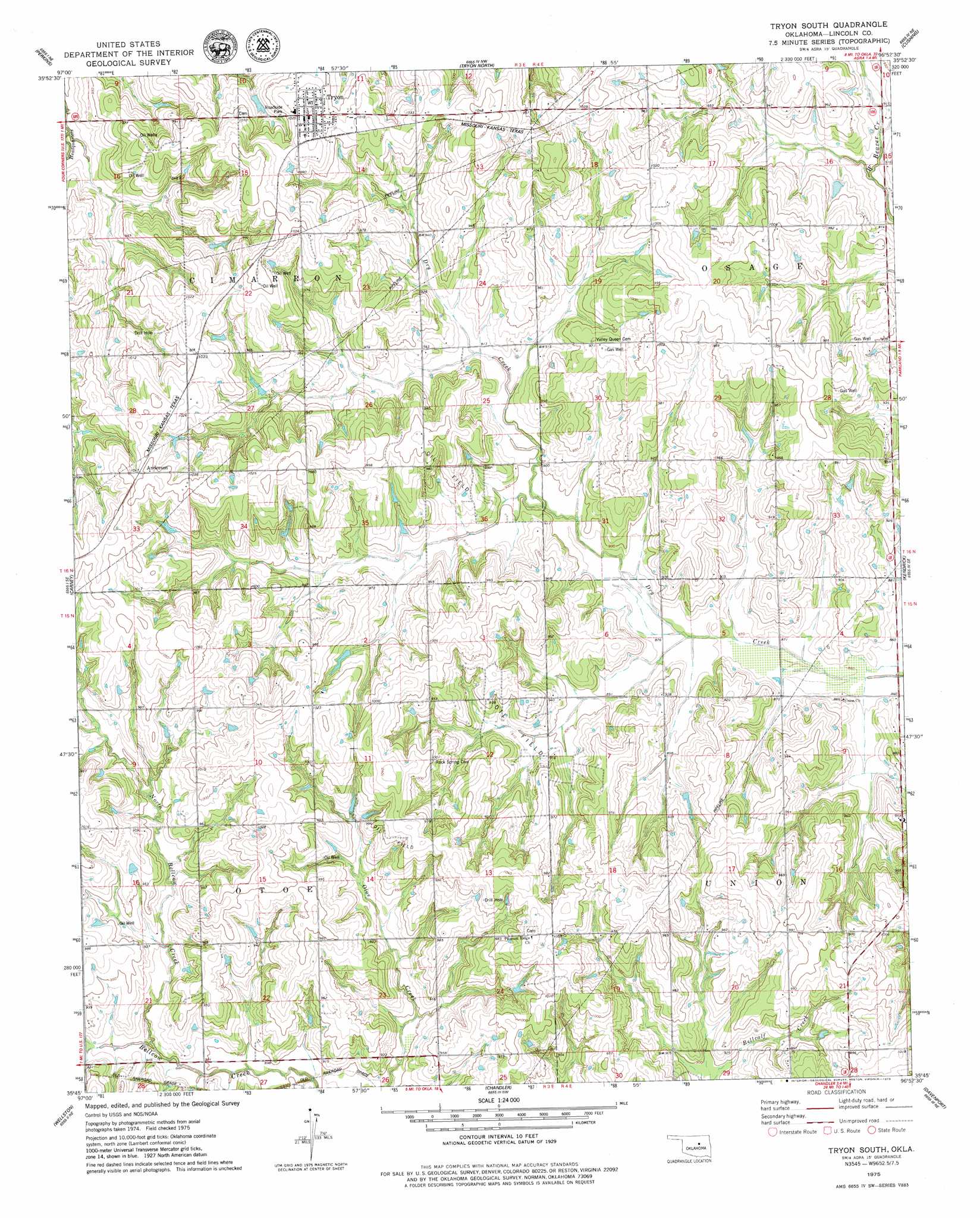
Tryon South Topo Map Oklahoma
To zoom in, hover over the map of Tryon South
USGS Topo Quad 35096g8 - 1:24,000 scale
| Topo Map Name: | Tryon South |
| USGS Topo Quad ID: | 35096g8 |
| Print Size: | ca. 21 1/4" wide x 27" high |
| Southeast Coordinates: | 35.75° N latitude / 96.875° W longitude |
| Map Center Coordinates: | 35.8125° N latitude / 96.9375° W longitude |
| U.S. State: | OK |
| Filename: | o35096g8.jpg |
| Download Map JPG Image: | Tryon South topo map 1:24,000 scale |
| Map Type: | Topographic |
| Topo Series: | 7.5´ |
| Map Scale: | 1:24,000 |
| Source of Map Images: | United States Geological Survey (USGS) |
| Alternate Map Versions: |
Tryon South OK 1975, updated 1979 Download PDF Buy paper map Tryon South OK 2010 Download PDF Buy paper map Tryon South OK 2012 Download PDF Buy paper map Tryon South OK 2016 Download PDF Buy paper map |
1:24,000 Topo Quads surrounding Tryon South
Stillwater Sw |
Stillwater South |
Ripley |
Twin Mounds |
Yale |
Coyle |
Perkins |
Tryon North |
Cushing |
North Village |
Meridian |
Carney |
Tryon South |
Kendrick |
Stroud North |
Luther |
Wellston |
Chandler |
Davenport |
Stroud South |
Horseshoe Lake |
Luther Se |
Meeker |
Sparks |
Arlington |
> Back to 35096e1 at 1:100,000 scale
> Back to 35096a1 at 1:250,000 scale
> Back to U.S. Topo Maps home
Tryon South topo map: Gazetteer
Tryon South: Airports
Melton Airport elevation 317m 1040′Tryon South: Dams
Oknoname 037034 Dam elevation 299m 980′Oknoname 08116 Dam elevation 284m 931′
Tryon South: Populated Places
Anderson elevation 317m 1040′Tryon elevation 316m 1036′
Tryon South: Reservoirs
Oknoname 037034 Reservoir elevation 299m 980′Oknoname 08116 Reservoir elevation 284m 931′
Tryon South: Streams
North Bellcow Creek elevation 276m 905′Tryon South digital topo map on disk
Buy this Tryon South topo map showing relief, roads, GPS coordinates and other geographical features, as a high-resolution digital map file on DVD: