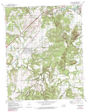
Kellyville Topo Map Oklahoma
To zoom in, hover over the map of Kellyville
USGS Topo Quad 35096h2 - 1:24,000 scale
| Topo Map Name: | Kellyville |
| USGS Topo Quad ID: | 35096h2 |
| Print Size: | ca. 21 1/4" wide x 27" high |
| Southeast Coordinates: | 35.875° N latitude / 96.125° W longitude |
| Map Center Coordinates: | 35.9375° N latitude / 96.1875° W longitude |
| U.S. State: | OK |
| Filename: | o35096h2.jpg |
| Download Map JPG Image: | Kellyville topo map 1:24,000 scale |
| Map Type: | Topographic |
| Topo Series: | 7.5´ |
| Map Scale: | 1:24,000 |
| Source of Map Images: | United States Geological Survey (USGS) |
| Alternate Map Versions: |
Kellyville OK 1972, updated 1973 Download PDF Buy paper map Kellyville OK 1972, updated 1989 Download PDF Buy paper map Kellyville OK 2010 Download PDF Buy paper map Kellyville OK 2012 Download PDF Buy paper map Kellyville OK 2016 Download PDF Buy paper map |
1:24,000 Topo Quads surrounding Kellyville
> Back to 35096e1 at 1:100,000 scale
> Back to 35096a1 at 1:250,000 scale
> Back to U.S. Topo Maps home
Kellyville topo map: Gazetteer
Kellyville: Dams
Kellyville Dam elevation 245m 803′Oknoname 037020 Dam elevation 253m 830′
Oknoname 037024 Dam elevation 253m 830′
Oknoname 037025 Dam elevation 255m 836′
Oknoname 037036 Dam elevation 225m 738′
Oknoname 037047 Dam elevation 238m 780′
Oknoname 037048 Dam elevation 239m 784′
Oknoname 037068 Dam elevation 220m 721′
Oknoname 063039 Dam elevation 225m 738′
Kellyville: Flats
Picket Prairie elevation 227m 744′Kellyville: Populated Places
Kellyville elevation 239m 784′Kellyville: Reservoirs
Kellyville Lake elevation 245m 803′Middle Lake elevation 206m 675′
Oknoname 037020 Reservoir elevation 253m 830′
Oknoname 037024 Reservoir elevation 253m 830′
Oknoname 037025 Reservoir elevation 255m 836′
Oknoname 037036 Reservoir elevation 225m 738′
Oknoname 037047 Reservoir elevation 238m 780′
Oknoname 037048 Reservoir elevation 239m 784′
Oknoname 037068 Reservoir elevation 220m 721′
Oknoname 063039 Reservoir elevation 225m 738′
Kellyville: Streams
Clear Creek elevation 211m 692′Euchee Creek elevation 204m 669′
Euchee Creek elevation 207m 679′
Kenyon Creek elevation 204m 669′
Little Polecat Creek elevation 218m 715′
Mountain Creek elevation 207m 679′
Kellyville digital topo map on disk
Buy this Kellyville topo map showing relief, roads, GPS coordinates and other geographical features, as a high-resolution digital map file on DVD:


