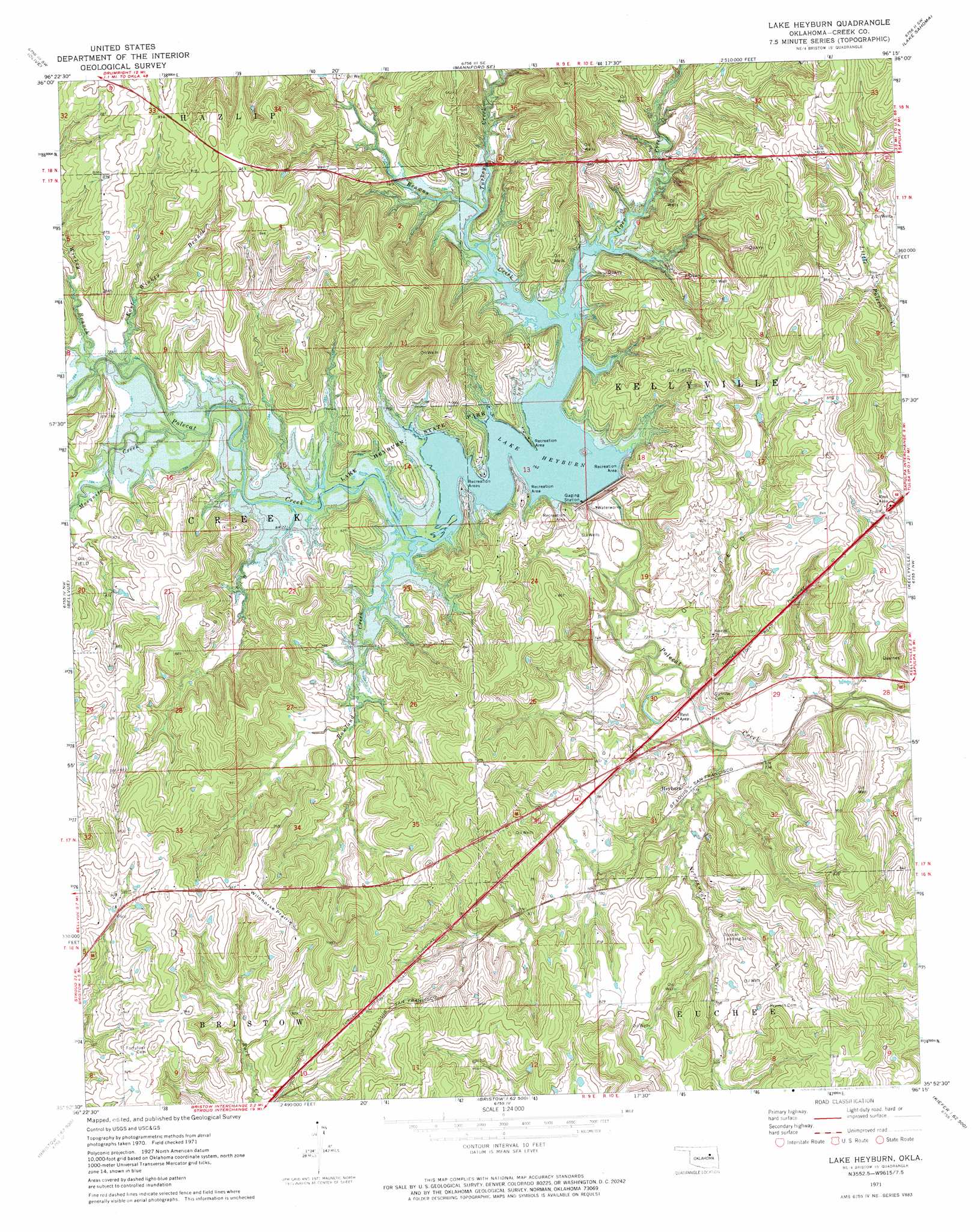
Heyburn Reservoir Topo Map Oklahoma
To zoom in, hover over the map of Heyburn Reservoir
USGS Topo Quad 35096h3 - 1:24,000 scale
| Topo Map Name: | Heyburn Reservoir |
| USGS Topo Quad ID: | 35096h3 |
| Print Size: | ca. 21 1/4" wide x 27" high |
| Southeast Coordinates: | 35.875° N latitude / 96.25° W longitude |
| Map Center Coordinates: | 35.9375° N latitude / 96.3125° W longitude |
| U.S. State: | OK |
| Filename: | o35096h3.jpg |
| Download Map JPG Image: | Heyburn Reservoir topo map 1:24,000 scale |
| Map Type: | Topographic |
| Topo Series: | 7.5´ |
| Map Scale: | 1:24,000 |
| Source of Map Images: | United States Geological Survey (USGS) |
| Alternate Map Versions: |
Lake Heyburn OK 1971, updated 1973 Download PDF Buy paper map Heyburn Reservoir OK 2010 Download PDF Buy paper map Heyburn Reservoir OK 2013 Download PDF Buy paper map Heyburn Reservoir OK 2016 Download PDF Buy paper map |
1:24,000 Topo Quads surrounding Heyburn Reservoir
Jennings |
Terlton |
Keystone Dam |
Wekiwa |
Sand Springs |
Oilton |
Olive |
Mannford Se |
Lake Sahoma |
Sapulpa North |
Drumright |
Bellvue |
Heyburn Reservoir |
Kellyville |
Sapulpa South |
Depew |
Bristow |
Slick |
Kiefer Sw |
Lake Boren |
Ritts Junction |
Gypsy |
Newby |
Nuyaka |
Beggs |
> Back to 35096e1 at 1:100,000 scale
> Back to 35096a1 at 1:250,000 scale
> Back to U.S. Topo Maps home
Heyburn Reservoir topo map: Gazetteer
Heyburn Reservoir: Airports
Neversweat Airport elevation 235m 770′Heyburn Reservoir: Dams
Heyburn Dam elevation 239m 784′Oknoname 037016 Dam elevation 267m 875′
Oknoname 037021 Dam elevation 249m 816′
Oknoname 037022 Dam elevation 250m 820′
Oknoname 037035 Dam elevation 225m 738′
Oknoname 037044 Dam elevation 277m 908′
Oknoname 037078 Dam elevation 251m 823′
Heyburn Reservoir: Flats
Wildhorse Prairie elevation 293m 961′Heyburn Reservoir: Parks
Lake Heyburn State Park elevation 257m 843′Waterfowl Refuge elevation 246m 807′
Heyburn Reservoir: Populated Places
Heyburn elevation 227m 744′Heyburn Reservoir: Reservoirs
Heyburn Lake elevation 239m 784′Heyburn Reservoir elevation 245m 803′
Oknoname 037016 Reservoir elevation 267m 875′
Oknoname 037021 Reservoir elevation 249m 816′
Oknoname 037022 Reservoir elevation 250m 820′
Oknoname 037035 Reservoir elevation 225m 738′
Oknoname 037044 Reservoir elevation 277m 908′
Oknoname 037078 Reservoir elevation 251m 823′
Heyburn Reservoir: Streams
Browns Creek elevation 232m 761′East Winkey Branch elevation 235m 770′
Mosquito Creek elevation 235m 770′
Neversweat Creek elevation 216m 708′
Rowland Creek elevation 233m 764′
Tiger Creek elevation 232m 761′
Turkey Creek elevation 251m 823′
Winkey Branch elevation 235m 770′
Heyburn Reservoir digital topo map on disk
Buy this Heyburn Reservoir topo map showing relief, roads, GPS coordinates and other geographical features, as a high-resolution digital map file on DVD: