Franklin Topo Map Oklahoma
To zoom in, hover over the map of Franklin
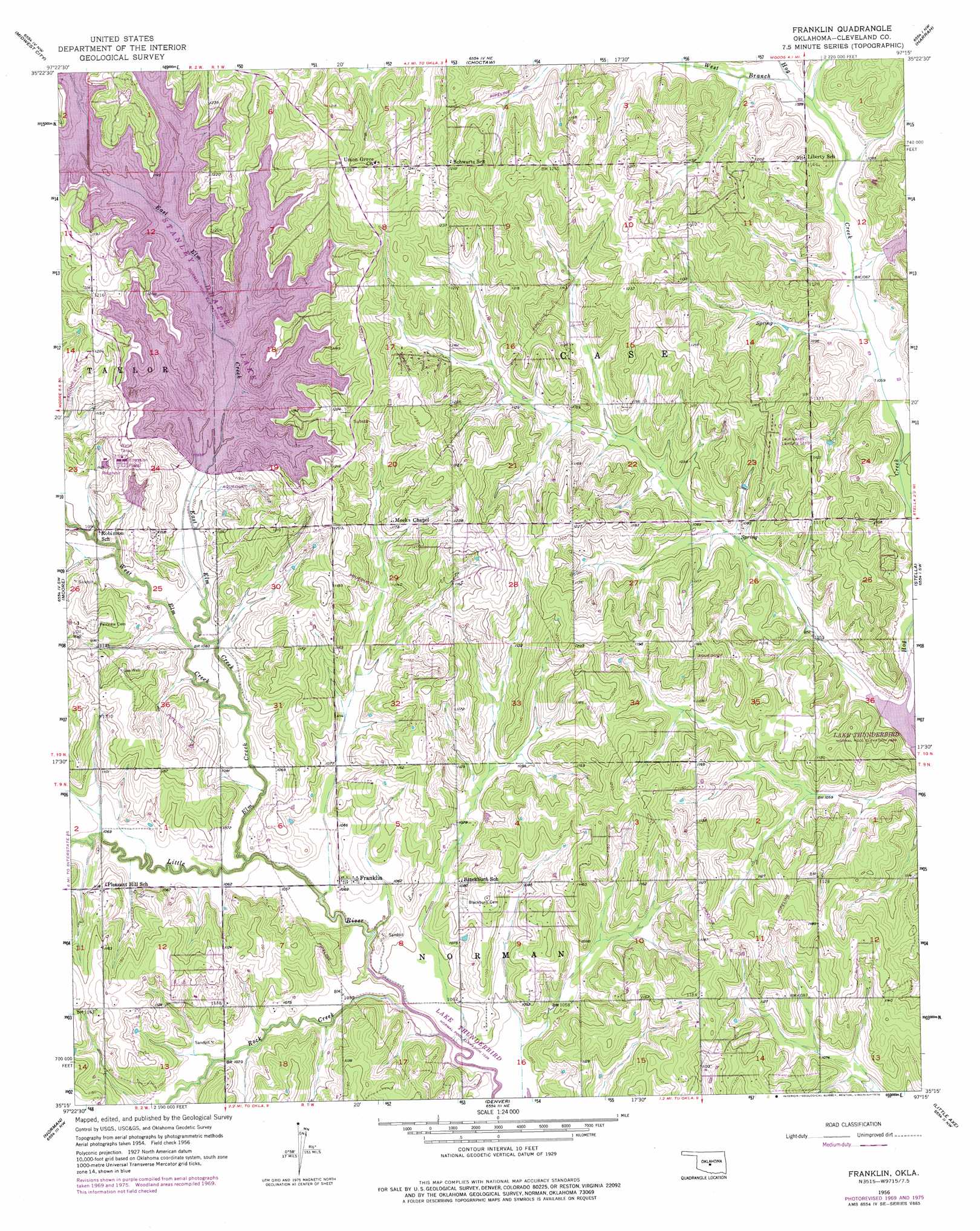
USGS Topo Quad 35097c3 - 1:24,000 scale
| Topo Map Name: | Franklin |
| USGS Topo Quad ID: | 35097c3 |
| Print Size: | ca. 21 1/4" wide x 27" high |
| Southeast Coordinates: | 35.25° N latitude / 97.25° W longitude |
| Map Center Coordinates: | 35.3125° N latitude / 97.3125° W longitude |
| U.S. State: | OK |
| Filename: | o35097c3.jpg |
| Download Map JPG Image: | Franklin topo map 1:24,000 scale |
| Map Type: | Topographic |
| Topo Series: | 7.5´ |
| Map Scale: | 1:24,000 |
| Source of Map Images: | United States Geological Survey (USGS) |
| Alternate Map Versions: |
Franklin OK 1956, updated 1957 Download PDF Buy paper map Franklin OK 1956, updated 1970 Download PDF Buy paper map Franklin OK 1956, updated 1976 Download PDF Buy paper map Franklin OK 2010 Download PDF Buy paper map Franklin OK 2013 Download PDF Buy paper map Franklin OK 2016 Download PDF Buy paper map |
1:24,000 Topo Quads surrounding Franklin
Britton |
Spencer |
Jones |
Horseshoe Lake |
Luther Se |
Oklahoma City |
Midwest City |
Choctaw |
Harrah |
Mcloud |
Oklahoma City Se |
Moore |
Franklin |
Stella |
Shawnee Reservoir |
Newcastle |
Norman |
Denver |
Little Axe |
Macomb |
Cole |
Washington |
Purcell |
Eason |
Tribbey |
> Back to 35097a1 at 1:100,000 scale
> Back to 35096a1 at 1:250,000 scale
> Back to U.S. Topo Maps home
Franklin topo map: Gazetteer
Franklin: Airports
Twin Lakes Airport elevation 360m 1181′Franklin: Dams
Stanley Draper Dam elevation 339m 1112′SW Oklahoma City Sludge Lagoon Dam elevation 338m 1108′
Franklin: Parks
Little River Wildlife Managment Area elevation 322m 1056′Franklin: Populated Places
Franklin elevation 327m 1072′Franklin: Reservoirs
Lake Stanley Draper elevation 339m 1112′Stanley Draper Lake elevation 336m 1102′
SW Oklahoma City Sludge Lagoon elevation 338m 1108′
Franklin: Streams
East Elm Creek elevation 321m 1053′Elm Creek elevation 318m 1043′
Rock Creek elevation 315m 1033′
West Branch Hog Creek elevation 329m 1079′
West Elm Creek elevation 322m 1056′
Franklin digital topo map on disk
Buy this Franklin topo map showing relief, roads, GPS coordinates and other geographical features, as a high-resolution digital map file on DVD: