Perkins Topo Map Oklahoma
To zoom in, hover over the map of Perkins
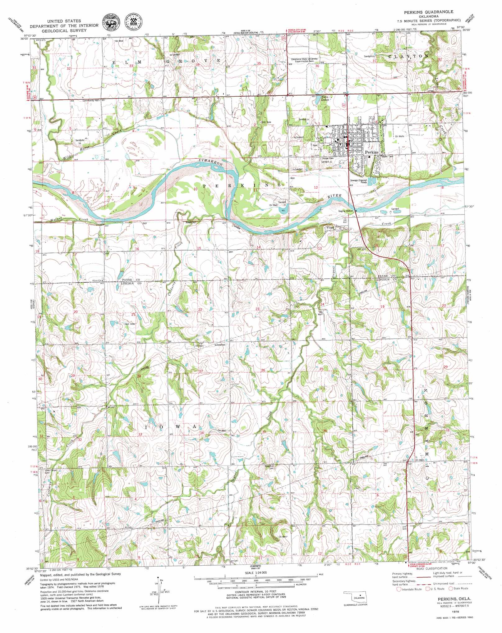
USGS Topo Quad 35097h1 - 1:24,000 scale
| Topo Map Name: | Perkins |
| USGS Topo Quad ID: | 35097h1 |
| Print Size: | ca. 21 1/4" wide x 27" high |
| Southeast Coordinates: | 35.875° N latitude / 97° W longitude |
| Map Center Coordinates: | 35.9375° N latitude / 97.0625° W longitude |
| U.S. State: | OK |
| Filename: | o35097h1.jpg |
| Download Map JPG Image: | Perkins topo map 1:24,000 scale |
| Map Type: | Topographic |
| Topo Series: | 7.5´ |
| Map Scale: | 1:24,000 |
| Source of Map Images: | United States Geological Survey (USGS) |
| Alternate Map Versions: |
Perkins OK 1978, updated 1979 Download PDF Buy paper map Perkins OK 2010 Download PDF Buy paper map Perkins OK 2012 Download PDF Buy paper map Perkins OK 2016 Download PDF Buy paper map |
1:24,000 Topo Quads surrounding Perkins
Orlando East |
Lake Carl Blackwell |
Stillwater North |
Glencoe |
West Point |
Clear Creek |
Stillwater Sw |
Stillwater South |
Ripley |
Twin Mounds |
Langston |
Coyle |
Perkins |
Tryon North |
Cushing |
Guthrie Se |
Meridian |
Carney |
Tryon South |
Kendrick |
Arcadia |
Luther |
Wellston |
Chandler |
Davenport |
> Back to 35097e1 at 1:100,000 scale
> Back to 35096a1 at 1:250,000 scale
> Back to U.S. Topo Maps home
Perkins topo map: Gazetteer
Perkins: Dams
Oknoname 08117 Dam elevation 273m 895′Perkins: Populated Places
Perkins elevation 273m 895′Vinco elevation 263m 862′
Perkins: Reservoirs
Oknoname 08117 Reservoir elevation 273m 895′Twin Lakes elevation 273m 895′
Perkins: Streams
Corduroy Creek elevation 253m 830′Walnut Creek elevation 256m 839′
Wild Horse Creek elevation 255m 836′
Perkins digital topo map on disk
Buy this Perkins topo map showing relief, roads, GPS coordinates and other geographical features, as a high-resolution digital map file on DVD: