Omega Topo Map Oklahoma
To zoom in, hover over the map of Omega
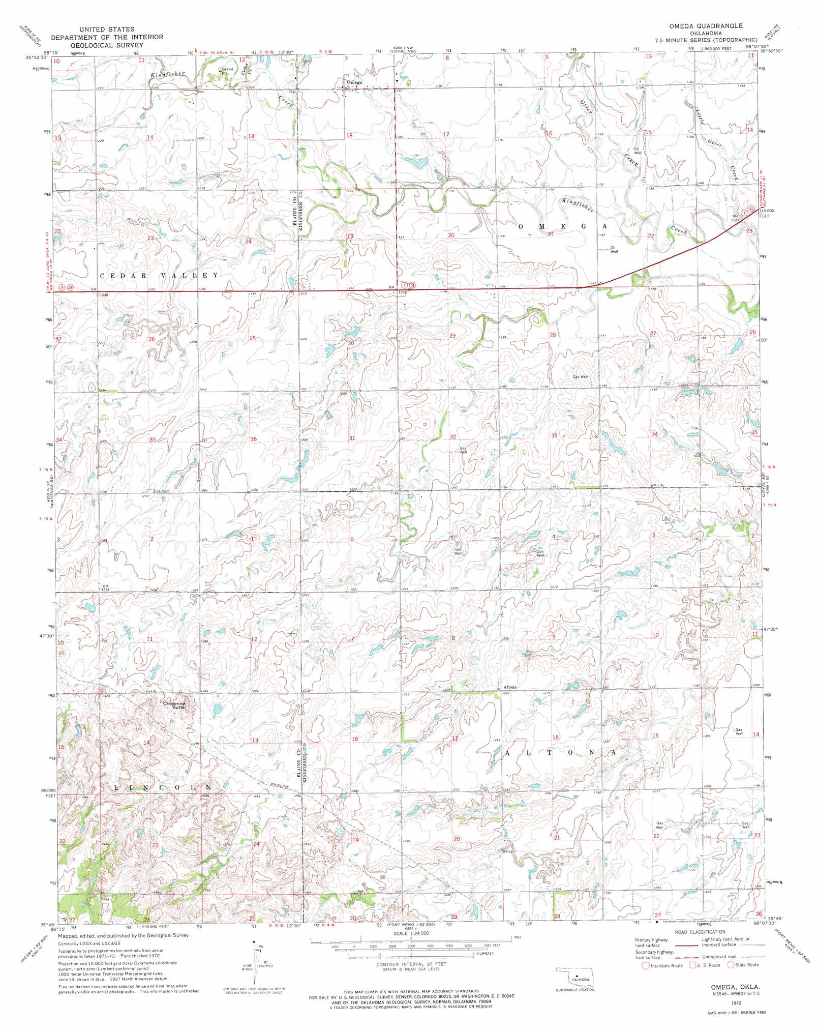
USGS Topo Quad 35098g2 - 1:24,000 scale
| Topo Map Name: | Omega |
| USGS Topo Quad ID: | 35098g2 |
| Print Size: | ca. 21 1/4" wide x 27" high |
| Southeast Coordinates: | 35.75° N latitude / 98.125° W longitude |
| Map Center Coordinates: | 35.8125° N latitude / 98.1875° W longitude |
| U.S. State: | OK |
| Filename: | o35098g2.jpg |
| Download Map JPG Image: | Omega topo map 1:24,000 scale |
| Map Type: | Topographic |
| Topo Series: | 7.5´ |
| Map Scale: | 1:24,000 |
| Source of Map Images: | United States Geological Survey (USGS) |
| Alternate Map Versions: |
Omega OK 1972, updated 1974 Download PDF Buy paper map Omega OK 2009 Download PDF Buy paper map Omega OK 2012 Download PDF Buy paper map Omega OK 2016 Download PDF Buy paper map |
1:24,000 Topo Quads surrounding Omega
Southard |
Okeene |
Parvin |
Lacey |
Hennessey |
Watonga Lake |
Hitchcock |
Loyal Nw |
Loyal |
Dover |
Watonga |
Watonga Se |
Omega |
Loyal Se |
Kingfisher |
Greenfield |
Geary North |
Porcupine Butte |
Fort Reno Ne |
Okarche |
Bridgeport |
Geary South |
Fort Reno Sw |
Fort Reno |
El Reno |
> Back to 35098e1 at 1:100,000 scale
> Back to 35098a1 at 1:250,000 scale
> Back to U.S. Topo Maps home
Omega topo map: Gazetteer
Omega: Populated Places
Altona elevation 379m 1243′Omega elevation 365m 1197′
Omega: Streams
Cedar Creek elevation 359m 1177′Little Otter Creek elevation 337m 1105′
Otter Creek elevation 342m 1122′
Omega: Summits
Cheyenne Butte elevation 423m 1387′Omega digital topo map on disk
Buy this Omega topo map showing relief, roads, GPS coordinates and other geographical features, as a high-resolution digital map file on DVD: