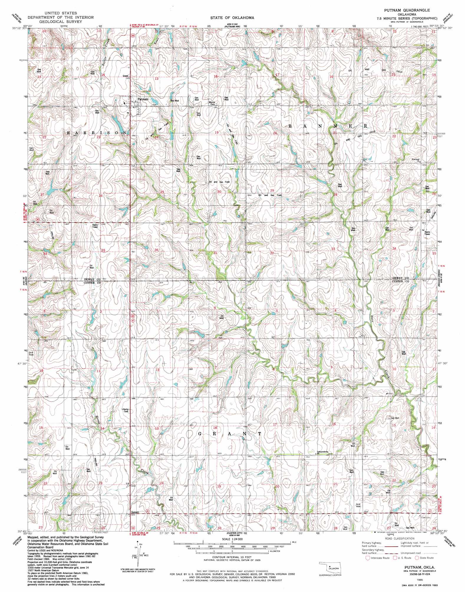
Putnam Topo Map Oklahoma
To zoom in, hover over the map of Putnam
USGS Topo Quad 35098g8 - 1:24,000 scale
| Topo Map Name: | Putnam |
| USGS Topo Quad ID: | 35098g8 |
| Print Size: | ca. 21 1/4" wide x 27" high |
| Southeast Coordinates: | 35.75° N latitude / 98.875° W longitude |
| Map Center Coordinates: | 35.8125° N latitude / 98.9375° W longitude |
| U.S. State: | OK |
| Filename: | o35098g8.jpg |
| Download Map JPG Image: | Putnam topo map 1:24,000 scale |
| Map Type: | Topographic |
| Topo Series: | 7.5´ |
| Map Scale: | 1:24,000 |
| Source of Map Images: | United States Geological Survey (USGS) |
| Alternate Map Versions: |
Putnam OK 1985, updated 1985 Download PDF Buy paper map Putnam OK 2010 Download PDF Buy paper map Putnam OK 2013 Download PDF Buy paper map Putnam OK 2016 Download PDF Buy paper map |
1:24,000 Topo Quads surrounding Putnam
Mutual Sw |
Lenora |
Taloga |
Hucmac |
Canton Sw |
Webb |
Aledo Nw |
Putnam Nw |
Parallel |
Oakwood |
Rhea |
Aledo |
Putnam |
Rough Creek |
Fay |
Butler |
Anthon |
Custer City |
Clinton Ne |
Weatherford Nw |
Foss Dam |
Stafford |
Clinton |
Indianapolis |
Weatherford |
> Back to 35098e1 at 1:100,000 scale
> Back to 35098a1 at 1:250,000 scale
> Back to U.S. Topo Maps home
Putnam topo map: Gazetteer
Putnam: Dams
Barnitz Creek Site 101 Dam elevation 570m 1870′Barnitz Creek Site 15a Dam elevation 571m 1873′
Ernst Dam elevation 562m 1843′
Putnam: Populated Places
Putnam elevation 598m 1961′Sunset elevation 567m 1860′
Putnam: Reservoirs
Barnitz Creek Site 101 Reservoir elevation 570m 1870′Barnitz Creek Site 15a Reservoir elevation 571m 1873′
Ernst Reservoir elevation 562m 1843′
Putnam digital topo map on disk
Buy this Putnam topo map showing relief, roads, GPS coordinates and other geographical features, as a high-resolution digital map file on DVD: