Loyal Topo Map Oklahoma
To zoom in, hover over the map of Loyal
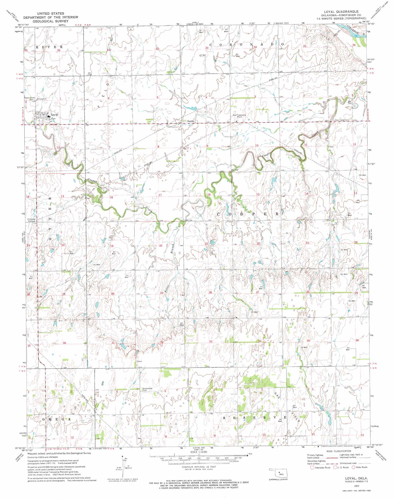
USGS Topo Quad 35098h1 - 1:24,000 scale
| Topo Map Name: | Loyal |
| USGS Topo Quad ID: | 35098h1 |
| Print Size: | ca. 21 1/4" wide x 27" high |
| Southeast Coordinates: | 35.875° N latitude / 98° W longitude |
| Map Center Coordinates: | 35.9375° N latitude / 98.0625° W longitude |
| U.S. State: | OK |
| Filename: | o35098h1.jpg |
| Download Map JPG Image: | Loyal topo map 1:24,000 scale |
| Map Type: | Topographic |
| Topo Series: | 7.5´ |
| Map Scale: | 1:24,000 |
| Source of Map Images: | United States Geological Survey (USGS) |
| Alternate Map Versions: |
Loyal OK 1972, updated 1974 Download PDF Buy paper map Loyal OK 2009 Download PDF Buy paper map Loyal OK 2012 Download PDF Buy paper map Loyal OK 2016 Download PDF Buy paper map |
1:24,000 Topo Quads surrounding Loyal
Isabella |
Ames |
Barr |
Bison |
Steinerts Lake |
Okeene |
Parvin |
Lacey |
Hennessey |
Union |
Hitchcock |
Loyal Nw |
Loyal |
Dover |
Kingfisher Ne |
Watonga Se |
Omega |
Loyal Se |
Kingfisher |
Kingfisher Se |
Geary North |
Porcupine Butte |
Fort Reno Ne |
Okarche |
El Reno Ne |
> Back to 35098e1 at 1:100,000 scale
> Back to 35098a1 at 1:250,000 scale
> Back to U.S. Topo Maps home
Loyal topo map: Gazetteer
Loyal: Dams
Oknoname 07310 Dam elevation 344m 1128′Loyal: Populated Places
Loyal elevation 339m 1112′Oneida elevation 335m 1099′
Loyal: Reservoirs
Oknoname 07310 Reservoir elevation 344m 1128′Loyal: Streams
Felter Branch elevation 328m 1076′Loyal digital topo map on disk
Buy this Loyal topo map showing relief, roads, GPS coordinates and other geographical features, as a high-resolution digital map file on DVD: