Eagle City Topo Map Oklahoma
To zoom in, hover over the map of Eagle City
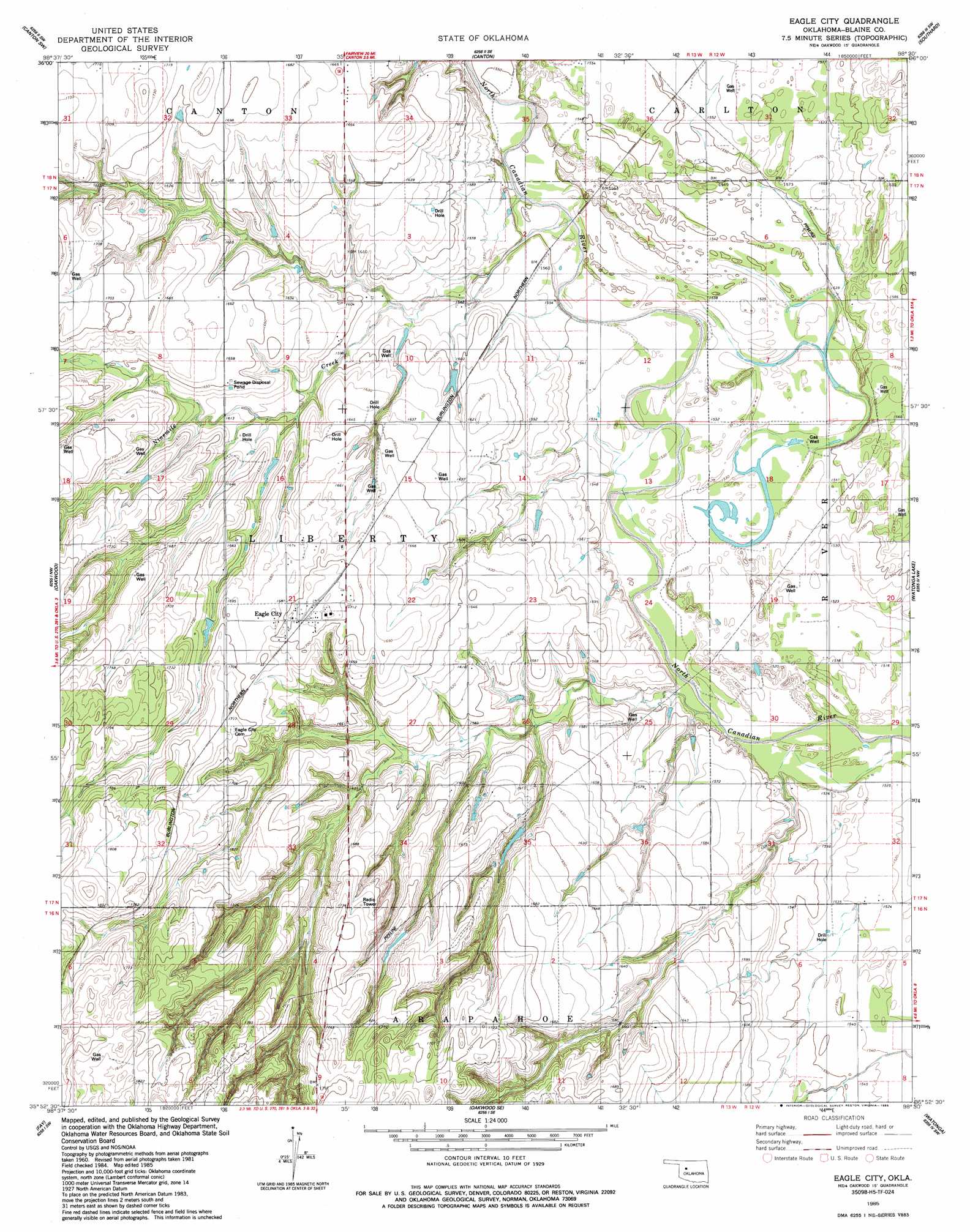
USGS Topo Quad 35098h5 - 1:24,000 scale
| Topo Map Name: | Eagle City |
| USGS Topo Quad ID: | 35098h5 |
| Print Size: | ca. 21 1/4" wide x 27" high |
| Southeast Coordinates: | 35.875° N latitude / 98.5° W longitude |
| Map Center Coordinates: | 35.9375° N latitude / 98.5625° W longitude |
| U.S. State: | OK |
| Filename: | o35098h5.jpg |
| Download Map JPG Image: | Eagle City topo map 1:24,000 scale |
| Map Type: | Topographic |
| Topo Series: | 7.5´ |
| Map Scale: | 1:24,000 |
| Source of Map Images: | United States Geological Survey (USGS) |
| Alternate Map Versions: |
Eagle City OK 1985, updated 1985 Download PDF Buy paper map Eagle City OK 2009 Download PDF Buy paper map Eagle City OK 2012 Download PDF Buy paper map Eagle City OK 2016 Download PDF Buy paper map |
1:24,000 Topo Quads surrounding Eagle City
Orion |
Canton Nw |
Longdale |
Homestead |
Isabella |
Hucmac |
Canton Sw |
Canton |
Southard |
Okeene |
Parallel |
Oakwood |
Eagle City |
Watonga Lake |
Hitchcock |
Rough Creek |
Fay |
Oakwood Se |
Watonga |
Watonga Se |
Clinton Ne |
Weatherford Nw |
Squaw Creek |
Greenfield |
Geary North |
> Back to 35098e1 at 1:100,000 scale
> Back to 35098a1 at 1:250,000 scale
> Back to U.S. Topo Maps home
Eagle City topo map: Gazetteer
Eagle City: Dams
Widney Irrigation Reservoir Dam elevation 493m 1617′Eagle City: Populated Places
Eagle City elevation 520m 1706′Eagle City: Reservoirs
Widney Irrigation Reservoir elevation 493m 1617′Eagle City: Streams
Ninemile Creek elevation 469m 1538′Eagle City digital topo map on disk
Buy this Eagle City topo map showing relief, roads, GPS coordinates and other geographical features, as a high-resolution digital map file on DVD: