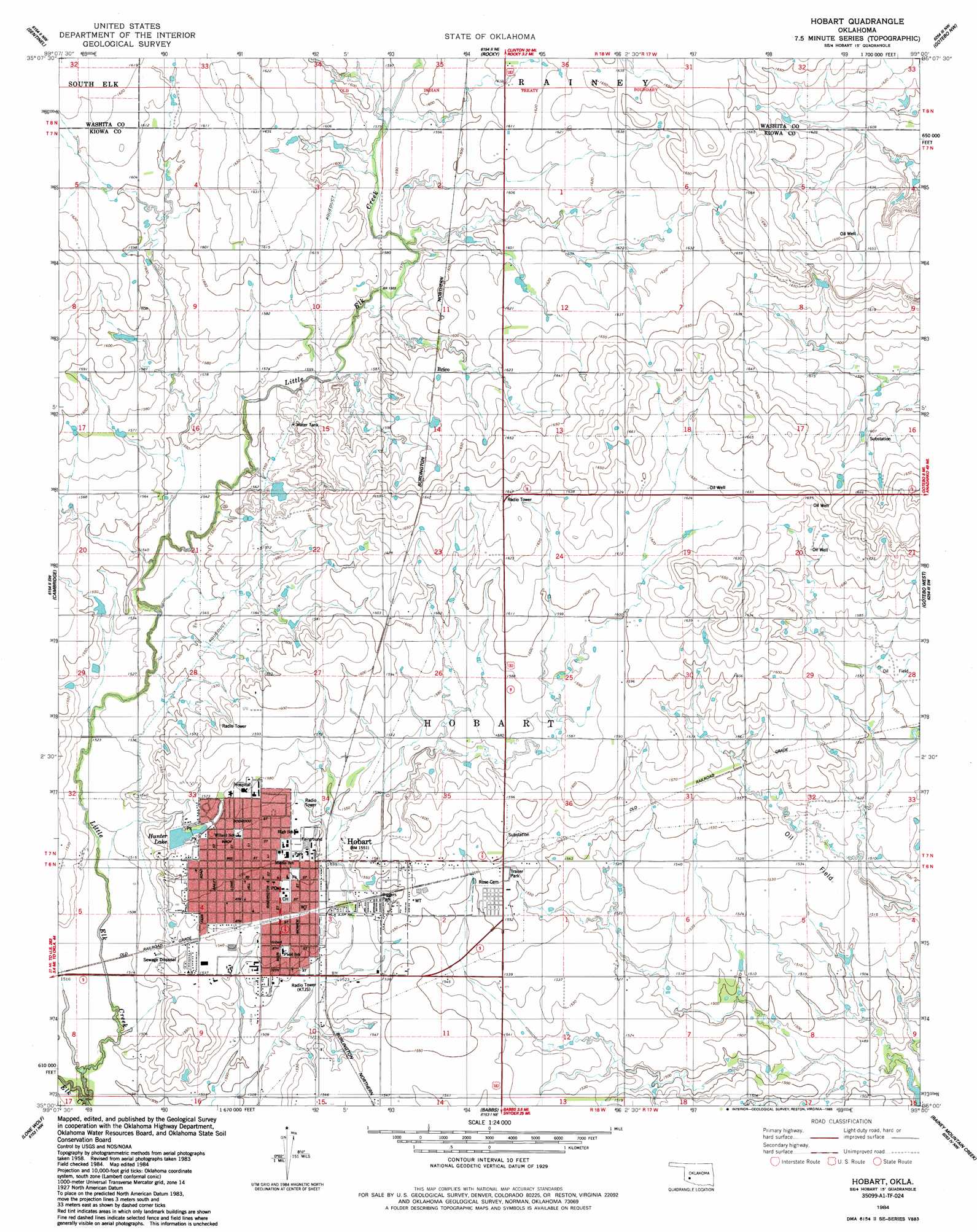
Hobart Topo Map Oklahoma
To zoom in, hover over the map of Hobart
USGS Topo Quad 35099a1 - 1:24,000 scale
| Topo Map Name: | Hobart |
| USGS Topo Quad ID: | 35099a1 |
| Print Size: | ca. 21 1/4" wide x 27" high |
| Southeast Coordinates: | 35° N latitude / 99° W longitude |
| Map Center Coordinates: | 35.0625° N latitude / 99.0625° W longitude |
| U.S. State: | OK |
| Filename: | o35099a1.jpg |
| Download Map JPG Image: | Hobart topo map 1:24,000 scale |
| Map Type: | Topographic |
| Topo Series: | 7.5´ |
| Map Scale: | 1:24,000 |
| Source of Map Images: | United States Geological Survey (USGS) |
| Alternate Map Versions: |
Hobart OK 1984, updated 1985 Download PDF Buy paper map Hobart OK 2010 Download PDF Buy paper map Hobart OK 2012 Download PDF Buy paper map Hobart OK 2016 Download PDF Buy paper map |
1:24,000 Topo Quads surrounding Hobart
Elk City Se |
Dill City |
Dill City Se |
Cordell |
Cloud Chief |
Retrop |
Sentinel |
Rocky |
Gotebo Nw |
Lake Valley |
Retrop Se |
Cambridge |
Hobart |
Gotebo West |
Gotebo East |
Lake Altus |
Lone Wolf |
Babbs |
Rainy Mountain Creek |
Unap Mountain |
Blair |
Warren |
Roosevelt |
Glen Mountains |
Cooperton |
> Back to 35099a1 at 1:100,000 scale
> Back to 35098a1 at 1:250,000 scale
> Back to U.S. Topo Maps home
Hobart topo map: Gazetteer
Hobart: Dams
Hunter Dam elevation 473m 1551′Hobart: Parks
Biggers Park elevation 469m 1538′Hunter Park elevation 479m 1571′
Hobart: Populated Places
Hobart elevation 473m 1551′Hobart: Reservoirs
Hunter Lake elevation 472m 1548′Hobart: Streams
Little Elk Creek elevation 457m 1499′Hobart digital topo map on disk
Buy this Hobart topo map showing relief, roads, GPS coordinates and other geographical features, as a high-resolution digital map file on DVD: