Plainview Topo Map Oklahoma
To zoom in, hover over the map of Plainview
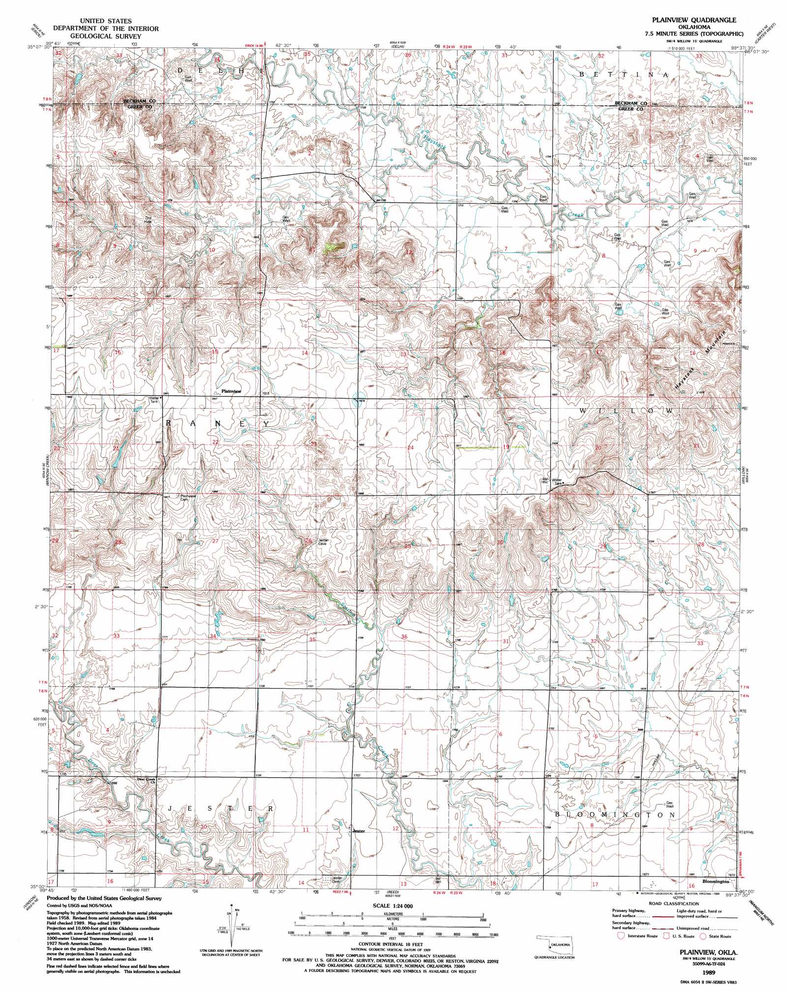
USGS Topo Quad 35099a6 - 1:24,000 scale
| Topo Map Name: | Plainview |
| USGS Topo Quad ID: | 35099a6 |
| Print Size: | ca. 21 1/4" wide x 27" high |
| Southeast Coordinates: | 35° N latitude / 99.625° W longitude |
| Map Center Coordinates: | 35.0625° N latitude / 99.6875° W longitude |
| U.S. State: | OK |
| Filename: | o35099a6.jpg |
| Download Map JPG Image: | Plainview topo map 1:24,000 scale |
| Map Type: | Topographic |
| Topo Series: | 7.5´ |
| Map Scale: | 1:24,000 |
| Source of Map Images: | United States Geological Survey (USGS) |
| Alternate Map Versions: |
Plainview OK 1989, updated 1989 Download PDF Buy paper map Plainview OK 2010 Download PDF Buy paper map Plainview OK 2012 Download PDF Buy paper map Plainview OK 2016 Download PDF Buy paper map |
1:24,000 Topo Quads surrounding Plainview
Mayfield |
Prentiss |
Sayre |
Doxey |
Hocker |
Texola |
Erick |
Dehli |
Carter West |
Carter East |
Bull Creek |
Minnow Creek |
Plainview |
Willow |
Lake Creek |
Madge |
Vinson |
Reed |
Mangum North |
Granite |
Mcknight |
Shrewder |
Russell |
Mangum South |
Hester |
> Back to 35099a1 at 1:100,000 scale
> Back to 35098a1 at 1:250,000 scale
> Back to U.S. Topo Maps home
Plainview topo map: Gazetteer
Plainview: Populated Places
Bloomington elevation 512m 1679′Jester elevation 518m 1699′
Plainview elevation 598m 1961′
Plainview: Summits
Haystack Mountain elevation 597m 1958′Plainview digital topo map on disk
Buy this Plainview topo map showing relief, roads, GPS coordinates and other geographical features, as a high-resolution digital map file on DVD: