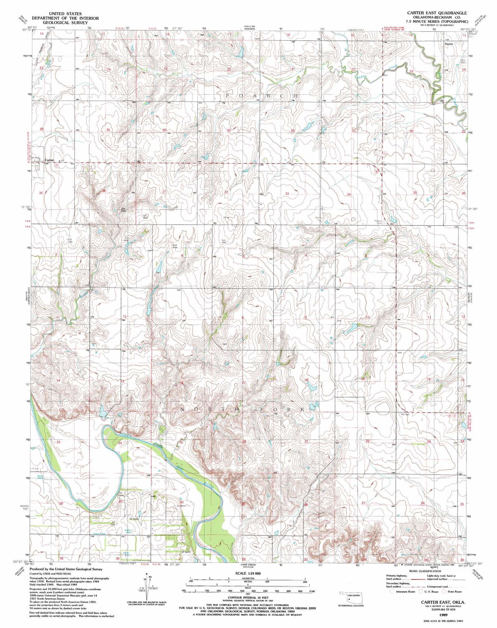
Carter East Topo Map Oklahoma
To zoom in, hover over the map of Carter East
USGS Topo Quad 35099b4 - 1:24,000 scale
| Topo Map Name: | Carter East |
| USGS Topo Quad ID: | 35099b4 |
| Print Size: | ca. 21 1/4" wide x 27" high |
| Southeast Coordinates: | 35.125° N latitude / 99.375° W longitude |
| Map Center Coordinates: | 35.1875° N latitude / 99.4375° W longitude |
| U.S. State: | OK |
| Filename: | o35099b4.jpg |
| Download Map JPG Image: | Carter East topo map 1:24,000 scale |
| Map Type: | Topographic |
| Topo Series: | 7.5´ |
| Map Scale: | 1:24,000 |
| Source of Map Images: | United States Geological Survey (USGS) |
| Alternate Map Versions: |
Carter East OK 1989, updated 1989 Download PDF Buy paper map Carter East OK 2010 Download PDF Buy paper map Carter East OK 2012 Download PDF Buy paper map Carter East OK 2016 Download PDF Buy paper map |
1:24,000 Topo Quads surrounding Carter East
Berlin |
Baker Lake |
Elk City |
Canute |
Foss |
Sayre |
Doxey |
Hocker |
Elk City Se |
Dill City |
Dehli |
Carter West |
Carter East |
Retrop |
Sentinel |
Plainview |
Willow |
Lake Creek |
Retrop Se |
Cambridge |
Reed |
Mangum North |
Granite |
Lake Altus |
Lone Wolf |
> Back to 35099a1 at 1:100,000 scale
> Back to 35098a1 at 1:250,000 scale
> Back to U.S. Topo Maps home
Carter East topo map: Gazetteer
Carter East: Dams
Upper Elk Creek Site 19 Dam elevation 538m 1765′Upper Elk Creek Site 20 Dam elevation 543m 1781′
Carter East: Populated Places
Taylor elevation 529m 1735′Carter East: Reservoirs
Upper Elk Creek Site 19 Reservoir elevation 538m 1765′Upper Elk Creek Site 20 Reservoir elevation 543m 1781′
Carter East: Streams
Sadler Creek elevation 516m 1692′Carter East digital topo map on disk
Buy this Carter East topo map showing relief, roads, GPS coordinates and other geographical features, as a high-resolution digital map file on DVD: