Dozier Topo Map Texas
To zoom in, hover over the map of Dozier
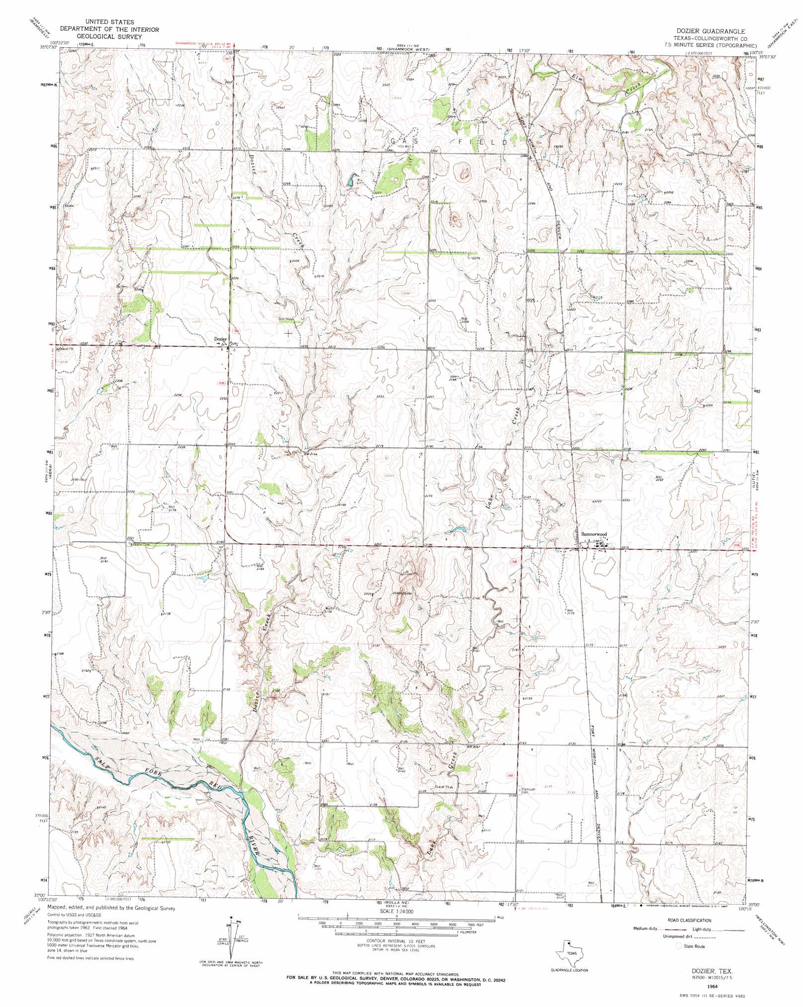
USGS Topo Quad 35100a3 - 1:24,000 scale
| Topo Map Name: | Dozier |
| USGS Topo Quad ID: | 35100a3 |
| Print Size: | ca. 21 1/4" wide x 27" high |
| Southeast Coordinates: | 35° N latitude / 100.25° W longitude |
| Map Center Coordinates: | 35.0625° N latitude / 100.3125° W longitude |
| U.S. State: | TX |
| Filename: | o35100a3.jpg |
| Download Map JPG Image: | Dozier topo map 1:24,000 scale |
| Map Type: | Topographic |
| Topo Series: | 7.5´ |
| Map Scale: | 1:24,000 |
| Source of Map Images: | United States Geological Survey (USGS) |
| Alternate Map Versions: |
Dozier TX 1964, updated 1967 Download PDF Buy paper map Dozier TX 2010 Download PDF Buy paper map Dozier TX 2012 Download PDF Buy paper map Dozier TX 2016 Download PDF Buy paper map |
1:24,000 Topo Quads surrounding Dozier
Back |
Pakan |
Wheeler Se |
Twitty |
Kelton Se |
Mclean |
Ramsdell |
Shamrock West |
Shamrock East |
Fuller |
Spencer Lake |
Abra |
Dozier |
Lutie |
Little Wolf Creek |
Mcknight |
Quail |
Rolla Ne |
Wellington Nw |
Shinnery Creek |
Giles |
Rolla Sw |
Rolla |
Wellington |
Dodson |
> Back to 35100a1 at 1:100,000 scale
> Back to 35100a1 at 1:250,000 scale
> Back to U.S. Topo Maps home
Dozier topo map: Gazetteer
Dozier: Populated Places
Dozier elevation 689m 2260′Samnorwood elevation 670m 2198′
Dozier: Springs
Elm Creek Springs elevation 674m 2211′Dozier: Streams
Dozier Creek elevation 623m 2043′Dozier digital topo map on disk
Buy this Dozier topo map showing relief, roads, GPS coordinates and other geographical features, as a high-resolution digital map file on DVD: