Twitty Topo Map Texas
To zoom in, hover over the map of Twitty
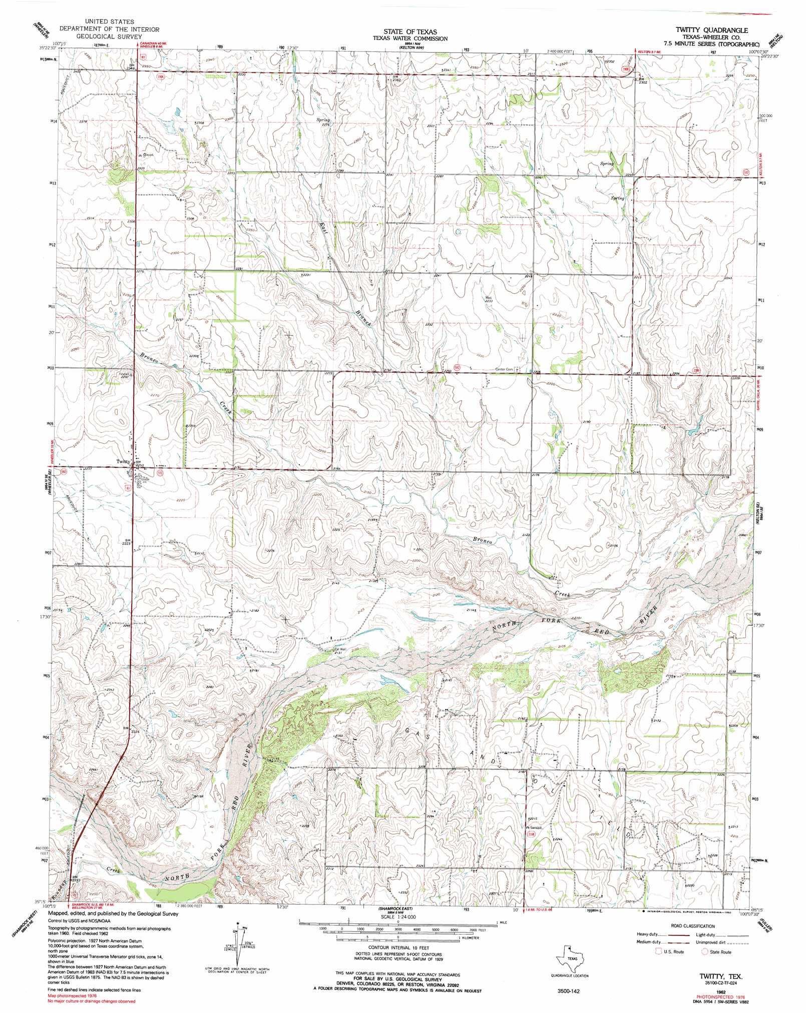
USGS Topo Quad 35100c2 - 1:24,000 scale
| Topo Map Name: | Twitty |
| USGS Topo Quad ID: | 35100c2 |
| Print Size: | ca. 21 1/4" wide x 27" high |
| Southeast Coordinates: | 35.25° N latitude / 100.125° W longitude |
| Map Center Coordinates: | 35.3125° N latitude / 100.1875° W longitude |
| U.S. State: | TX |
| Filename: | o35100c2.jpg |
| Download Map JPG Image: | Twitty topo map 1:24,000 scale |
| Map Type: | Topographic |
| Topo Series: | 7.5´ |
| Map Scale: | 1:24,000 |
| Source of Map Images: | United States Geological Survey (USGS) |
| Alternate Map Versions: |
Twitty TX 1962, updated 1965 Download PDF Buy paper map Twitty TX 1962, updated 1992 Download PDF Buy paper map Twitty TX 2010 Download PDF Buy paper map Twitty TX 2012 Download PDF Buy paper map Twitty TX 2016 Download PDF Buy paper map |
1:24,000 Topo Quads surrounding Twitty
Mobeetie |
Briscoe |
Allison Sw |
Allison |
Reydon Sw |
Spring Creek |
Wheeler |
Kelton Nw |
Kelton |
Sweetwater |
Pakan |
Wheeler Se |
Twitty |
Kelton Se |
Mayfield |
Ramsdell |
Shamrock West |
Shamrock East |
Fuller |
Texola |
Abra |
Dozier |
Lutie |
Little Wolf Creek |
Bull Creek |
> Back to 35100a1 at 1:100,000 scale
> Back to 35100a1 at 1:250,000 scale
> Back to U.S. Topo Maps home
Twitty topo map: Gazetteer
Twitty: Populated Places
Twitty elevation 686m 2250′Twitty: Streams
Bronco Creek elevation 637m 2089′East Branch Bronco Creek elevation 648m 2125′
Roundup Creek elevation 659m 2162′
Twitty digital topo map on disk
Buy this Twitty topo map showing relief, roads, GPS coordinates and other geographical features, as a high-resolution digital map file on DVD: