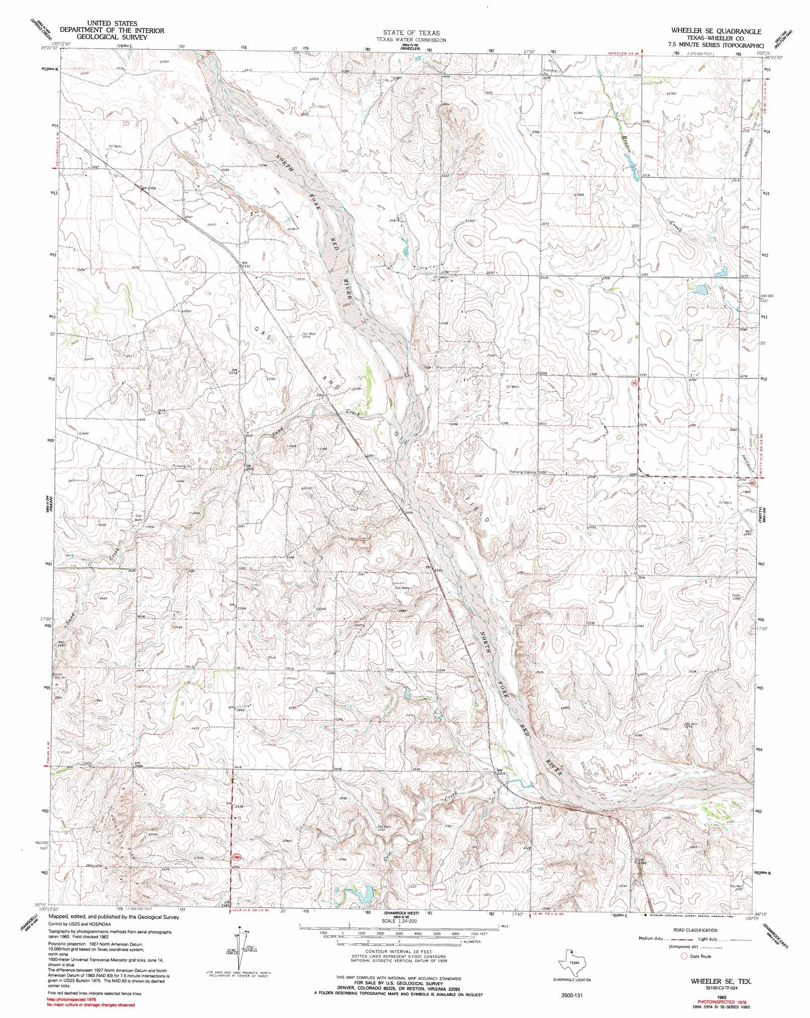
Wheeler Se Topo Map Texas
To zoom in, hover over the map of Wheeler Se
USGS Topo Quad 35100c3 - 1:24,000 scale
| Topo Map Name: | Wheeler Se |
| USGS Topo Quad ID: | 35100c3 |
| Print Size: | ca. 21 1/4" wide x 27" high |
| Southeast Coordinates: | 35.25° N latitude / 100.25° W longitude |
| Map Center Coordinates: | 35.3125° N latitude / 100.3125° W longitude |
| U.S. State: | TX |
| Filename: | o35100c3.jpg |
| Download Map JPG Image: | Wheeler Se topo map 1:24,000 scale |
| Map Type: | Topographic |
| Topo Series: | 7.5´ |
| Map Scale: | 1:24,000 |
| Source of Map Images: | United States Geological Survey (USGS) |
| Alternate Map Versions: |
Wheeler SE TX 1962, updated 1965 Download PDF Buy paper map Wheeler SE TX 1962, updated 1992 Download PDF Buy paper map Wheeler SE TX 2010 Download PDF Buy paper map Wheeler SE TX 2012 Download PDF Buy paper map Wheeler SE TX 2016 Download PDF Buy paper map |
1:24,000 Topo Quads surrounding Wheeler Se
Tody School |
Mobeetie |
Briscoe |
Allison Sw |
Allison |
Pond Creek |
Spring Creek |
Wheeler |
Kelton Nw |
Kelton |
Back |
Pakan |
Wheeler Se |
Twitty |
Kelton Se |
Mclean |
Ramsdell |
Shamrock West |
Shamrock East |
Fuller |
Spencer Lake |
Abra |
Dozier |
Lutie |
Little Wolf Creek |
> Back to 35100a1 at 1:100,000 scale
> Back to 35100a1 at 1:250,000 scale
> Back to U.S. Topo Maps home
Wheeler Se topo map: Gazetteer
Wheeler Se: Dams
Wardlow Lake Dam elevation 703m 2306′Wheeler Se: Reservoirs
Wardlow Lake elevation 703m 2306′Wheeler Se: Streams
Cole Creek elevation 670m 2198′Finley Creek elevation 669m 2194′
Sand Creek elevation 683m 2240′
Wheeler Se digital topo map on disk
Buy this Wheeler Se topo map showing relief, roads, GPS coordinates and other geographical features, as a high-resolution digital map file on DVD: