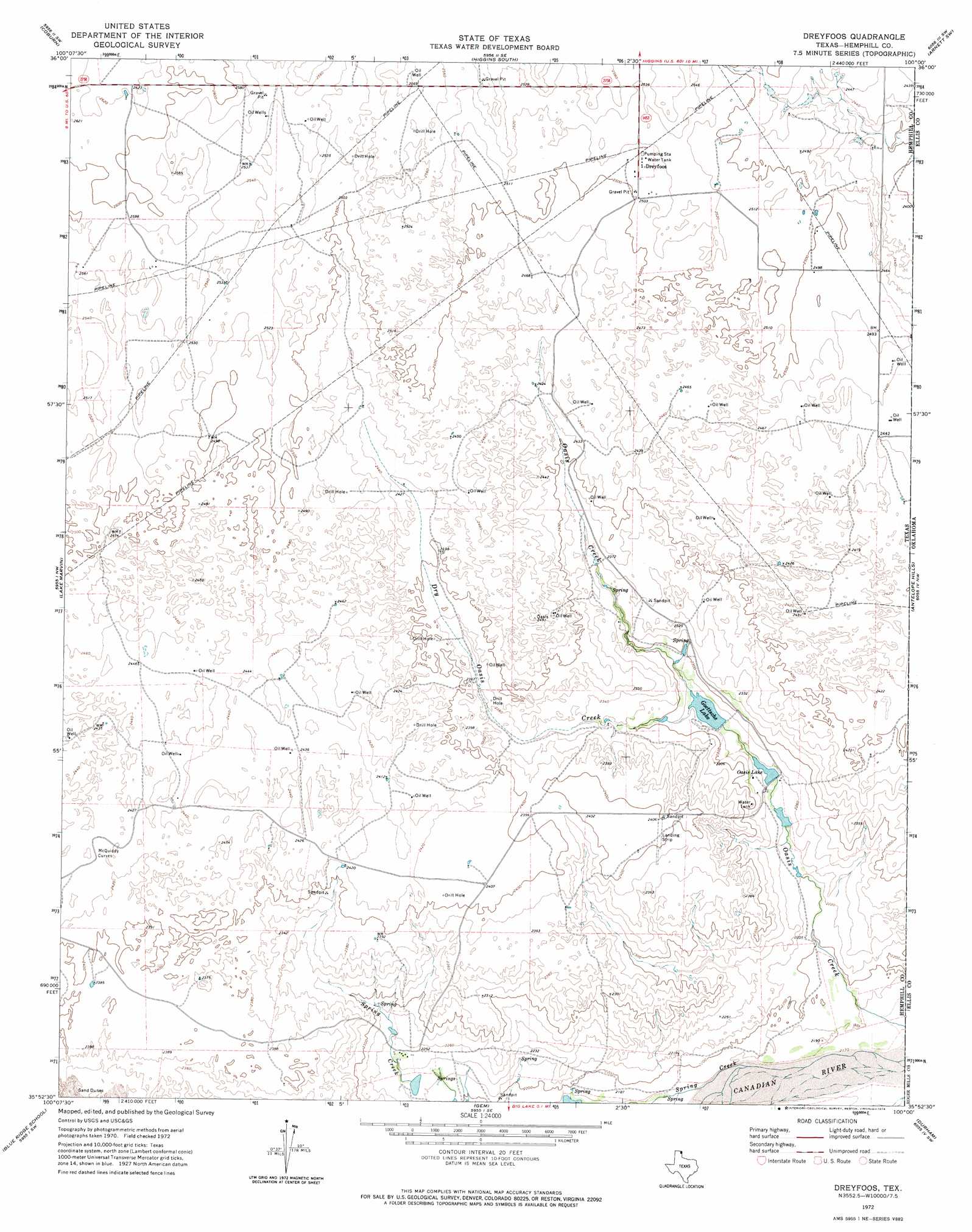
Dreyfoos Topo Map Texas
To zoom in, hover over the map of Dreyfoos
USGS Topo Quad 35100h1 - 1:24,000 scale
| Topo Map Name: | Dreyfoos |
| USGS Topo Quad ID: | 35100h1 |
| Print Size: | ca. 21 1/4" wide x 27" high |
| Southeast Coordinates: | 35.875° N latitude / 100° W longitude |
| Map Center Coordinates: | 35.9375° N latitude / 100.0625° W longitude |
| U.S. State: | TX |
| Filename: | o35100h1.jpg |
| Download Map JPG Image: | Dreyfoos topo map 1:24,000 scale |
| Map Type: | Topographic |
| Topo Series: | 7.5´ |
| Map Scale: | 1:24,000 |
| Source of Map Images: | United States Geological Survey (USGS) |
| Alternate Map Versions: |
Dreyfoos TX 1972, updated 1974 Download PDF Buy paper map Dreyfoos TX 2010 Download PDF Buy paper map Dreyfoos TX 2012 Download PDF Buy paper map Dreyfoos TX 2016 Download PDF Buy paper map |
1:24,000 Topo Quads surrounding Dreyfoos
Lipscomb |
Willow Creek |
Higgins North |
Goodwin |
Arnett |
Glazier |
Coburn |
Higgins South |
Arnett Sw |
Arnett Se |
Canadian East |
Lake Marvin |
Dreyfoos |
Antelope Hills |
Antelope Hills Ne |
Canadian Se |
Blue Ridge School |
Gem |
Durham |
Crawford |
Dads Creek |
Lake June |
Hackberry Creek |
Reydon |
Mackie |
> Back to 35100e1 at 1:100,000 scale
> Back to 35100a1 at 1:250,000 scale
> Back to U.S. Topo Maps home
Dreyfoos topo map: Gazetteer
Dreyfoos: Dams
Club Lake Dam elevation 690m 2263′Oasis Lake Dam elevation 690m 2263′
Dreyfoos: Populated Places
Dreyfoos elevation 766m 2513′Dreyfoos: Reservoirs
Club Lake elevation 690m 2263′Goettsche Lake elevation 691m 2267′
Oasis Lake elevation 688m 2257′
Dreyfoos: Streams
Dry Oasis Creek elevation 695m 2280′Oasis Creek elevation 662m 2171′
Spring Creek elevation 662m 2171′
Dreyfoos digital topo map on disk
Buy this Dreyfoos topo map showing relief, roads, GPS coordinates and other geographical features, as a high-resolution digital map file on DVD: