Claude Topo Map Texas
To zoom in, hover over the map of Claude
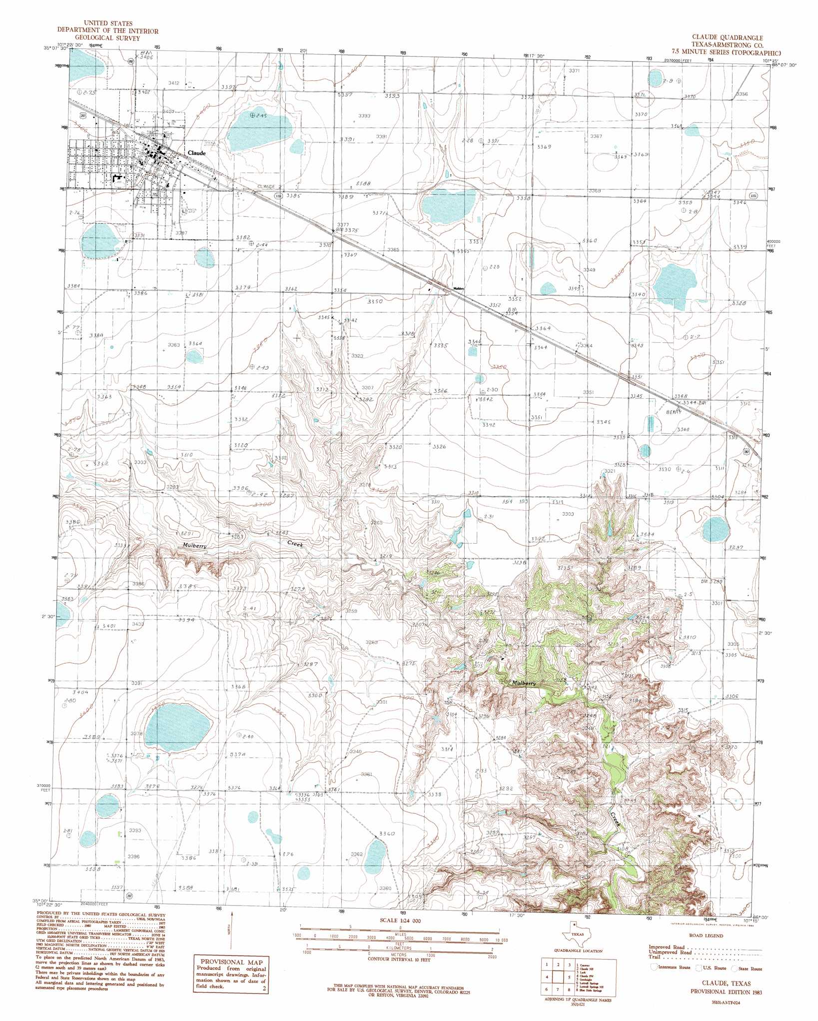
USGS Topo Quad 35101a3 - 1:24,000 scale
| Topo Map Name: | Claude |
| USGS Topo Quad ID: | 35101a3 |
| Print Size: | ca. 21 1/4" wide x 27" high |
| Southeast Coordinates: | 35° N latitude / 101.25° W longitude |
| Map Center Coordinates: | 35.0625° N latitude / 101.3125° W longitude |
| U.S. State: | TX |
| Filename: | o35101a3.jpg |
| Download Map JPG Image: | Claude topo map 1:24,000 scale |
| Map Type: | Topographic |
| Topo Series: | 7.5´ |
| Map Scale: | 1:24,000 |
| Source of Map Images: | United States Geological Survey (USGS) |
| Alternate Map Versions: |
Claude TX 1983, updated 1984 Download PDF Buy paper map Claude TX 2010 Download PDF Buy paper map Claude TX 2012 Download PDF Buy paper map Claude TX 2016 Download PDF Buy paper map |
1:24,000 Topo Quads surrounding Claude
Sevenmile Basin |
Panhandle West |
Panhandle East |
White Deer Sw |
Grandview School |
Washburn |
Conway |
Claude Ne |
Lark |
Groom |
Fairview |
Claude Sw |
Claude |
Goodnight |
Ashtola |
Pony Flats |
Luttrell Springs |
Luttrell Springs Ne |
Blue Hole Springs |
Buffalo Arroyo |
Wayside |
Pleasant Creek |
Gip Creek |
Paloduro |
Tate Arroyo |
> Back to 35101a1 at 1:100,000 scale
> Back to 35100a1 at 1:250,000 scale
> Back to U.S. Topo Maps home
Claude digital topo map on disk
Buy this Claude topo map showing relief, roads, GPS coordinates and other geographical features, as a high-resolution digital map file on DVD: