Thomas Ranch Topo Map Texas
To zoom in, hover over the map of Thomas Ranch
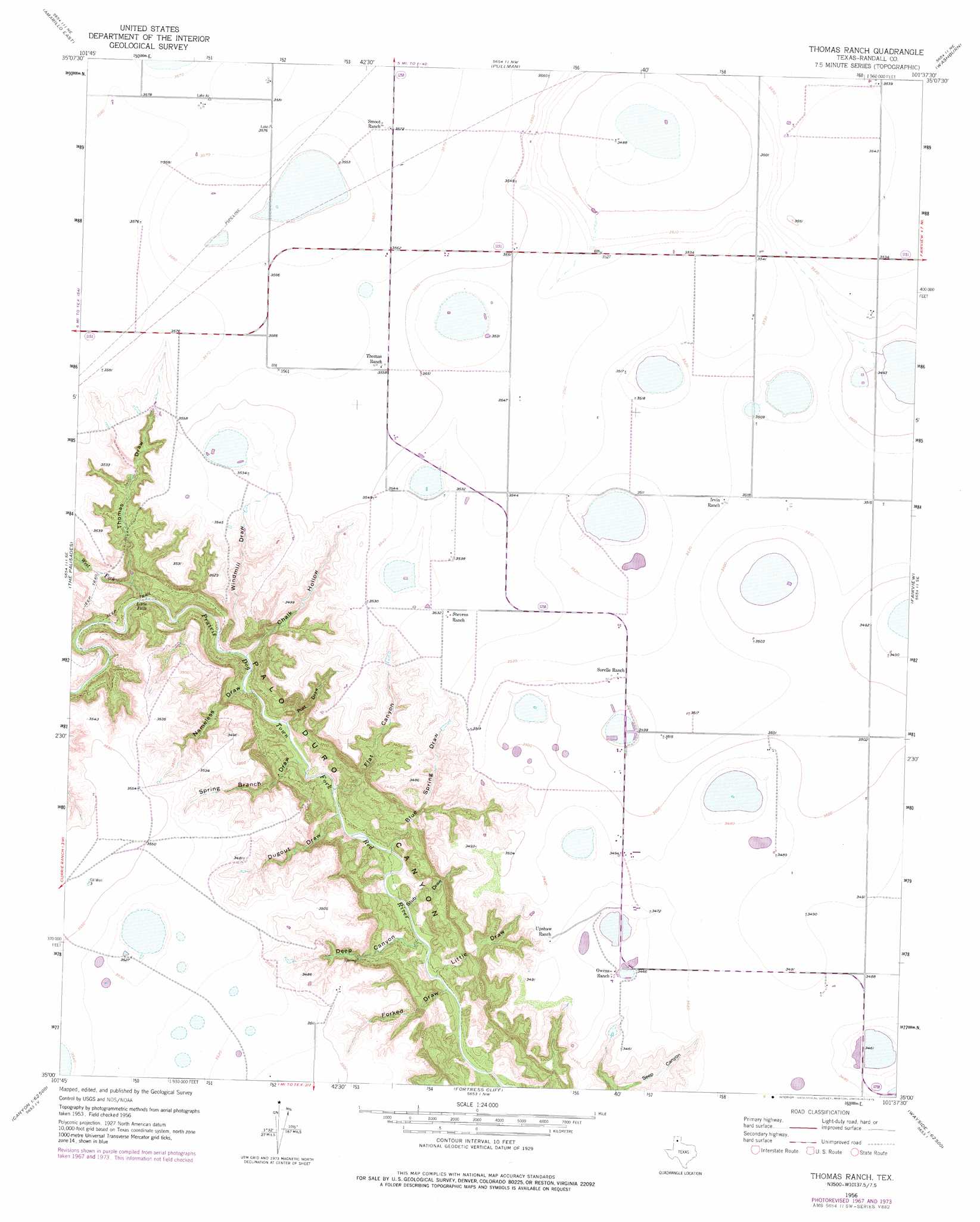
USGS Topo Quad 35101a6 - 1:24,000 scale
| Topo Map Name: | Thomas Ranch |
| USGS Topo Quad ID: | 35101a6 |
| Print Size: | ca. 21 1/4" wide x 27" high |
| Southeast Coordinates: | 35° N latitude / 101.625° W longitude |
| Map Center Coordinates: | 35.0625° N latitude / 101.6875° W longitude |
| U.S. State: | TX |
| Filename: | o35101a6.jpg |
| Download Map JPG Image: | Thomas Ranch topo map 1:24,000 scale |
| Map Type: | Topographic |
| Topo Series: | 7.5´ |
| Map Scale: | 1:24,000 |
| Source of Map Images: | United States Geological Survey (USGS) |
| Alternate Map Versions: |
Thomas Ranch TX 1956, updated 1957 Download PDF Buy paper map Thomas Ranch TX 1956, updated 1968 Download PDF Buy paper map Thomas Ranch TX 1956, updated 1975 Download PDF Buy paper map Thomas Ranch TX 2010 Download PDF Buy paper map Thomas Ranch TX 2012 Download PDF Buy paper map Thomas Ranch TX 2016 Download PDF Buy paper map |
1:24,000 Topo Quads surrounding Thomas Ranch
Cliffside |
Pleasant Valley |
Mayer |
Sevenmile Basin |
Panhandle West |
Amarillo West |
Amarillo East |
Pullman |
Washburn |
Conway |
Buffalo Stadium |
The Palisades |
Thomas Ranch |
Fairview |
Claude Sw |
Canyon |
Nance Ranch |
Fortress Cliff |
Pony Flats |
Luttrell Springs |
Ogg |
Canyon Se |
Wesley Point |
Wayside |
Pleasant Creek |
> Back to 35101a1 at 1:100,000 scale
> Back to 35100a1 at 1:250,000 scale
> Back to U.S. Topo Maps home
Thomas Ranch topo map: Gazetteer
Thomas Ranch: Airports
True Airport elevation 1090m 3576′Thomas Ranch: Falls
Little Falls elevation 963m 3159′Thomas Ranch: Streams
Spring Branch elevation 917m 3008′West Fork Prairie Dog Town Fork Red River elevation 962m 3156′
Thomas Ranch: Valleys
Blue Spring Draw elevation 903m 2962′Chalk Hollow elevation 934m 3064′
Deep Canyon elevation 899m 2949′
Dugout Draw elevation 914m 2998′
Flat Canyon elevation 912m 2992′
Forked Draw elevation 891m 2923′
Little Draw elevation 893m 2929′
Nameless Draw elevation 935m 3067′
Post Draw elevation 922m 3024′
Stub Draw elevation 899m 2949′
Thomas Draw elevation 976m 3202′
Windmill Draw elevation 941m 3087′
Thomas Ranch digital topo map on disk
Buy this Thomas Ranch topo map showing relief, roads, GPS coordinates and other geographical features, as a high-resolution digital map file on DVD: