Pleasant Valley Topo Map Texas
To zoom in, hover over the map of Pleasant Valley
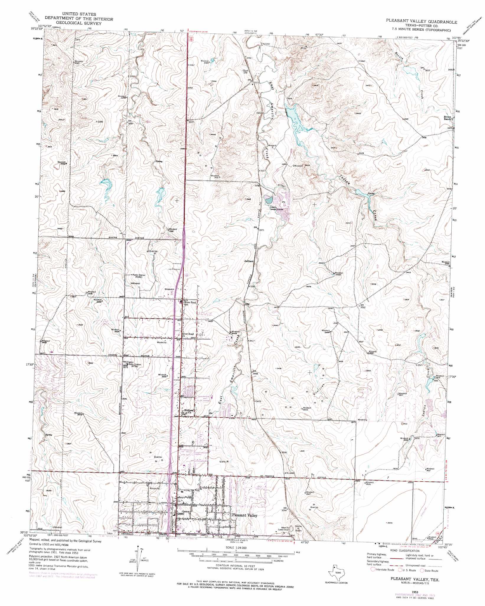
USGS Topo Quad 35101c7 - 1:24,000 scale
| Topo Map Name: | Pleasant Valley |
| USGS Topo Quad ID: | 35101c7 |
| Print Size: | ca. 21 1/4" wide x 27" high |
| Southeast Coordinates: | 35.25° N latitude / 101.75° W longitude |
| Map Center Coordinates: | 35.3125° N latitude / 101.8125° W longitude |
| U.S. State: | TX |
| Filename: | o35101c7.jpg |
| Download Map JPG Image: | Pleasant Valley topo map 1:24,000 scale |
| Map Type: | Topographic |
| Topo Series: | 7.5´ |
| Map Scale: | 1:24,000 |
| Source of Map Images: | United States Geological Survey (USGS) |
| Alternate Map Versions: |
Pleasant Valley TX 1953, updated 1954 Download PDF Buy paper map Pleasant Valley TX 1953, updated 1968 Download PDF Buy paper map Pleasant Valley TX 1953, updated 1975 Download PDF Buy paper map Pleasant Valley TX 2010 Download PDF Buy paper map Pleasant Valley TX 2012 Download PDF Buy paper map Pleasant Valley TX 2016 Download PDF Buy paper map |
1:24,000 Topo Quads surrounding Pleasant Valley
Little Indian Creek |
Marsh |
Mcdowell Creek |
Alibates Ranch |
Deal |
Boden |
Puente |
Chunky |
Berry Sand Draw |
Pomeroy |
Wolf Mountain |
Cliffside |
Pleasant Valley |
Mayer |
Sevenmile Basin |
Bushland |
Amarillo West |
Amarillo East |
Pullman |
Washburn |
Bivins Lake |
Buffalo Stadium |
The Palisades |
Thomas Ranch |
Fairview |
> Back to 35101a1 at 1:100,000 scale
> Back to 35100a1 at 1:250,000 scale
> Back to U.S. Topo Maps home
Pleasant Valley topo map: Gazetteer
Pleasant Valley: Dams
6 Section Lake Dam elevation 1005m 3297′Ross Rogers Golf Course Lake Dam elevation 1071m 3513′
Southwestern Public Service Lake Dam elevation 1085m 3559′
Pleasant Valley: Mines
Caliche Quarry elevation 1099m 3605′Pleasant Valley: Populated Places
Gluck elevation 1010m 3313′Juilliard elevation 1029m 3375′
Pleasant Valley elevation 1070m 3510′
Pleasant Valley: Reservoirs
6 Section Lake elevation 1005m 3297′Ross Rogers Golf Course Lake elevation 1071m 3513′
Southwestern Public Service Lake elevation 1085m 3559′
Pleasant Valley: Streams
Indian Creek elevation 1000m 3280′Pleasant Valley digital topo map on disk
Buy this Pleasant Valley topo map showing relief, roads, GPS coordinates and other geographical features, as a high-resolution digital map file on DVD: