Skellytown Ne Topo Map Texas
To zoom in, hover over the map of Skellytown Ne
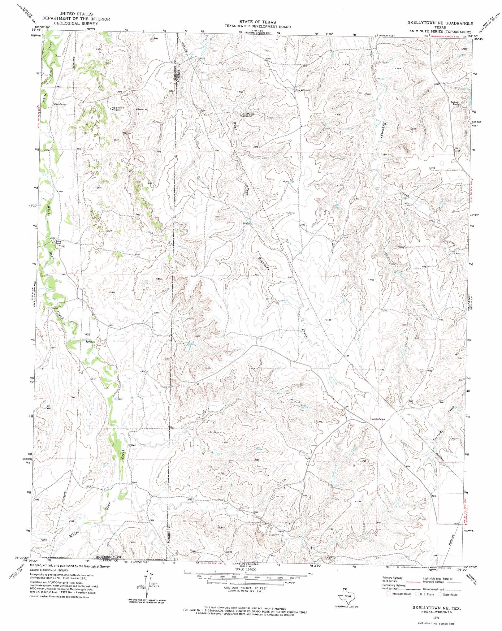
USGS Topo Quad 35101f1 - 1:24,000 scale
| Topo Map Name: | Skellytown Ne |
| USGS Topo Quad ID: | 35101f1 |
| Print Size: | ca. 21 1/4" wide x 27" high |
| Southeast Coordinates: | 35.625° N latitude / 101° W longitude |
| Map Center Coordinates: | 35.6875° N latitude / 101.0625° W longitude |
| U.S. State: | TX |
| Filename: | o35101f1.jpg |
| Download Map JPG Image: | Skellytown Ne topo map 1:24,000 scale |
| Map Type: | Topographic |
| Topo Series: | 7.5´ |
| Map Scale: | 1:24,000 |
| Source of Map Images: | United States Geological Survey (USGS) |
| Alternate Map Versions: |
Skellytown NE TX 1971, updated 1974 Download PDF Buy paper map Skellytown NE TX 2010 Download PDF Buy paper map Skellytown NE TX 2012 Download PDF Buy paper map Skellytown NE TX 2016 Download PDF Buy paper map |
1:24,000 Topo Quads surrounding Skellytown Ne
Stinnett Station |
Adobe Creek |
Garden Springs |
Dry Creek North |
Dry Creek Ne |
Plemons |
Adobe Creek Sw |
Adobe Creek Se |
Dry Creek South |
Dry Creek Se |
Phillips |
Skellytown Nw |
Skellytown Ne |
Pampa Nw |
Pampa Ne |
Borger Se |
Skellytown |
Lake Mcconnell |
Pampa |
Hoover |
Cuyler |
White Deer |
Kingsmill |
Bowers City |
Lefors |
> Back to 35101e1 at 1:100,000 scale
> Back to 35100a1 at 1:250,000 scale
> Back to U.S. Topo Maps home
No gazetteer data is available for the Skellytown Ne topo map sheet.
Skellytown Ne digital topo map on disk
Buy this Skellytown Ne topo map showing relief, roads, GPS coordinates and other geographical features, as a high-resolution digital map file on DVD: