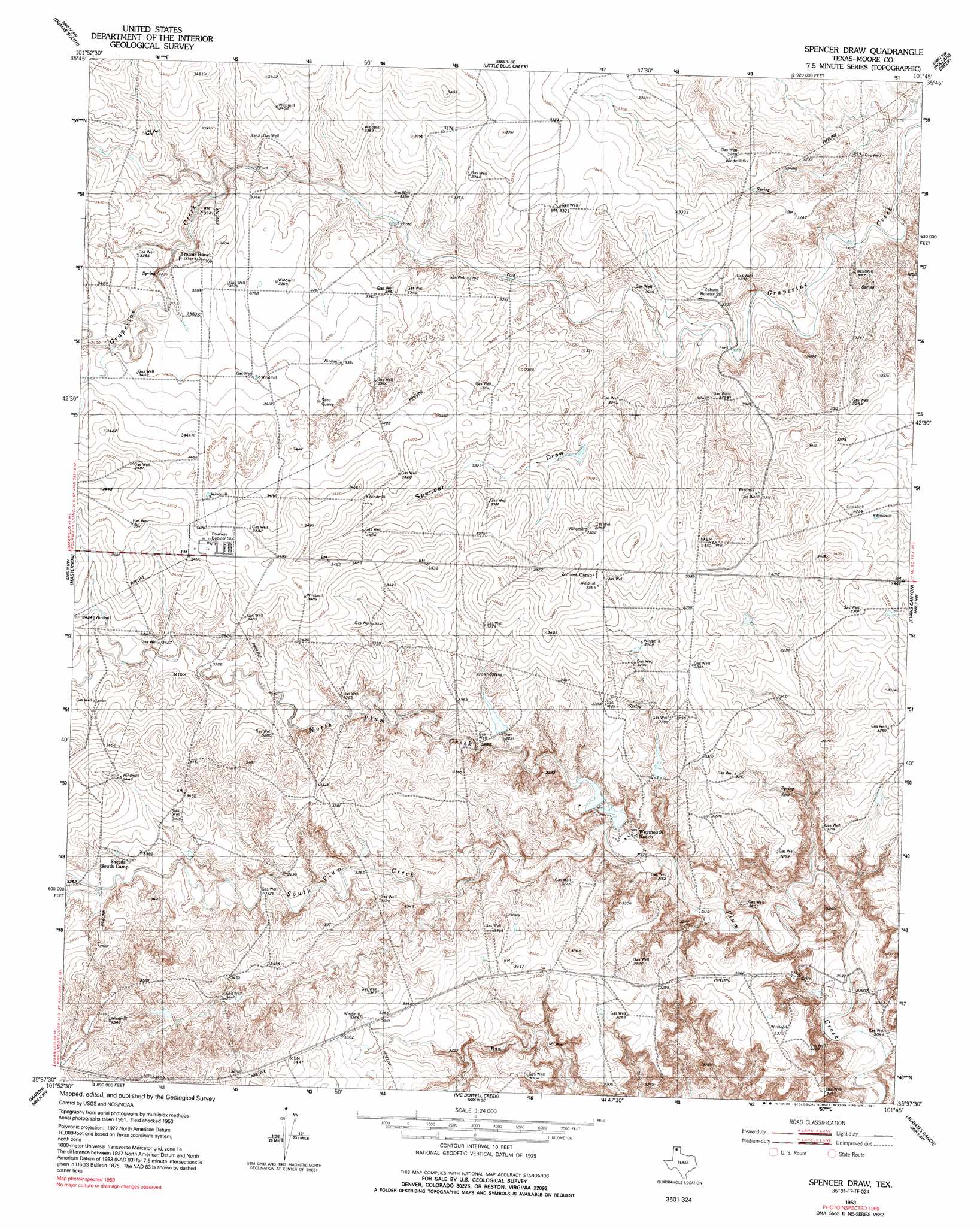
Spencer Draw Topo Map Texas
To zoom in, hover over the map of Spencer Draw
USGS Topo Quad 35101f7 - 1:24,000 scale
| Topo Map Name: | Spencer Draw |
| USGS Topo Quad ID: | 35101f7 |
| Print Size: | ca. 21 1/4" wide x 27" high |
| Southeast Coordinates: | 35.625° N latitude / 101.75° W longitude |
| Map Center Coordinates: | 35.6875° N latitude / 101.8125° W longitude |
| U.S. State: | TX |
| Filename: | o35101f7.jpg |
| Download Map JPG Image: | Spencer Draw topo map 1:24,000 scale |
| Map Type: | Topographic |
| Topo Series: | 7.5´ |
| Map Scale: | 1:24,000 |
| Source of Map Images: | United States Geological Survey (USGS) |
| Alternate Map Versions: |
Spencer Draw TX 1953, updated 1954 Download PDF Buy paper map Spencer Draw TX 1953, updated 1991 Download PDF Buy paper map Spencer Draw TX 2010 Download PDF Buy paper map Spencer Draw TX 2012 Download PDF Buy paper map Spencer Draw TX 2016 Download PDF Buy paper map |
1:24,000 Topo Quads surrounding Spencer Draw
Stallwitz Lake Ne |
Dumas North |
Dumas Ne |
Pollard Creek Nw |
Pollard Creek Ne |
Stallwitz Lake |
Dumas South |
Little Blue Creek |
Pollard Creek |
Camp Creek |
Bautista |
Masterson |
Spencer Draw |
Evans Canyon |
Sanford |
Little Indian Creek |
Marsh |
Mcdowell Creek |
Alibates Ranch |
Deal |
Boden |
Puente |
Chunky |
Berry Sand Draw |
Pomeroy |
> Back to 35101e1 at 1:100,000 scale
> Back to 35100a1 at 1:250,000 scale
> Back to U.S. Topo Maps home
Spencer Draw topo map: Gazetteer
Spencer Draw: Dams
Thompson Estate Lake Dam elevation 999m 3277′Weymouth Middle Lake Dam elevation 971m 3185′
Spencer Draw: Reservoirs
Thompson Estate Lake elevation 999m 3277′Weymouth Middle Lake elevation 971m 3185′
Spencer Draw: Streams
North Plum Creek elevation 961m 3152′South Plum Creek elevation 961m 3152′
Spencer Draw: Valleys
Red Draw elevation 952m 3123′Spencer Draw elevation 1000m 3280′
Spencer Draw digital topo map on disk
Buy this Spencer Draw topo map showing relief, roads, GPS coordinates and other geographical features, as a high-resolution digital map file on DVD: