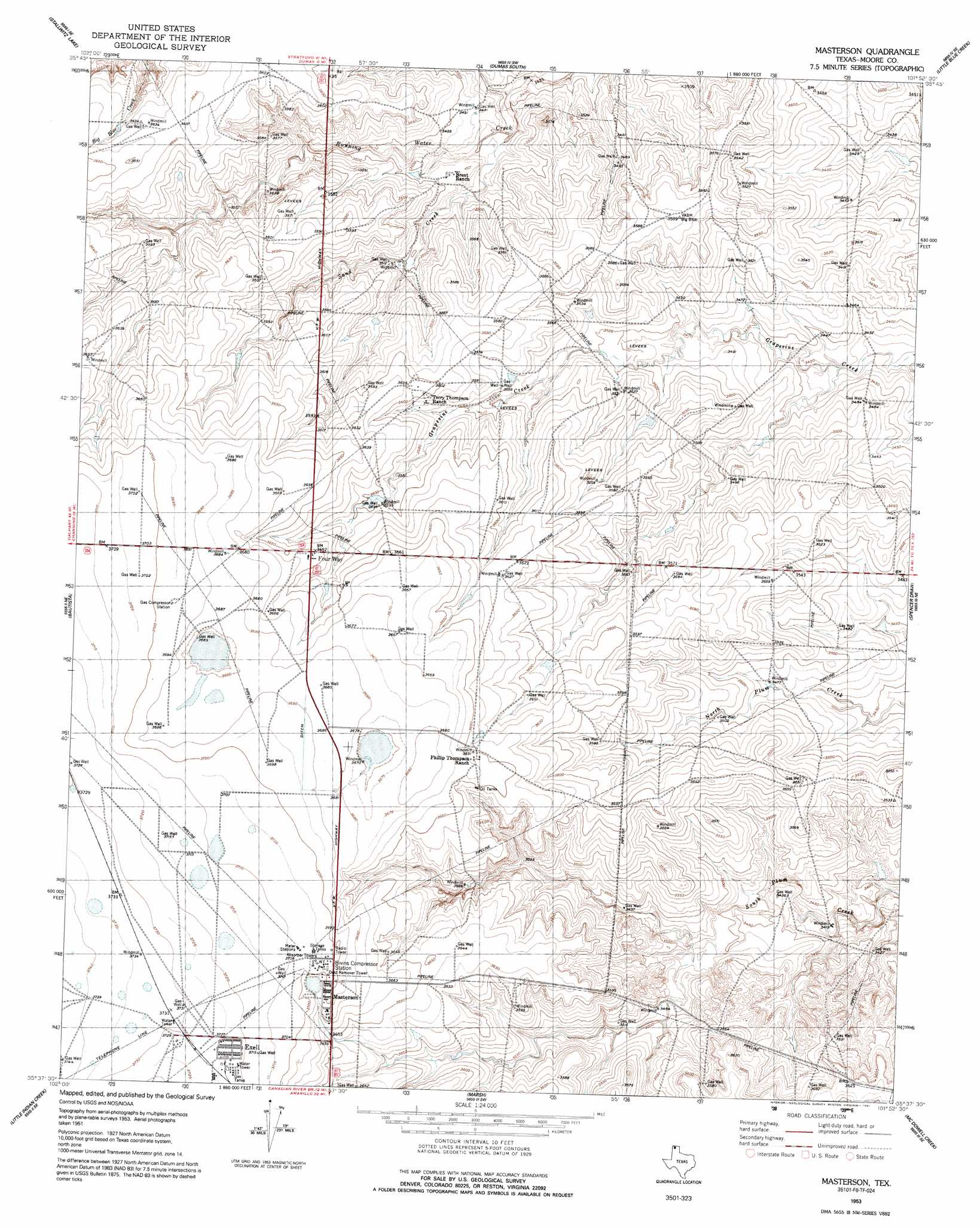
Masterson Topo Map Texas
To zoom in, hover over the map of Masterson
USGS Topo Quad 35101f8 - 1:24,000 scale
| Topo Map Name: | Masterson |
| USGS Topo Quad ID: | 35101f8 |
| Print Size: | ca. 21 1/4" wide x 27" high |
| Southeast Coordinates: | 35.625° N latitude / 101.875° W longitude |
| Map Center Coordinates: | 35.6875° N latitude / 101.9375° W longitude |
| U.S. State: | TX |
| Filename: | o35101f8.jpg |
| Download Map JPG Image: | Masterson topo map 1:24,000 scale |
| Map Type: | Topographic |
| Topo Series: | 7.5´ |
| Map Scale: | 1:24,000 |
| Source of Map Images: | United States Geological Survey (USGS) |
| Alternate Map Versions: |
Masterson TX 1953, updated 1954 Download PDF Buy paper map Masterson TX 1953, updated 1991 Download PDF Buy paper map Masterson TX 2010 Download PDF Buy paper map Masterson TX 2012 Download PDF Buy paper map Masterson TX 2016 Download PDF Buy paper map |
1:24,000 Topo Quads surrounding Masterson
Moran Ranch |
Stallwitz Lake Ne |
Dumas North |
Dumas Ne |
Pollard Creek Nw |
Bird Ranch Store |
Stallwitz Lake |
Dumas South |
Little Blue Creek |
Pollard Creek |
Bivins Channing Ranch |
Bautista |
Masterson |
Spencer Draw |
Evans Canyon |
Boys Ranch East |
Little Indian Creek |
Marsh |
Mcdowell Creek |
Alibates Ranch |
Ady |
Boden |
Puente |
Chunky |
Berry Sand Draw |
> Back to 35101e1 at 1:100,000 scale
> Back to 35100a1 at 1:250,000 scale
> Back to U.S. Topo Maps home
Masterson topo map: Gazetteer
Masterson: Populated Places
Exell elevation 1135m 3723′Four Way elevation 1114m 3654′
Masterson elevation 1129m 3704′
Masterson: Streams
Little Blue Creek elevation 1048m 3438′Sand Creek elevation 1048m 3438′
Masterson digital topo map on disk
Buy this Masterson topo map showing relief, roads, GPS coordinates and other geographical features, as a high-resolution digital map file on DVD: