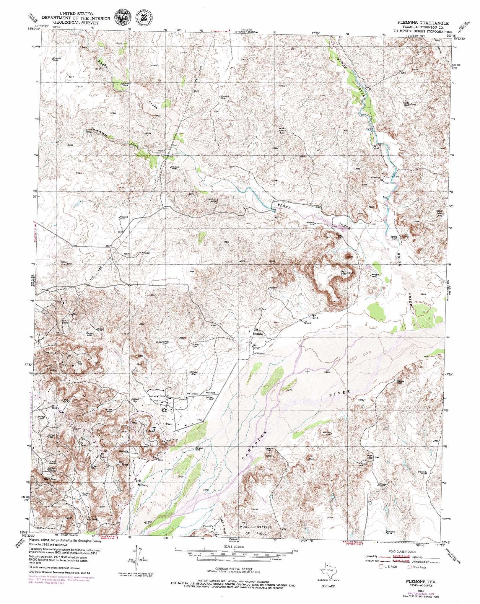
Plemons Topo Map Texas
To zoom in, hover over the map of Plemons
USGS Topo Quad 35101g3 - 1:24,000 scale
| Topo Map Name: | Plemons |
| USGS Topo Quad ID: | 35101g3 |
| Print Size: | ca. 21 1/4" wide x 27" high |
| Southeast Coordinates: | 35.75° N latitude / 101.25° W longitude |
| Map Center Coordinates: | 35.8125° N latitude / 101.3125° W longitude |
| U.S. State: | TX |
| Filename: | o35101g3.jpg |
| Download Map JPG Image: | Plemons topo map 1:24,000 scale |
| Map Type: | Topographic |
| Topo Series: | 7.5´ |
| Map Scale: | 1:24,000 |
| Source of Map Images: | United States Geological Survey (USGS) |
| Alternate Map Versions: |
Plemons TX 1953, updated 1954 Download PDF Buy paper map Plemons TX 1953, updated 1954 Download PDF Buy paper map Plemons TX 1953, updated 1979 Download PDF Buy paper map Plemons TX 2010 Download PDF Buy paper map Plemons TX 2013 Download PDF Buy paper map Plemons TX 2016 Download PDF Buy paper map |
1:24,000 Topo Quads surrounding Plemons
Capps Switch Se |
Morse |
Morse Se |
Holt |
Spearman Se |
Pollard Creek Ne |
Pringle |
Stinnett Station |
Adobe Creek |
Garden Springs |
Camp Creek |
Stinnett |
Plemons |
Adobe Creek Sw |
Adobe Creek Se |
Sanford |
Borger |
Phillips |
Skellytown Nw |
Skellytown Ne |
Deal |
Mcbride |
Borger Se |
Skellytown |
Lake Mcconnell |
> Back to 35101e1 at 1:100,000 scale
> Back to 35100a1 at 1:250,000 scale
> Back to U.S. Topo Maps home
Plemons topo map: Gazetteer
Plemons: Oilfields
Dial Oil Field elevation 892m 2926′Plemons: Populated Places
Plemons elevation 835m 2739′Plemons: Streams
Bear Creek elevation 830m 2723′Bugby Creek elevation 828m 2716′
Moore Creek elevation 820m 2690′
Smokehouse Creek elevation 876m 2874′
Plemons digital topo map on disk
Buy this Plemons topo map showing relief, roads, GPS coordinates and other geographical features, as a high-resolution digital map file on DVD: