Landergin Topo Map Texas
To zoom in, hover over the map of Landergin
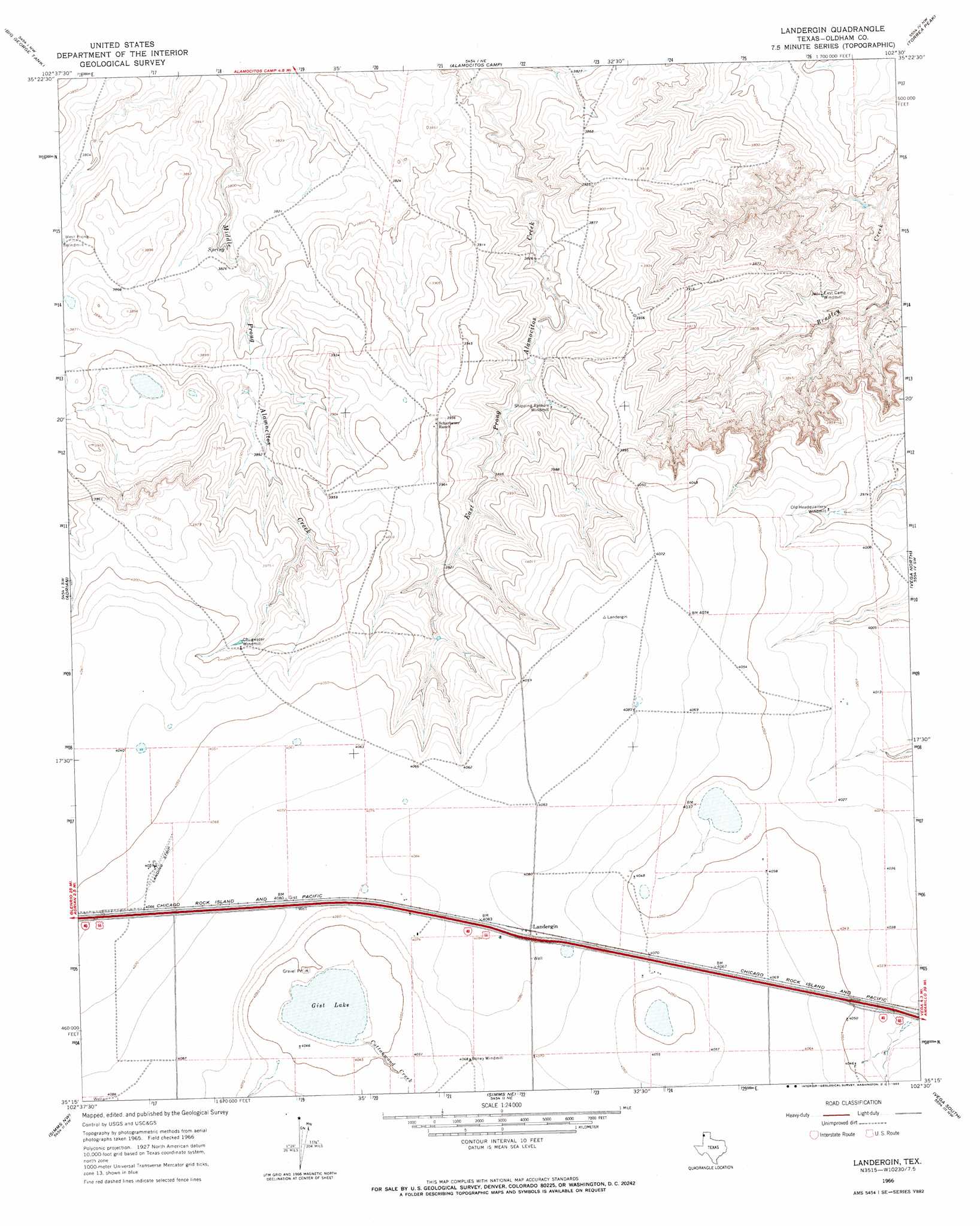
USGS Topo Quad 35102c5 - 1:24,000 scale
| Topo Map Name: | Landergin |
| USGS Topo Quad ID: | 35102c5 |
| Print Size: | ca. 21 1/4" wide x 27" high |
| Southeast Coordinates: | 35.25° N latitude / 102.5° W longitude |
| Map Center Coordinates: | 35.3125° N latitude / 102.5625° W longitude |
| U.S. State: | TX |
| Filename: | o35102c5.jpg |
| Download Map JPG Image: | Landergin topo map 1:24,000 scale |
| Map Type: | Topographic |
| Topo Series: | 7.5´ |
| Map Scale: | 1:24,000 |
| Source of Map Images: | United States Geological Survey (USGS) |
| Alternate Map Versions: |
Landergin TX 1966, updated 1969 Download PDF Buy paper map Landergin TX 2010 Download PDF Buy paper map Landergin TX 2012 Download PDF Buy paper map Landergin TX 2016 Download PDF Buy paper map |
1:24,000 Topo Quads surrounding Landergin
Romero Se |
Humdinger Spring |
Many Post Camp |
Torrey House |
Boys Ranch West |
Vat Camp |
Big George Tank |
Alamocitos Camp |
Torrea Peak |
Halfway Creek |
Signal Spring Se |
Adrian |
Landergin |
Vega North |
Jay Taylor Ranch |
Boise |
Simms Nw |
Simms Ne |
Vega South |
Everett |
Norton Lake |
Simms |
Overstreet Lake |
Ford |
Allison Ranch |
> Back to 35102a1 at 1:100,000 scale
> Back to 35102a1 at 1:250,000 scale
> Back to U.S. Topo Maps home
Landergin topo map: Gazetteer
Landergin: Lakes
Gist Lake elevation 1230m 4035′Landergin: Populated Places
Landergin elevation 1244m 4081′Landergin: Streams
Cottonwood Creek elevation 1232m 4041′Landergin digital topo map on disk
Buy this Landergin topo map showing relief, roads, GPS coordinates and other geographical features, as a high-resolution digital map file on DVD: