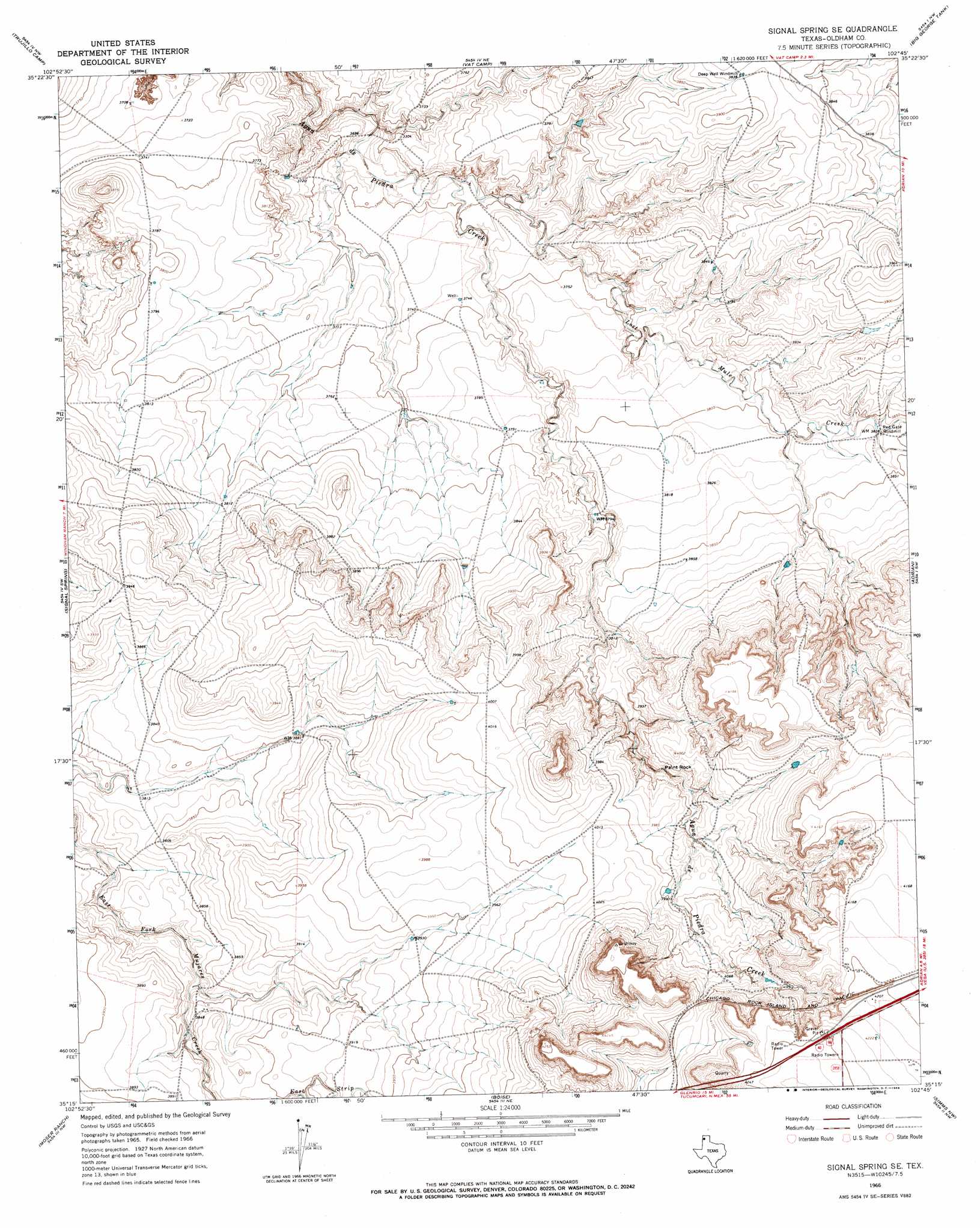
Signal Spring Se Topo Map Texas
To zoom in, hover over the map of Signal Spring Se
USGS Topo Quad 35102c7 - 1:24,000 scale
| Topo Map Name: | Signal Spring Se |
| USGS Topo Quad ID: | 35102c7 |
| Print Size: | ca. 21 1/4" wide x 27" high |
| Southeast Coordinates: | 35.25° N latitude / 102.75° W longitude |
| Map Center Coordinates: | 35.3125° N latitude / 102.8125° W longitude |
| U.S. State: | TX |
| Filename: | o35102c7.jpg |
| Download Map JPG Image: | Signal Spring Se topo map 1:24,000 scale |
| Map Type: | Topographic |
| Topo Series: | 7.5´ |
| Map Scale: | 1:24,000 |
| Source of Map Images: | United States Geological Survey (USGS) |
| Alternate Map Versions: |
Signal Spring SE TX 1966, updated 1969 Download PDF Buy paper map Signal Spring SE TX 2010 Download PDF Buy paper map Signal Spring SE TX 2012 Download PDF Buy paper map Signal Spring SE TX 2016 Download PDF Buy paper map |
1:24,000 Topo Quads surrounding Signal Spring Se
Nara Visa |
Knoblaw |
Romero Se |
Humdinger Spring |
Many Post Camp |
Sanchez Springs |
Trujillo Camp |
Vat Camp |
Big George Tank |
Alamocitos Camp |
Martin Draw |
Signal Spring |
Signal Spring Se |
Adrian |
Landergin |
Glenrio |
Moser Ranch |
Boise |
Simms Nw |
Simms Ne |
Rock Camp |
Sand Point |
Norton Lake |
Simms |
Overstreet Lake |
> Back to 35102a1 at 1:100,000 scale
> Back to 35102a1 at 1:250,000 scale
> Back to U.S. Topo Maps home
Signal Spring Se topo map: Gazetteer
Signal Spring Se: Dams
Curry Lake Dam elevation 1147m 3763′Signal Spring Se: Pillars
Paint Rock elevation 1188m 3897′Signal Spring Se: Reservoirs
Curry Lake elevation 1147m 3763′Signal Spring Se: Streams
East Strip East Fork Mujares Creek elevation 1183m 3881′Lost Mule Creek elevation 1122m 3681′
Signal Spring Se digital topo map on disk
Buy this Signal Spring Se topo map showing relief, roads, GPS coordinates and other geographical features, as a high-resolution digital map file on DVD: