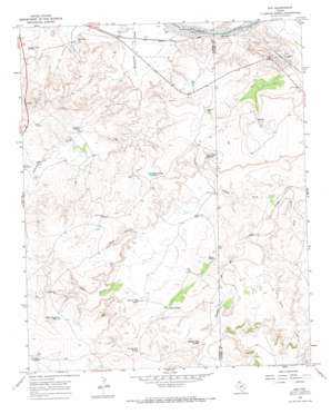
Ady Topo Map Texas
To zoom in, hover over the map of Ady
USGS Topo Quad 35102d2 - 1:24,000 scale
| Topo Map Name: | Ady |
| USGS Topo Quad ID: | 35102d2 |
| Print Size: | ca. 21 1/4" wide x 27" high |
| Southeast Coordinates: | 35.375° N latitude / 102.125° W longitude |
| Map Center Coordinates: | 35.4375° N latitude / 102.1875° W longitude |
| U.S. State: | TX |
| Filename: | o35102d2.jpg |
| Download Map JPG Image: | Ady topo map 1:24,000 scale |
| Map Type: | Topographic |
| Topo Series: | 7.5´ |
| Map Scale: | 1:24,000 |
| Source of Map Images: | United States Geological Survey (USGS) |
| Alternate Map Versions: |
Ady TX 1966, updated 1969 Download PDF Buy paper map Ady TX 2010 Download PDF Buy paper map Ady TX 2012 Download PDF Buy paper map Ady TX 2016 Download PDF Buy paper map |
1:24,000 Topo Quads surrounding Ady
> Back to 35102a1 at 1:100,000 scale
> Back to 35102a1 at 1:250,000 scale
> Back to U.S. Topo Maps home
Ady topo map: Gazetteer
Ady: Populated Places
Ady elevation 960m 3149′Ady: Reservoirs
Allen Tank elevation 994m 3261′Basin Tank elevation 1067m 3500′
Buckle Tank elevation 999m 3277′
Bull Tubs Tank elevation 995m 3264′
Eagle Canyon Tank elevation 1073m 3520′
Rheumatism Tank elevation 1015m 3330′
Ady: Springs
Division Pens Spring elevation 988m 3241′Granite Tubs Spring elevation 992m 3254′
Lost Tubs Springs elevation 1003m 3290′
Prairie Dog Spring elevation 1019m 3343′
Ady: Streams
Bush Creek elevation 954m 3129′Cedar Creek elevation 969m 3179′
Ady: Valleys
Eagle Canyon elevation 1004m 3293′Fuqua Draw elevation 955m 3133′
Rock Canyon elevation 1004m 3293′
Ady: Wells
Basin Well elevation 988m 3241′Hereford Well elevation 1029m 3375′
Rock Canyon Well elevation 1045m 3428′
Ady digital topo map on disk
Buy this Ady topo map showing relief, roads, GPS coordinates and other geographical features, as a high-resolution digital map file on DVD:


