Vat Camp Topo Map Texas
To zoom in, hover over the map of Vat Camp
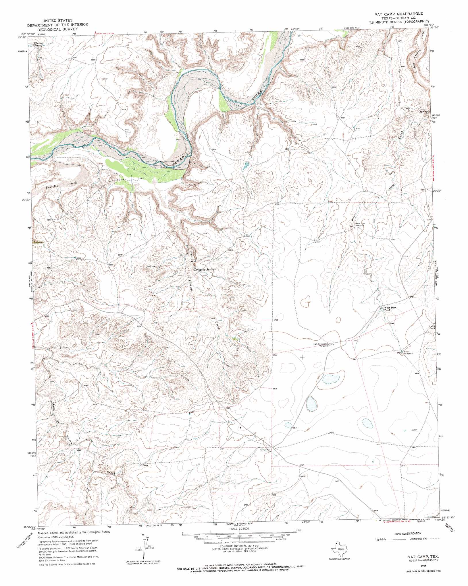
USGS Topo Quad 35102d7 - 1:24,000 scale
| Topo Map Name: | Vat Camp |
| USGS Topo Quad ID: | 35102d7 |
| Print Size: | ca. 21 1/4" wide x 27" high |
| Southeast Coordinates: | 35.375° N latitude / 102.75° W longitude |
| Map Center Coordinates: | 35.4375° N latitude / 102.8125° W longitude |
| U.S. State: | TX |
| Filename: | o35102d7.jpg |
| Download Map JPG Image: | Vat Camp topo map 1:24,000 scale |
| Map Type: | Topographic |
| Topo Series: | 7.5´ |
| Map Scale: | 1:24,000 |
| Source of Map Images: | United States Geological Survey (USGS) |
| Alternate Map Versions: |
Vat Camp TX 1966, updated 1969 Download PDF Buy paper map Vat Camp TX 2010 Download PDF Buy paper map Vat Camp TX 2012 Download PDF Buy paper map Vat Camp TX 2016 Download PDF Buy paper map |
1:24,000 Topo Quads surrounding Vat Camp
Doyle Hill |
Romero |
Spring Creek Ranch |
Pedarosa Camp |
Proctor Ranch |
Nara Visa |
Knoblaw |
Romero Se |
Humdinger Spring |
Many Post Camp |
Sanchez Springs |
Trujillo Camp |
Vat Camp |
Big George Tank |
Alamocitos Camp |
Martin Draw |
Signal Spring |
Signal Spring Se |
Adrian |
Landergin |
Glenrio |
Moser Ranch |
Boise |
Simms Nw |
Simms Ne |
> Back to 35102a1 at 1:100,000 scale
> Back to 35102a1 at 1:250,000 scale
> Back to U.S. Topo Maps home
Vat Camp topo map: Gazetteer
Vat Camp: Airports
Coleman Cattle Company Number 2 Airport elevation 1168m 3832′Vat Camp: Reservoirs
West Dam Tank elevation 1140m 3740′Vat Camp: Springs
Charvez Spring elevation 1098m 3602′Dripping Springs elevation 1086m 3562′
Vat Camp: Streams
Dripping Springs Creek elevation 1041m 3415′Trujillo Creek elevation 1041m 3415′
Vat Camp digital topo map on disk
Buy this Vat Camp topo map showing relief, roads, GPS coordinates and other geographical features, as a high-resolution digital map file on DVD: