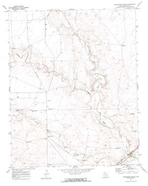
Whiteaker Ranch Topo Map Texas
To zoom in, hover over the map of Whiteaker Ranch
USGS Topo Quad 35102g8 - 1:24,000 scale
| Topo Map Name: | Whiteaker Ranch |
| USGS Topo Quad ID: | 35102g8 |
| Print Size: | ca. 21 1/4" wide x 27" high |
| Southeast Coordinates: | 35.75° N latitude / 102.875° W longitude |
| Map Center Coordinates: | 35.8125° N latitude / 102.9375° W longitude |
| U.S. State: | TX |
| Filename: | o35102g8.jpg |
| Download Map JPG Image: | Whiteaker Ranch topo map 1:24,000 scale |
| Map Type: | Topographic |
| Topo Series: | 7.5´ |
| Map Scale: | 1:24,000 |
| Source of Map Images: | United States Geological Survey (USGS) |
| Alternate Map Versions: |
Whiteaker Ranch TX 1971, updated 1973 Download PDF Buy paper map Whiteaker Ranch TX 2010 Download PDF Buy paper map Whiteaker Ranch TX 2012 Download PDF Buy paper map Whiteaker Ranch TX 2016 Download PDF Buy paper map |
1:24,000 Topo Quads surrounding Whiteaker Ranch
> Back to 35102e1 at 1:100,000 scale
> Back to 35102a1 at 1:250,000 scale
> Back to U.S. Topo Maps home
Whiteaker Ranch topo map: Gazetteer
Whiteaker Ranch: Streams
Cramer Creek elevation 1198m 3930′Monia Creek elevation 1216m 3989′
Whiteaker Ranch: Wells
Camp Creek East Well elevation 1278m 4192′Camp Creek West Well elevation 1285m 4215′
Dump Ground Well elevation 1233m 4045′
Horn Well elevation 1249m 4097′
Little Sandy Well elevation 1264m 4146′
Middle Red Well elevation 1278m 4192′
Northeast Park Hill Well elevation 1244m 4081′
Park Hill Well elevation 1244m 4081′
Sand Camp Well elevation 1271m 4169′
Thousand Acre Well elevation 1226m 4022′
Whiteaker Ranch digital topo map on disk
Buy this Whiteaker Ranch topo map showing relief, roads, GPS coordinates and other geographical features, as a high-resolution digital map file on DVD:


