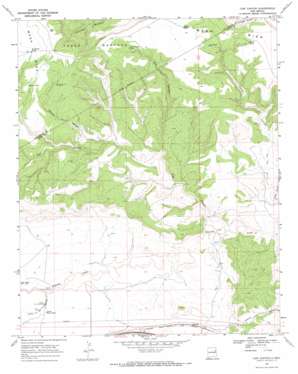
Cow Canyon Topo Map New Mexico
To zoom in, hover over the map of Cow Canyon
USGS Topo Quad 35103b8 - 1:24,000 scale
| Topo Map Name: | Cow Canyon |
| USGS Topo Quad ID: | 35103b8 |
| Print Size: | ca. 21 1/4" wide x 27" high |
| Southeast Coordinates: | 35.125° N latitude / 103.875° W longitude |
| Map Center Coordinates: | 35.1875° N latitude / 103.9375° W longitude |
| U.S. State: | NM |
| Filename: | o35103b8.jpg |
| Download Map JPG Image: | Cow Canyon topo map 1:24,000 scale |
| Map Type: | Topographic |
| Topo Series: | 7.5´ |
| Map Scale: | 1:24,000 |
| Source of Map Images: | United States Geological Survey (USGS) |
| Alternate Map Versions: |
Cow Canyon NM 1968, updated 1971 Download PDF Buy paper map Cow Canyon NM 2010 Download PDF Buy paper map Cow Canyon NM 2013 Download PDF Buy paper map Cow Canyon NM 2017 Download PDF Buy paper map |
1:24,000 Topo Quads surrounding Cow Canyon
> Back to 35103a1 at 1:100,000 scale
> Back to 35102a1 at 1:250,000 scale
> Back to U.S. Topo Maps home
Cow Canyon topo map: Gazetteer
Cow Canyon: Populated Places
Palomas elevation 1330m 4363′Cow Canyon: Reservoirs
Cow Canyon Tank elevation 1482m 4862′Elliott Tank elevation 1473m 4832′
Hondo Tank elevation 1467m 4812′
Kauffman Tank elevation 1491m 4891′
Paul Tank elevation 1439m 4721′
Primo Tank elevation 1474m 4835′
Red Tank elevation 1288m 4225′
South Privo Tank elevation 1284m 4212′
Cow Canyon: Streams
Arroyo de las Palomas elevation 1281m 4202′Cow Canyon: Valleys
Cow Canyon elevation 1308m 4291′Spring Canyon elevation 1327m 4353′
Vigil Canyon elevation 1256m 4120′
Cow Canyon: Wells
05085 Water Well elevation 1339m 4393′10097 Water Well elevation 1314m 4311′
10106 Water Well elevation 1283m 4209′
10111 Water Well elevation 1269m 4163′
10114 Water Well elevation 1306m 4284′
Cow Canyon digital topo map on disk
Buy this Cow Canyon topo map showing relief, roads, GPS coordinates and other geographical features, as a high-resolution digital map file on DVD:


