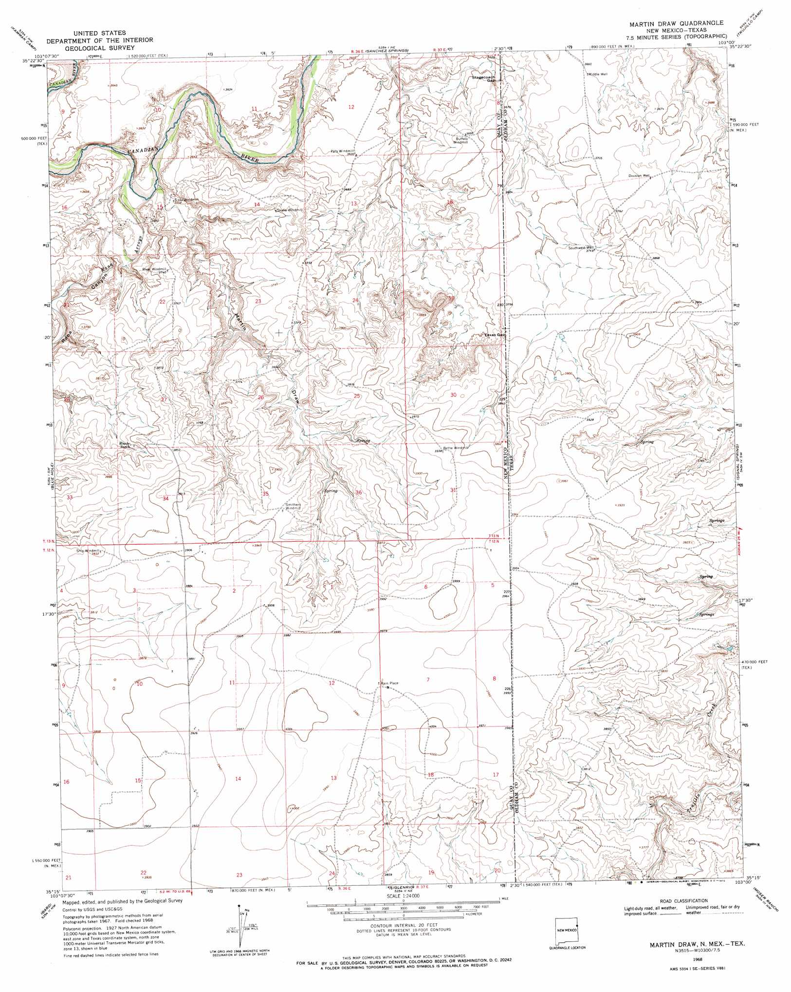
Martin Draw Topo Map New Mexico
To zoom in, hover over the map of Martin Draw
USGS Topo Quad 35103c1 - 1:24,000 scale
| Topo Map Name: | Martin Draw |
| USGS Topo Quad ID: | 35103c1 |
| Print Size: | ca. 21 1/4" wide x 27" high |
| Southeast Coordinates: | 35.25° N latitude / 103° W longitude |
| Map Center Coordinates: | 35.3125° N latitude / 103.0625° W longitude |
| U.S. States: | NM, TX |
| Filename: | o35103c1.jpg |
| Download Map JPG Image: | Martin Draw topo map 1:24,000 scale |
| Map Type: | Topographic |
| Topo Series: | 7.5´ |
| Map Scale: | 1:24,000 |
| Source of Map Images: | United States Geological Survey (USGS) |
| Alternate Map Versions: |
Martin Draw NM 1968, updated 1972 Download PDF Buy paper map Martin Draw NM 2010 Download PDF Buy paper map Martin Draw NM 2013 Download PDF Buy paper map Martin Draw NM 2017 Download PDF Buy paper map |
1:24,000 Topo Quads surrounding Martin Draw
Lockney |
Obar |
Nara Visa |
Knoblaw |
Romero Se |
Logan Ne |
Cammak Camp |
Sanchez Springs |
Trujillo Camp |
Vat Camp |
Tuscocoillo Canyon |
Blue Hole |
Martin Draw |
Signal Spring |
Signal Spring Se |
Porter |
Bard |
Glenrio |
Moser Ranch |
Boise |
San Jon |
Riley Camp |
Rock Camp |
Sand Point |
Norton Lake |
> Back to 35103a1 at 1:100,000 scale
> Back to 35102a1 at 1:250,000 scale
> Back to U.S. Topo Maps home
Martin Draw topo map: Gazetteer
Martin Draw: Gaps
Stagecoach Gap elevation 1096m 3595′Texas Gap elevation 1141m 3743′
Martin Draw: Populated Places
Rain Place elevation 1214m 3982′Martin Draw: Streams
Rana Arroyo elevation 1077m 3533′Trujillo Creek elevation 1135m 3723′
Martin Draw: Valleys
Martin Draw elevation 1078m 3536′Rana Canyon elevation 1079m 3540′
Martin Draw: Wells
05424 Water Well elevation 1195m 3920′05425 Water Well elevation 1179m 3868′
05429 Water Well elevation 1213m 3979′
05430 Water Well elevation 1202m 3943′
05431 Water Well elevation 1202m 3943′
05432 Water Well elevation 1187m 3894′
05524 Water Well elevation 1083m 3553′
05526 Water Well elevation 1141m 3743′
05530 Water Well elevation 1126m 3694′
05531 Water Well elevation 1195m 3920′
Division Well elevation 1143m 3750′
Middle Well elevation 1116m 3661′
Southwest Well elevation 1144m 3753′
Martin Draw digital topo map on disk
Buy this Martin Draw topo map showing relief, roads, GPS coordinates and other geographical features, as a high-resolution digital map file on DVD: